Blog Article
Hurricane Nolo Nears Hawaii, Nor'easter Threatens Northeast
Hurricane Nolo is set to strengthen near Hawaii with catastrophic flooding risk, while a stalling nor'easter brings coastal flooding to the Northeast this weekend.
Hurricane Nolo Closes In on Hawaii While a Nor'easter Sets Up Along the Northeast Coast
Alright y'all, there's a lot on the board this morning, but one story sits above the rest. Hurricane Nolo is bearing down on Hawaii, and this is a 'take it seriously right now' kind of setup, not a wait-and-see one.
Hurricane Nolo: the story Hawaii can't ignore
As of the latest advisory, Nolo is a Category 1 hurricane with 81 mph sustained winds, sitting about 240 miles south of South Point on the Big Island and creeping north-northeast at just 5 mph. That slow forward speed is part of what makes this dangerous. A hurricane recon plane is in the air right now, and the discussion notes some conflicting readings between flight-level winds and central pressure, but the pressure trend (985 mb and still working) tells forecasters this system has more strengthening left in the tank.
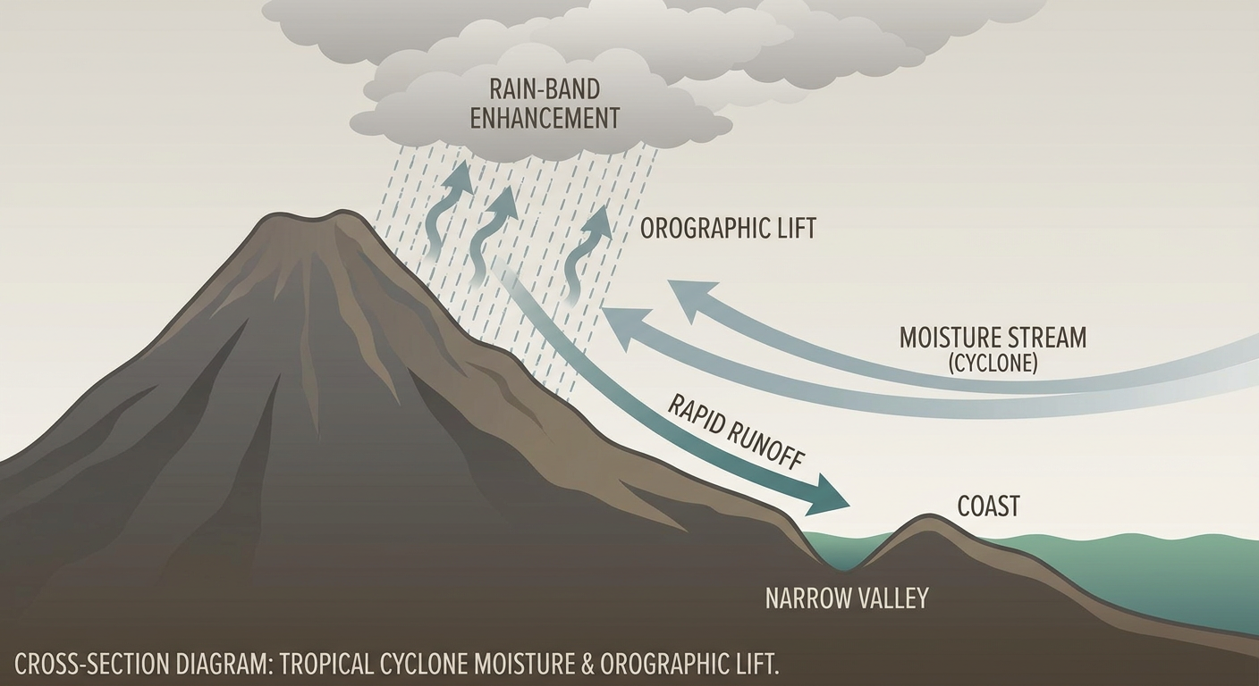
Here's the timeline: Nolo is forecast to reach major hurricane strength, with winds near 110 to 125 mph, as it passes near or just south of Hawaii Island on Saturday. A Hurricane Watch is up for Hawaii County, and Maui is under a Tropical Storm Watch. Even if the core stays offshore, this storm is enormous and slow, which means the rain totals are the real headline. Forecasters are talking about 15 to 35 inches of rain on the Big Island and 4 to 15 inches on Maui. That is catastrophic, life-threatening flash flood and mudslide territory, especially over the steep volcanic terrain that channels runoff fast.
If you're on Hawaii Island or Maui, this is not the weekend to wing it. Have your supplies staged, know your evacuation route if you're near a stream or drainage, and watch official guidance out of Honolulu, not just the wind speed number. With a storm like this, the water is the threat, not just the wind.
A crowded Pacific, but Nolo is the one that matters most to the US
While Nolo grabs the headlines, there are two more hurricanes spinning in the Eastern Pacific right now, though neither is a US mainland concern. Hurricane Polo regained Category 5 status overnight with 161 mph winds and a 929 mb pressure, sitting a few hundred miles offshore of Manzanillo, Mexico. Polo is forecast to weaken some as it tracks toward Baja California Sur, with a landfall target near Loreto by Monday evening. Areas like La Paz, San Jose del Cabo, and Topolobampo are in a 'prepare' posture. If you've got travel plans to that part of Mexico next week, keep an eye on this one.
Hurricane Odalys, a Category 3 with 115 mph winds, is well offshore and curving northeast, but it's expected to weaken sharply before it gets anywhere near Baja, so that one looks more like a fish storm. Over in the Atlantic, Tropical Storm Fay is fading in the open ocean and Tropical Storm Gonzalo is bringing tropical storm conditions to the Cabo Verde Islands today, with an area of interest (Invest 90AL) trailing behind it. None of that Atlantic activity is a US threat at this time.
The Northeast: a nor'easter that's about to park itself offshore
Second big story of the day. A coastal low is deepening off the East Coast, and it's forecast to stall near or just east of New Jersey and south of Long Island through the weekend. WPC has a Slight Risk of excessive rainfall posted for Saturday across the northern Mid-Atlantic coast into southern New England, and that risk holds into Sunday as the storm lingers.
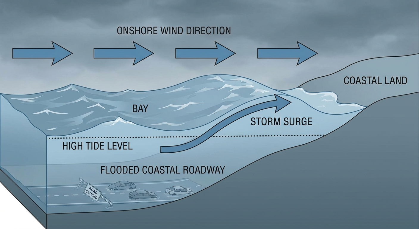
This is shaping up to be a multi-day coastal event, not a quick hit. Local forecast offices from Boston to DC are already flagging wind gusts of 45 to 55 mph, 2 to 4-plus inches of rain, and moderate to major coastal flooding tied to persistent onshore flow stacking on top of high astronomical tides. Cape Cod and the Islands, the NYC metro, Long Island, the Jersey Shore, and the Chesapeake Bay's western shore all look to be in the bullseye. Airports are already bracing for it too. LGA, JFK, EWR, and BOS are all expected to see ground stop potential Saturday as the rain and wind move in.
If you've got tickets to Oceans Calling in Ocean City, Maryland, or All Things Go in Columbia, Maryland this weekend, today looks like the better of the two outdoor days. Conditions trend downhill Saturday into Sunday as onshore wind and rain build in along the coast. Build in extra time either way and watch for parking lot flooding if you're anywhere near tidal water.
Plains: a modest severe weather day, not a repeat of last week
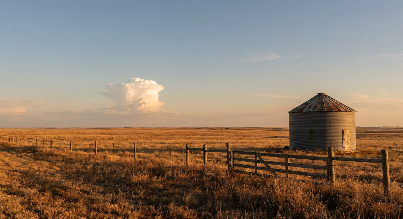
SPC has a Marginal Risk of severe thunderstorms up Saturday for the central and southern Plains, from Wichita and Topeka down through Enid and into the southeastern Texas Panhandle near Lubbock. This is a low-end setup: isolated large hail and a few damaging wind gusts are possible where storms fire along an upper-level impulse riding over a building ridge, but there's no widespread severe outbreak signal like what we saw earlier this month with those 80-plus mph gusts in Kansas.
The State Fair of Texas is underway in Dallas, which sits south of the highlighted risk area, so fairgoers should be fine, but keep half an eye on the sky if storms build northward during the afternoon. There's also lingering flash flood potential from overnight rain across eastern New Mexico and the Texas Panhandle Friday morning, tied to a Slight Risk excessive rainfall outlook, though WPC expects that heavy rain to be short-lived.
The bright spot: a genuinely nice stretch for the interior
Here's some good news buried in a busy pattern. A broad stretch from the Tennessee Valley and Ohio Valley into the Great Lakes and northern Plains is looking at a NICE-to-BEAUTIFUL day today, with light winds, low humidity, and mostly clear skies. That trend holds into Saturday, when the best weather nationally sets up across the central and eastern Plains, Midwest, Ohio Valley, and into Georgia and the Carolinas, with dewpoints dropping into the upper 40s. That is a genuine fall preview, and it's a great weekend for outdoor golf if you're catching the Walmart NW Arkansas Championship.
Space weather: a minor geomagnetic storm today
NOAA's Space Weather Prediction Center is calling for a G1 (Minor) geomagnetic storm today, September 25, with Kp reaching 5 as a coronal hole high-speed stream continues to influence the solar wind. This is a low-end event. Aurora watchers at far northern latitudes near the Canadian border might catch a faint glow after dark, but this isn't a widespread display and it has no direct impact on daily weather.
Key things I'm watching
- Hurricane Nolo's exact track and intensity as it nears Hawaii Island Saturday, and whether rainfall totals push toward the higher end of that 15 to 35 inch range on the Big Island
- Whether the Northeast coastal low deepens further or shifts its stall point, which would change who sees the worst of the 45 to 55 mph gusts and coastal flooding
- Hurricane Polo's landfall intensity near Loreto, Mexico, expected Monday evening
- Any northward creep in Saturday's Plains severe risk that could bring storms closer to the Dallas Fair grounds
Bottom line
If you're in Hawaii, especially on the Big Island or Maui, today is the day to finish your prep. The wind matters, but the rain and mudslide threat is the real danger with this slow-moving system. If you're along the Northeast coast from Massachusetts down through the Delmarva, plan for a soggy, windy, flood-prone weekend and check on any coastal or tidal-adjacent travel before you go. Folks in the southern Plains can enjoy the weekend with just a normal severe-weather-season heads up for Saturday afternoon. And if you're anywhere from the Tennessee Valley through the Ohio Valley and Great Lakes, go outside and enjoy it. This is about as good as a late September weekend gets.