Blog Article
Northeast Freeze, California Rain, and Plains Fire Danger
A powerful cold front brings a hard freeze to the Northeast, while California tracks a cutoff low and the High Plains face critical fire weather conditions.
A Deep Freeze for the Northeast and California's Cutoff Low
Alright folks, that massive cold front we tracked across Texas and the Plains yesterday is now making its presence known on the East Coast. If you are waking up in the Northeast today, you already know what I am talking about. We are trading severe thunderstorms for a late-season deep freeze.
A Harsh Reality Check for the Northeast
The cold air advection behind this front is no joke. We are looking at temperatures plummeting into the teens and 20s across upstate New York and New England by Monday morning. For context, the normal low in New York City this time of year is around 44 degrees. This is a serious drop.
The Weather Prediction Center is tracking a rapid changeover from rain to snow in the higher elevations of the Adirondacks, the Green Mountains, and the White Mountains today. But the bigger hazard for most folks is going to be the black ice. Any standing water from Sunday's rain is going to freeze solid tonight. If you are traveling or heading out early Monday for the Boston Marathon, you need to prepare for a bitterly cold start and potentially slick spots on untreated surfaces.
Fire Danger Holds Steady in the Plains
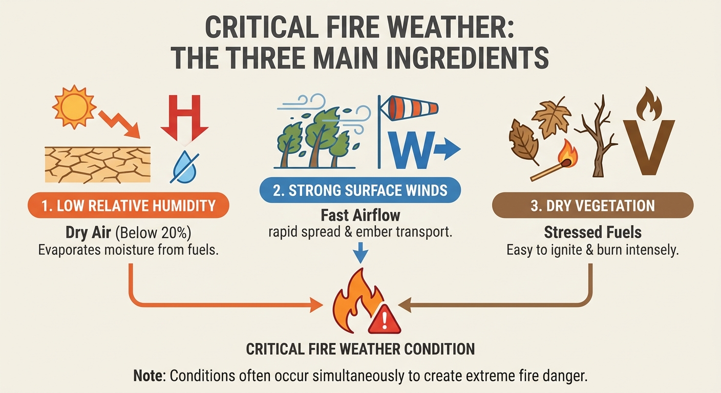
As we talked about yesterday, the fire threat in the Southern High Plains is exactly what we feared. The Storm Prediction Center has a Critical fire weather area highlighted today for the Texas and Oklahoma Panhandles, stretching up into southwest Kansas.
We have relative humidity dropping into the single digits. When you combine that bone-dry air with southwest winds gusting up to 30 mph, any spark will spread rapidly. Please hold off on any outdoor burning today.
California's Cutoff Low
While the East Coast freezes, the West Coast is watching a different setup. A large upper-level cutoff low is spinning off the Pacific coast and will slowly drift into Northern California by Monday.
Cutoff lows are notoriously slow movers. Because this system is detached from the main jet stream, it is just going to meander inland and bring an extended period of light to moderate rainfall. The WPC has outlined a Marginal Risk for excessive rainfall for Northern California starting Monday, expanding down the coast by Tuesday. The main concerns are localized flash flooding in urban centers like the Bay Area and over sensitive burn scars. If you are driving up the coast after the Long Beach Grand Prix or Coachella this weekend, expect conditions to deteriorate as you head north into Monday.
The Next Severe Setup
I also want to put a bug in your ear about the middle of next week. The Storm Prediction Center has already highlighted a 15 percent risk area for severe weather on Thursday and Friday across the Central and Southern Plains.
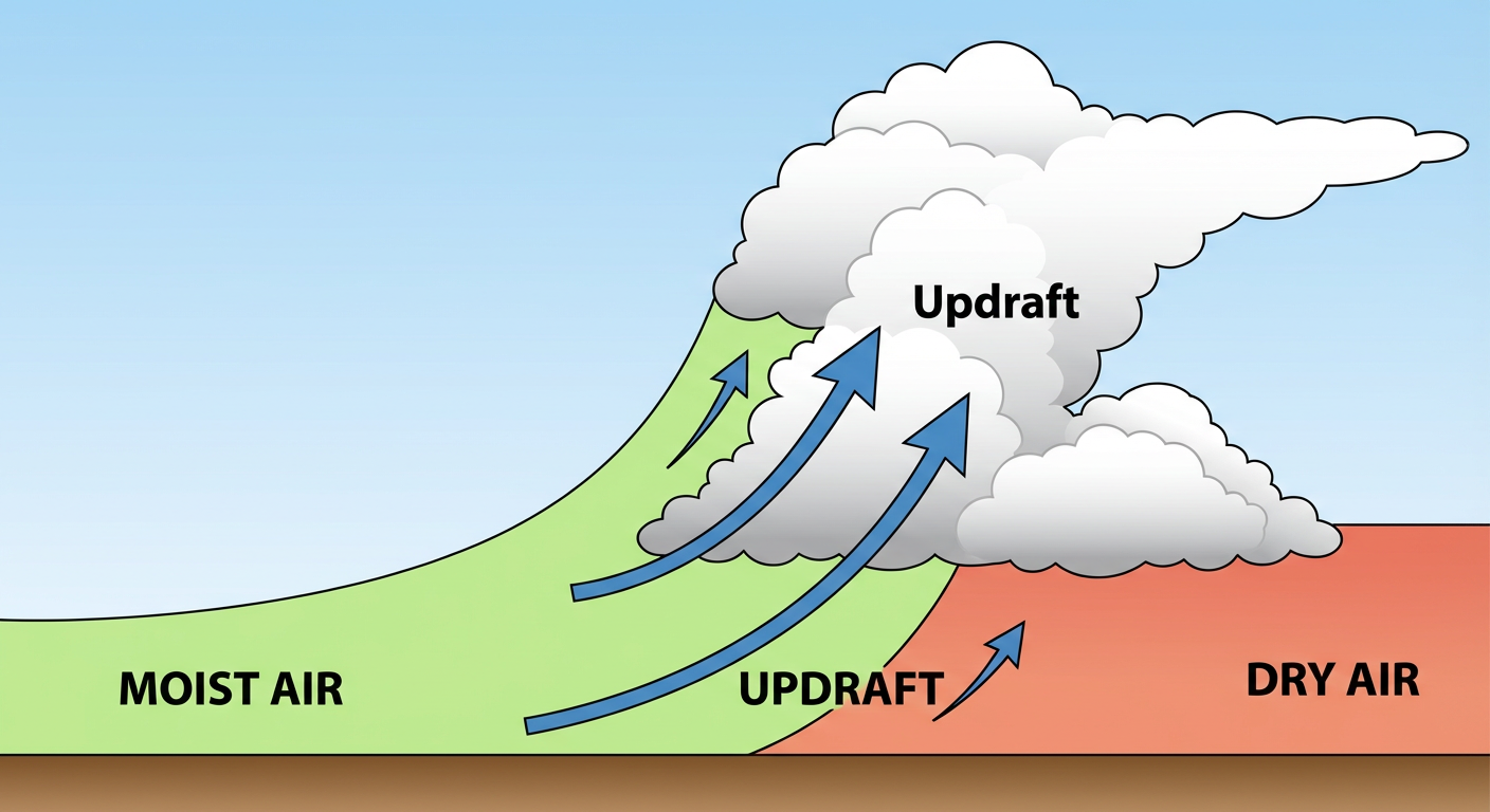
Moisture is going to surge back northward ahead of a new western trough. We will see a dryline sharpen across western Nebraska and Kansas, setting the stage for supercell development. Cities from Oklahoma City up to Kansas City, and eventually over toward Memphis and Shreveport, need to keep a close eye on the forecast as we get closer to Thursday.
Bottom Line
- Northeast: Prepare for a hard freeze tonight. Watch for black ice on your Monday morning commute.
- High Plains: Critical fire danger today. Do not burn anything outdoors.
- California: A slow-moving system brings a localized flood risk to the northern half of the state Monday and Tuesday.
- Southern Plains: Enjoy the quiet weather now, but have your severe weather plan ready to go for Thursday and Friday.
https://ryanhallyall.com/blog/a-deep-freeze-for-the-northeast-and-californias-cutoff-low