Blog Article
Multi-Day Severe Weather Threat and Sunday Outbreak Risk
A multi-day severe weather setup is targeting the Central Plains, with risks for 3-inch hail, strong tornadoes, and a potential outbreak by Sunday and Monday.
A Multi-Day Severe Marathon and Sunday Outbreak Potential
Alright folks, yesterday we talked about the severe weather setup initiating in the Central Plains. Well, the newest data is in, and we are looking at a marathon, not a sprint. The Storm Prediction Center is tracking severe weather risks every single day from now through Monday. The intensity of these storms is going to ramp up significantly as we head into the weekend.
Here is how this complex forecast breaks down.
The Daily Plains Threat
Today and tomorrow feature Slight Risks centered around Kansas, Missouri, and Nebraska. A system pushing out of the Rockies is clashing with a very juicy airmass streaming up from the Gulf of Mexico. To put this in perspective, Dallas usually sees highs around 84 degrees in mid-May. We are seeing temperatures push well above normal across the deep south, pumping a ton of heat and moisture northward. That creates a highly unstable environment.
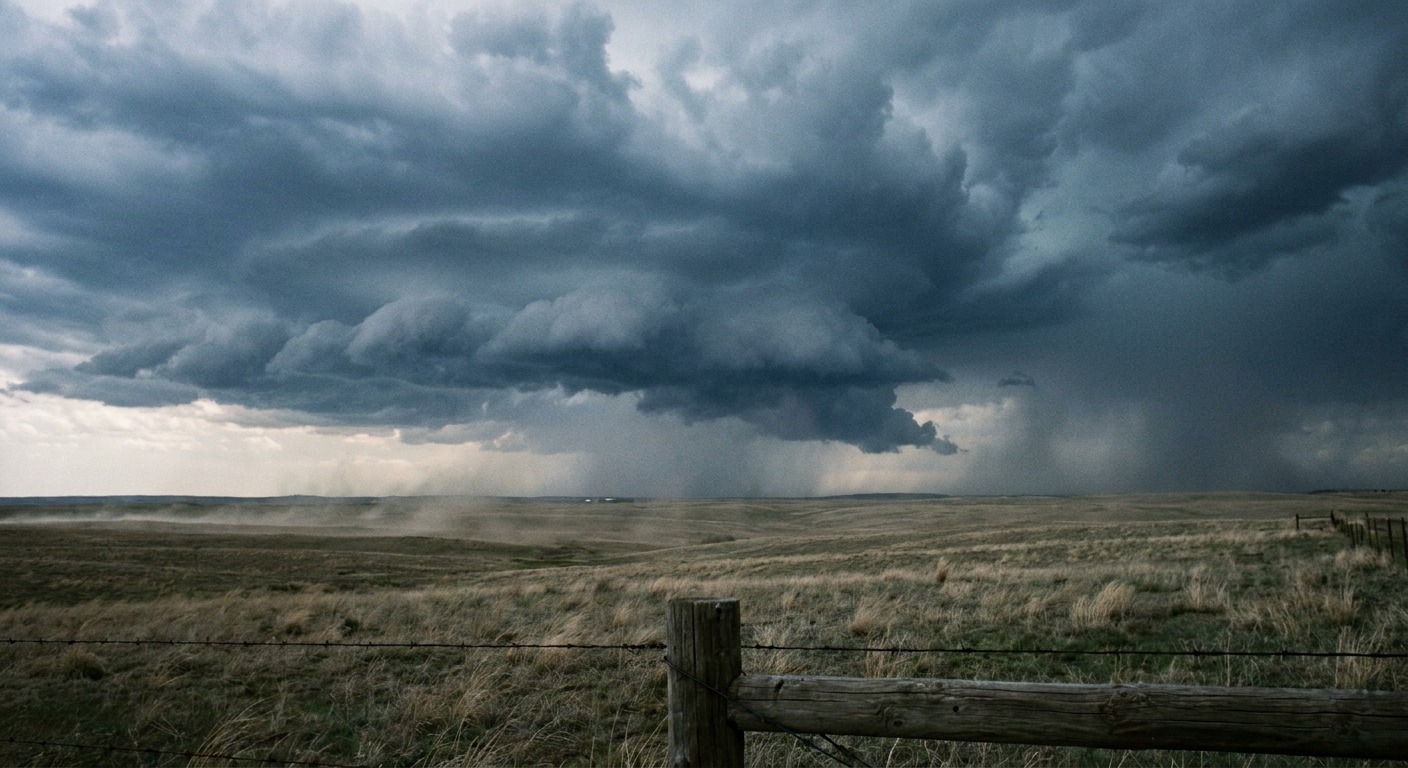
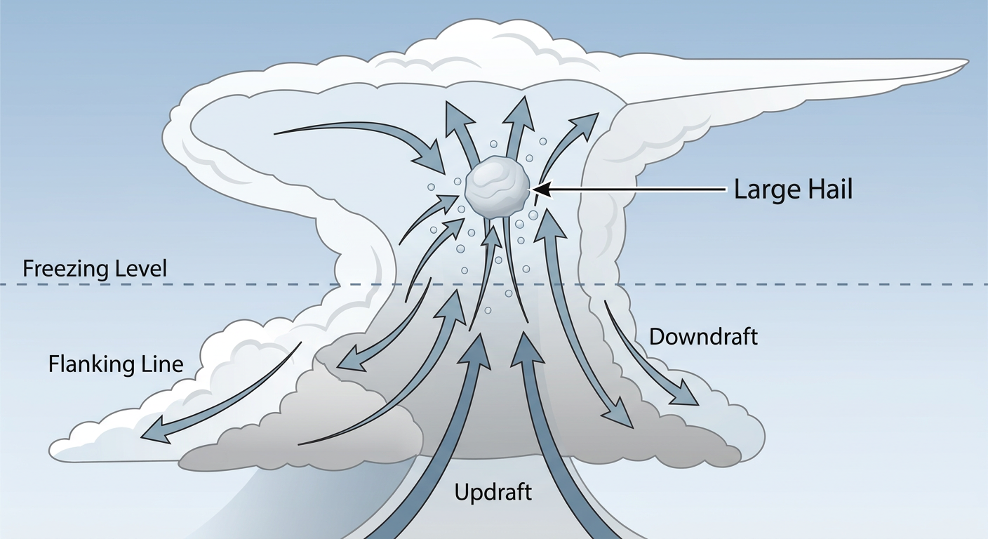
The main hazard for Thursday and Friday is large hail. We have hatched areas indicating the potential for hailstones 2 inches or larger. That is hen-egg size. If you live in Wichita, Topeka, or Kansas City, you need to park your vehicles in a garage or under a carport.
Saturday is when the ceiling on this event gets higher. The SPC has another Slight Risk posted for places like Omaha, Lincoln, and Des Moines. The forecast discussion explicitly mentions the potential for hailstones up to 3 inches in diameter and a strong tornado. That is a day you need to have your weather radio on standby.
Sunday and Monday Outbreak Potential
Get this. The SPC has already outlined 30 percent risk areas for Sunday and Monday. That covers a huge chunk of real estate from Sioux Falls down through Omaha and Des Moines.
The discussion uses the phrase "SEVERE WEATHER OUTBREAK POSSIBLE" for Sunday and Monday. We do not see that wording often this far out. A strong upper-level trough is going to swing out of the Intermountain West and tap into that deeply unstable airmass. If you are traveling along I-80 or I-35 this weekend, or if you have outdoor plans across the Midwest, you need to monitor this forecast closely.
Texas Fire Danger
While the Plains deal with storms, the southern end of this system is pulling in bone-dry air. By Friday, we have a Critical Fire Weather area for the Texas Caprock and upper Rolling Plains.
Places like Lubbock and Plainview are looking at single-digit humidity and strong westerly winds. The vegetation out there is dry, and any spark is going to run fast. Please avoid any outdoor burning or activities that could throw a spark into dry grass.
A Quick Space Weather Note
Just a quick heads up for our sky watchers. We have a G2 Moderate Geomagnetic Storm ongoing right now. If you live in the northern tier of the United States and have clear skies tonight, keep an eye out. You might catch a glimpse of the aurora.
Bottom Line
The Central US is entering a highly active and potentially dangerous weather period. We are looking at five straight days of severe weather risks, peaking Sunday and Monday. Have multiple ways to get warnings that will wake you up at night. Review your shelter plans today while the weather is quiet, and make sure your family knows exactly where to go if a warning is issued.
https://ryanhallyall.com/blog/a-multi-day-severe-marathon-and-sunday-outbreak-potential