Blog Article
Multi-Day Severe Weather Threat: Texas to the Midwest
A major temperature clash is sparking a multi-day severe weather threat across the Plains and South, plus heavy snow out West and ice in the Northeast.
Alright folks, let's talk about what is happening out there. As we talked about yesterday, that massive atmospheric tug-of-war between the freezing Arctic air and our record-breaking Southern heat is officially underway. Y'all, we literally saw a 130-degree temperature difference between the wind chills in Alaska and the heat in West Texas yesterday. When you have extremes fighting like that, the weather gets wild in the middle.
Now, we are looking down the barrel of a multi-day severe weather setup across the central United States, a messy winter storm in the Northeast, and some serious mountain snow out West. Let us break down exactly what you need to know to keep your family safe this week.
The Big Picture: A Coast-to-Coast Clash
Before we get to the severe storms, let us look at the ends of the country. Out West, a really potent cold front is sweeping through the Intermountain West and Rockies. If you are traveling through the Cascades or into Idaho and Montana, you need to be ready for heavy mountain snow. Snow levels are dropping down to 3,000 feet, which means you will definitely want to leave early for your commute and prep for winter driving conditions.
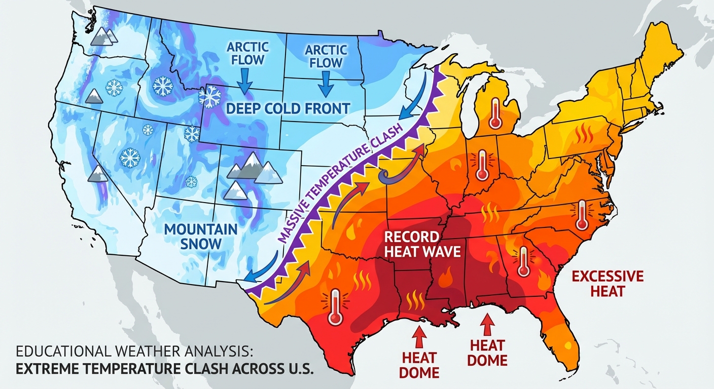
Meanwhile, in the Northeast and Mid-Atlantic today, we are dealing with a totally different headache. A warm front is lifting north, but cold air is stubbornly trapped at the surface. That is creating a nasty wintry mix of snow, sleet, and freezing rain. If you live north of I-90 in New York or New England, you are holding onto the snow and ice the longest today. Please take it slow on the roads, especially if you are heading out this afternoon.
Multi-Day Severe Weather Threat
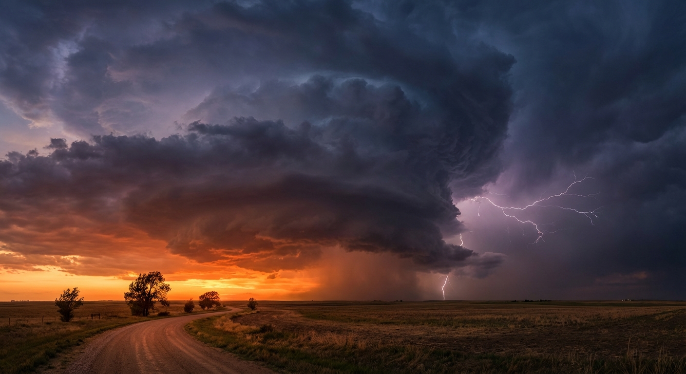
Here is the thing, the biggest story of the week is going to be the severe weather in the central part of the country. The heat building up down south is acting like premium fuel for thunderstorms. If you are heading out to the polls today for the Texas and North Carolina primary elections, expect it to be unseasonably warm. In the Texas Panhandle and Southern High Plains, it is going to be dry and windy, creating an elevated fire risk today. Please do not do any outdoor burning.
But as we move into the middle and end of the week, that dryline and cold front will start lighting up with storms.
- Wednesday (Day 2): We have a Slight Risk (Level 2 out of 5) for severe storms from north-central Texas up through southeast Oklahoma and into the Missouri Ozarks. If you live in Dallas, Fort Worth, or Arlington, keep an eye on the sky tomorrow afternoon and evening. We are looking at large hail and damaging wind gusts as a line of strong storms develops.
- Thursday (Day 3): The focus shifts a bit further west. We are watching another Slight Risk area for folks in Lubbock, Amarillo, and Lawton. Scattered storms are expected to fire up right along the dryline in the late afternoon. Large hail and a tornado or two are absolutely possible here.
- Friday (Day 4): Get this, the Storm Prediction Center has already issued a 30% risk area for Friday. When meteorologists highlight an area that high this many days in advance, you need to pay attention. A highly unstable airmass is going to be in place from the Red River in Texas up through eastern Oklahoma, eastern Kansas, and northwestern Missouri.
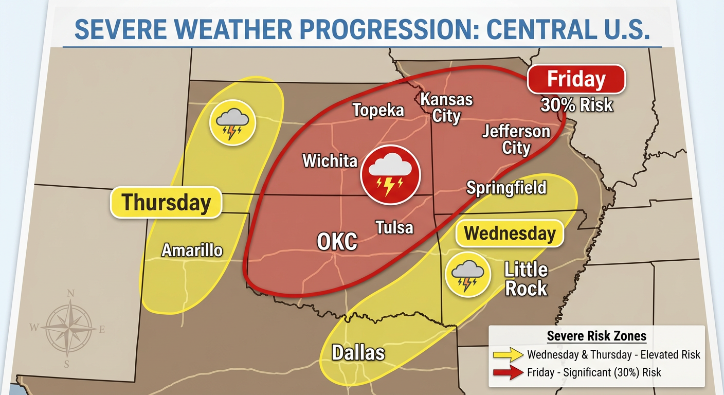
Friday has the potential to produce supercells capable of tornadoes, very large hail, and severe wind gusts. Cities like Oklahoma City, Tulsa, and Kansas City are right in the bullseye. If you have outdoor plans Friday night, you need to start thinking about a backup plan now.
Flash Flooding Concerns
On top of the wind and hail, we are going to see a lot of water. We have a conveyor belt of moisture riding up from Texas straight into the Ohio Valley. Because these storms are going to track over the same areas again and again, we are looking at 1 to 3 inches of rainfall through Thursday morning. The Weather Prediction Center has outlined a Marginal Risk for flash flooding from the Missouri Ozarks into southern Ohio.
If you live in a low-lying area or near a creek that likes to jump its banks, keep an eye on the water levels.
The Bottom Line
We are in a very active, spring-like weather pattern. You will be swinging from the AC to hoodies depending on what side of this storm system you are on.
- For the West and Northeast: Prepare for slick roads and winter travel impacts today and tomorrow.
- For the Plains and South: You need to be weather-aware from Wednesday through Friday. Friday looks particularly dangerous for the Southern and Central Plains.
- Take Action: Download a reliable weather app, make sure your phone is charged, and have multiple ways to receive severe weather warnings that will wake you up at night.
I will keep watching the data and updating y'all as this situation evolves. Stay safe out there!
https://ryanhallyall.com/blog/a-multi-day-severe-weather-outbreak-is-brewing-what-yall-need-to-know