Blog Article
Severe Storms in the Plains & Texas Flood Risk | June 2
While the Memorial Tournament enjoys perfect weather, the Northern Plains face severe storms and the Texas Panhandle braces for flash flooding.
A Tale of Two Skies: Pristine Golf Weather vs. Plains Storms
Good evening, y'all. If you follow sports, you probably saw the news today about Jake Knapp suddenly withdrawing from the Memorial Tournament. It is a shame, especially because the weather up in the Ohio Valley this week is absolutely perfect. We are talking crisp air, clear skies, and zero humidity. But while the Midwest gets a pristine stretch of early June weather, the atmosphere is putting in overtime almost everywhere else.
We have a lot of moving parts tonight. Let's look at what is happening out west.
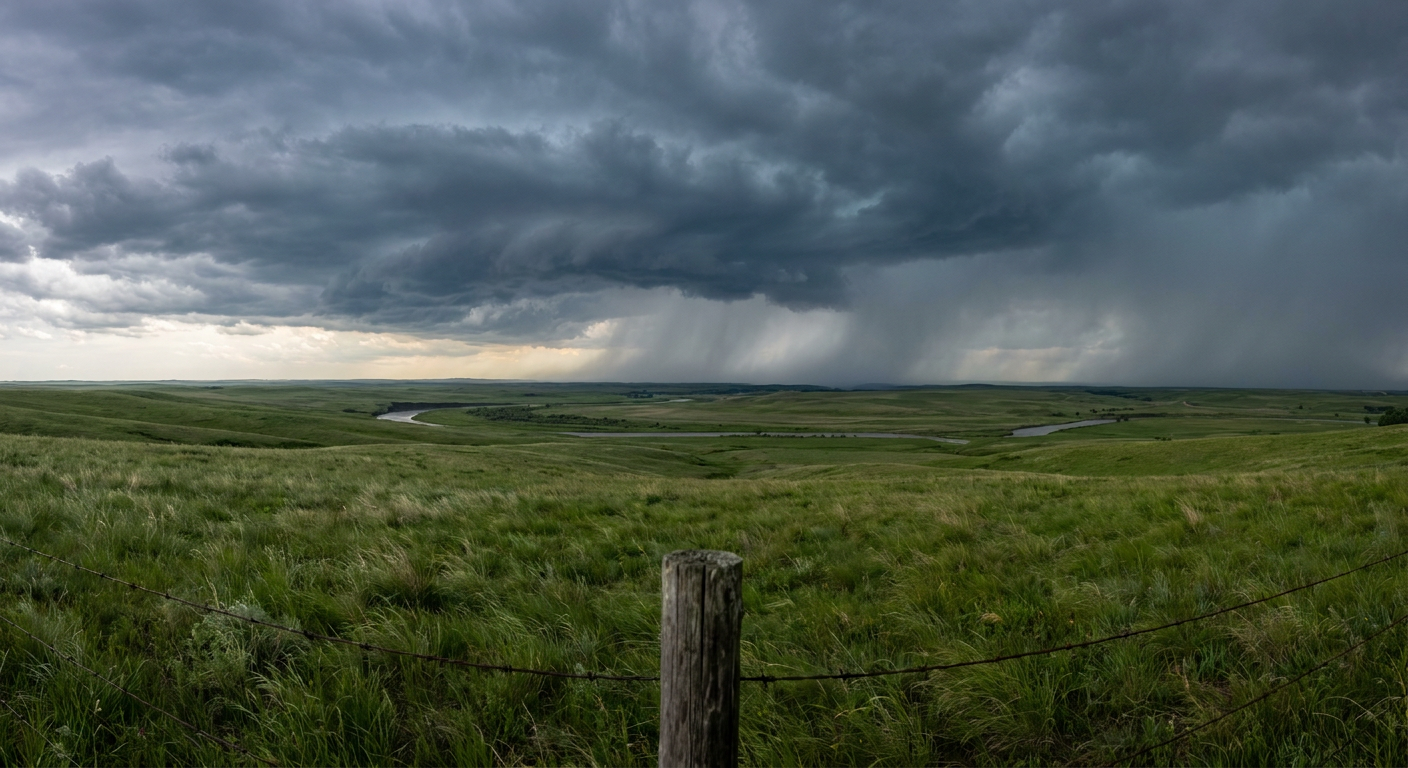
The Northern Plains Wind Threat
Up in the Dakotas and stretching into Minnesota, things are quite a bit rowdier. We have a Slight Risk for severe weather tonight and tomorrow. If you are heading out to the White Sox and Twins game in Minneapolis tonight, you might dodge the worst of it. But by Wednesday, we are looking at a setup where isolated supercells will likely merge into a solid line of storms.
The main threat up there is damaging wind. The Storm Prediction Center is highlighting a 15 percent chance of severe wind gusts for Wednesday, and some of those could pack a serious punch. We are also watching a hatched area for hail two inches or larger. That is hen-egg size, folks. It will absolutely dent a car or ruin a roof.
Texas Panhandle Soaking
Down in the Southern Plains, the story is water. The Texas Panhandle and western Oklahoma are sitting under a Slight Risk for excessive rainfall.
The atmosphere down there is loaded with moisture. In fact, the water content in the air is two standard deviations above normal for early June. That means any storm that forms is going to dump rain like a bucket. We could easily see localized totals of three to four inches. The ground in West Texas can only take so much water at once before it runs off. Flash flooding is a real concern tonight and tomorrow.
Tropics and Space
And get this. The atmosphere is so busy right now that we are even tracking action in space and the deep ocean.
The Space Weather Prediction Center issued a forecast for a G1 minor geomagnetic storm today. You might actually see the Northern Lights if the clouds clear out in the northern tier of the country. Meanwhile, way out in the Eastern Pacific, we just got our first tropical depression of the season. Tropical Depression One-E is spinning over open water with 30 mph winds. It is not a threat to land, but it is a solid reminder that hurricane season is officially awake.
The map is lit up with a little bit of everything tonight. Enjoy the quiet if you have it out east. For those of you in the Dakotas, keep your phone loud enough to wake you up if a warning gets issued tonight. And down in the Texas Panhandle, respect the water and turn around if you see a flooded road.
https://ryanhallyall.com/blog/a-tale-of-two-skies-pristine-golf-weather-vs-plains-storms