Blog Article
Hawaii Tropical Watch, New England Rain, Aurora Chance
NHC gives a 90% chance of tropical depression formation near Hawaii, while New England faces a soggy weekend and a G2 geomagnetic storm could bring aurora south.
A Tropical System Taking Shape Near Hawaii, a Soggy New England Weekend, and a Northern Lights Shot
Alright y'all, good Friday morning. No named storms spinning anywhere in the Atlantic or Pacific right now, but don't let that fool you into thinking it's a quiet day on the weather desk. Get this: we've got a system south of Hawaii that's about to become something, a wet pattern locked in over southeastern New England, and a geomagnetic storm watch that could put the northern lights on your weekend radar if you're far enough north. Let's get into it.
Tropical Watch: Central Pacific System Likely to Become a Depression Today
The big tropical story this morning is sitting a few hundred miles southeast of the Big Island. The National Hurricane Center has been watching this area of low pressure for a couple days now, and as of last night's outlook, they're giving it a 90 percent chance of becoming a tropical depression on Friday. That's about as confident as these outlooks get before something actually spins up and gets a name.
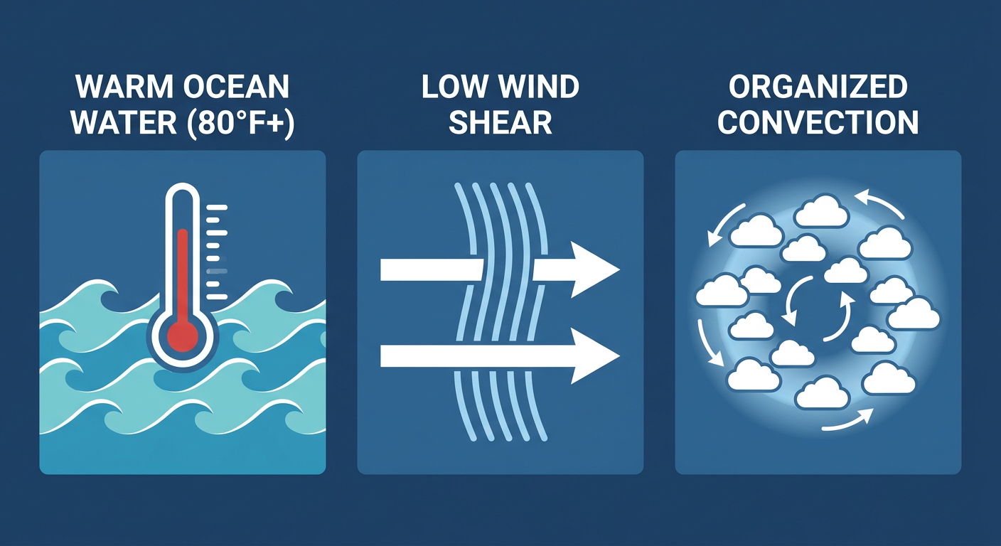
Here's the setup in plain terms: warm ocean water, low wind shear, and showers and thunderstorms that have been slowly organizing around a center. Environmental conditions are described as conducive for additional development, and the system is forecast to track west-northwestward to westward over the next several days, generally staying south of the main Hawaiian Islands. That track matters a lot for impacts. If it holds, direct land effects should stay limited, but marine interests, surfers, and anyone with boats in Hawaiian waters need to keep an eye on swell and wind as this thing organizes.
We'll keep tracking this one since a 90 percent chance 48 hours out is about as close to a lock as the tropics give you this time of year. Meanwhile, there's a second area, EP-AREA-3 in the eastern Pacific, sitting at a more modest 40 percent chance over the next week, and a non-tropical gale-force low a few hundred miles south of Bermuda that could pick up some subtropical characteristics before it loses support from unfavorable upper-level winds by late weekend. Neither of those is an immediate concern, but they're worth a glance.
Rain Risk: Soggy Stretch Continues for Southeastern New England
If you're in Boston or anywhere from the Rhode Island coast into southeastern Massachusetts, you already know what we're talking about. WPC has southeastern New England under a Slight Risk of excessive rainfall today into Saturday morning, with the heaviest focus expanding into Boston Metro, eastern and southeastern Connecticut, and far eastern Long Island. That trending search for "weather boston" this morning makes a lot of sense. An 18-day dry stretch just ended, and now the region's dealing with a slow-moving trough that keeps wringing out moisture.
This isn't a flash flood emergency kind of setup like what hammered north Georgia and southeastern Tennessee earlier this week, where training storms dropped 5 to 8+ inches and the Toccoa River crested at a record 18.05 feet in McCaysville. But soils and storm drains in Rhode Island and eastern Massachusetts are still working through residual saturation, so another round of heavy rain on top of that is a real concern for urban flooding and small-stream rises. If you commute through the Boston metro Friday into Saturday morning, give yourself extra time and watch for standing water on underpasses.
Further south, coastal New Jersey and the southern Delmarva sit under a Marginal Risk today too, tied to the same slow-moving frontal boundary. That's a lower-end signal, but still enough to produce locally enhanced rainfall totals along the coast.
Severe Weather: An Isolated Threat Along the Carolina Coast
SPC has a Marginal Risk posted today from the Carolinas into the Mid-Atlantic coast, covering Raleigh, Virginia Beach, Norfolk, and up toward the Delmarva. This ties back to that same upper-level low over the eastern Great Lakes merging with a shortwave trough sliding across the central Appalachians. The tornado probability sits at just 2 percent and the wind probability at 5 percent, both Level 1 on SPC's scale. In plain English, that means isolated strong to severe storms are possible, mainly along the eastern Carolinas and southern Mid-Atlantic coast, but this is not a setup that should disrupt your Friday plans. Just know a stray strong gust or a quick spin-up isn't out of the question if storms manage to organize along the coast.
Looking Ahead: Texas Rain, SoCal Fire Weather, and a Shot at Aurora
A few things worth keeping on your radar heading into the weekend:
- South and south-central Texas move into a WPC Slight Risk for excessive rainfall by Sunday into Monday as an upper-level trough shifts out of the Southwest. The Hill Country and Rio Grande Valley are the areas to watch for locally heavy downpours and isolated flash flooding.
- Southern California fire weather picks up Saturday. SPC's Day 2 outlook flags a weak to moderate Santa Ana wind event across the San Gabriel, Santa Monica, and Santa Susana mountains, with sustained winds near 20 mph gusting 30 to 40 mph and relative humidity dropping to 15-20 percent. That's an elevated fire weather setup, not extreme, but it's worth attention given how dry those slopes already are heading into the dry season.
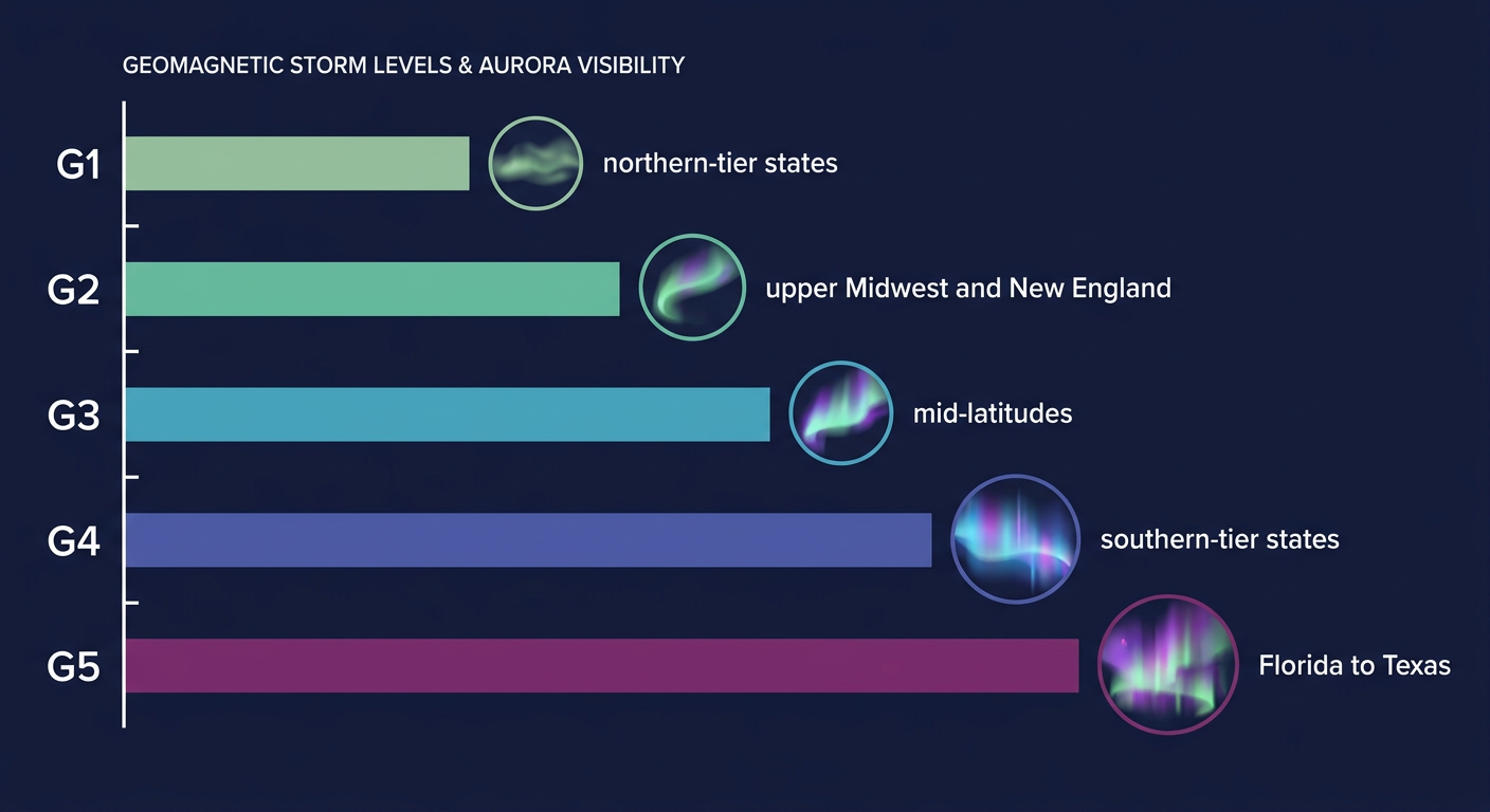
- Space weather could give skywatchers a treat. SWPC's forecast calls for G1 Minor geomagnetic storming likely November 6-8, with a chance of G2 Moderate levels on the 7th and 8th, driven by a coronal hole high-speed stream and some flare activity out of active regions 4565 and 4566. If you're anywhere in the northern tier, especially the upper Midwest or New England, keep an eye to the north after dark this weekend.
- Southeast Arizona carries a Marginal excessive rainfall risk Saturday as a developing upper-level wave brings isolated to scattered thunderstorms capable of producing around an inch of rain, enough for localized flash flooding concerns in desert drainages.
As for the rest of the country, the "nice weather" outlook this morning actually reads pretty good for a lot of folks. The best outdoor conditions today run in a narrow corridor from northern Louisiana and southwest Mississippi into southern Arizona and southern California, and a broader comfortable zone stretches from the desert Southwest across the southern Rockies into the Tennessee and lower Mississippi Valleys. If you're headed to an outdoor event this weekend in that stretch, you're in decent shape. Saturday's best bet shifts toward eastern Tennessee, the western Carolinas, southwest Virginia, and pockets of the southern Rockies, with temperatures running seasonable for early November, think OKC and Tulsa in the upper 50s to low 60s, Dallas in the mid 60s, right around normal for this time of year.
Key Factors We're Watching
- Whether the Central Pacific system actually organizes into a depression today and how close its westward track takes it to the main Hawaiian Islands
- How much additional rain southeastern New England picks up before the Slight Risk window closes Saturday morning, especially given already-saturated ground
- Whether Carolina coast storms today can tap enough instability to turn that Marginal severe risk into anything beyond isolated gusts
- Santa Ana wind timing and duration Saturday across the San Gabriel and Santa Monica mountains
- Geomagnetic storm intensity trending toward G2 levels Saturday into Sunday night
Bottom Line
No named storms today, but there's a strong chance one gets born in the Central Pacific before the day's out, so Hawaii marine and surf interests should stay tuned. If you're in southeastern New England, plan around more rain through Saturday morning and watch for standing water on your commute. The Carolina coast severe threat is low-end, worth a glance at the sky but not a reason to change plans. And if you're way up north this weekend, it might be worth stepping outside after dark Saturday to check for aurora. Nothing urgent out there today, just a handful of things worth keeping half an eye on.