Blog Article
Midwest Severe Outbreak and Gulf Coast Flooding
A Moderate Risk for severe storms threatens the Midwest on Wednesday, while the Texas and Louisiana coasts face a multi-day flash flood emergency.

A Volatile Wednesday for the Midwest, While the Gulf Coast Keeps Flooding
Yesterday we spent a lot of time talking about the water hose pointed at the Texas Gulf Coast. That situation is still very much an emergency today. But overnight, the Storm Prediction Center issued a Moderate Risk for severe weather for Wednesday across central Illinois and northwest Indiana.
We do not see Moderate Risks every day. When they pop up, it means forecasters have high confidence in a significant event. If you live anywhere near Springfield, Peoria, or over toward Indianapolis, tomorrow is a 'have your plan ready' kind of day.
A Volatile Wednesday in the Midwest
Here is the setup for tomorrow. A potent weather system is going to swing through the Midwest, pulling a very juicy airmass north. Chicago usually sees high temperatures around 80 degrees this time of year, but the air moving in is going to feel heavy and unstable.
The Storm Prediction Center is not mincing words. They are calling for an outbreak of severe thunderstorms. The main threats include intense tornadoes, swaths of damaging wind gusts up to 80 mph, and hail the size of tennis balls.
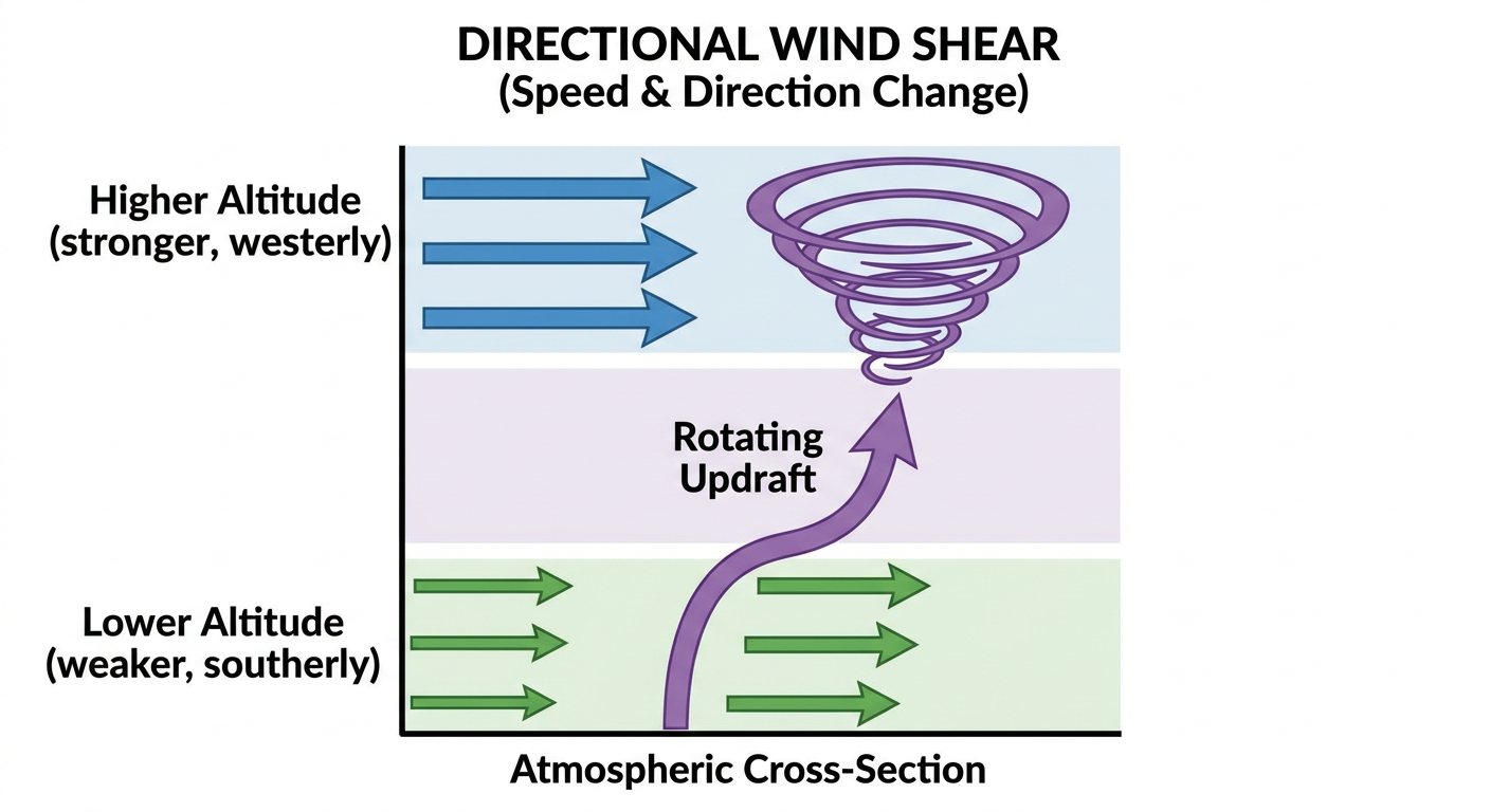
The hatched areas on the outlook mean we could see EF3 or stronger tornadoes. Tomorrow's setup in Illinois and Indiana actually mirrors the June 2015 outbreak that produced widespread damage across this exact same corridor.
If you are flying through Chicago O'Hare or Midway tomorrow, expect significant delays and ground stops. For the baseball fans, the Cubs are hosting the Rockies at Wrigley Field Wednesday night, and that game is going to be dodging some serious weather.
The Gulf Coast Flood Threat Continues
Down south, the Texas and Louisiana coasts are still dealing with a stalled tropical disturbance. The National Hurricane Center gives this system, known as AL90, a 60 percent chance of developing into a tropical depression or storm.
But as we said yesterday, the name does not matter. The water does.
The Weather Prediction Center has kept a Moderate Risk for excessive rainfall in place for today, tomorrow, and Thursday. That covers the upper Texas coast right through southwestern Louisiana. Yesterday, we saw nearly nine inches of rain fall at Cinco Ranch in Texas. The ground is completely saturated. Any new rain is going to run straight off into the streets and bayous.
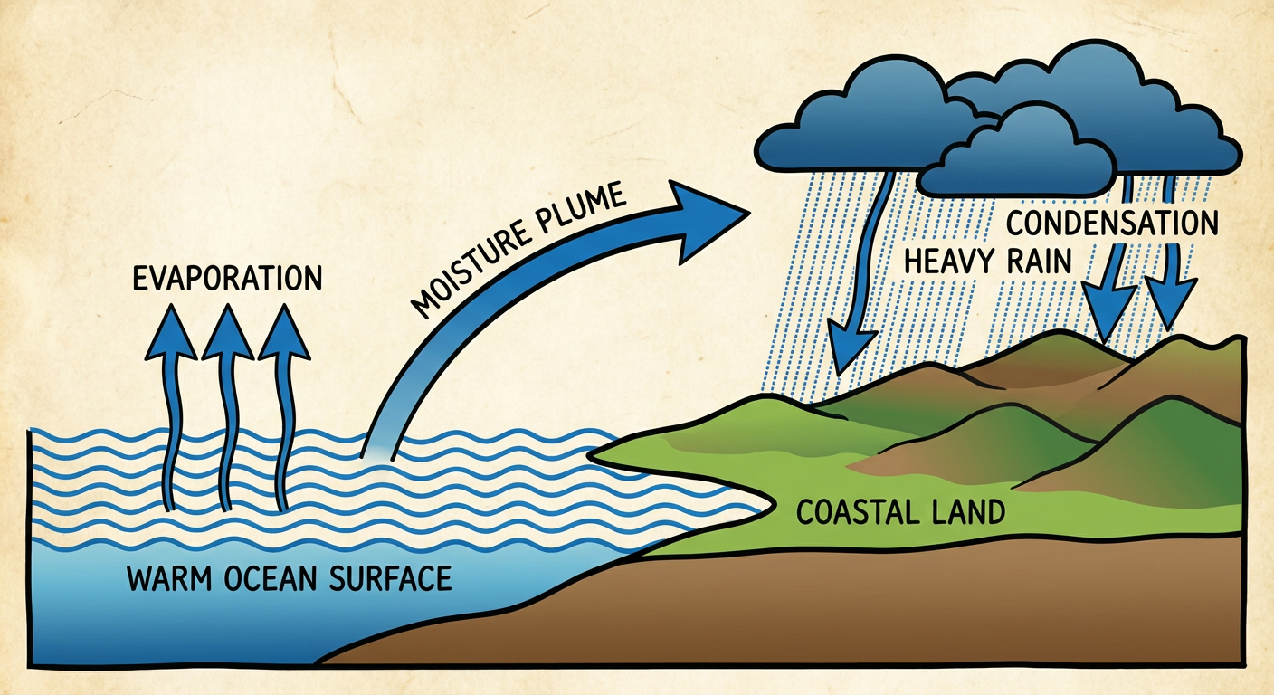
If you are in Houston, Beaumont, or Lake Charles, you need to be incredibly careful on your commute. We are looking at the potential for three to four inches of rain per hour in the heaviest bands.
Critical Fire Weather Out West
While the middle of the country deals with storms and floods, the Pacific Northwest has a completely different problem. The Storm Prediction Center has highlighted a Critical fire weather area for eastern Washington and north-central Oregon today.
A strong jet streak is moving over the region, bringing dry air and west-northwesterly winds gusting over 25 mph. In the Columbia Basin, humidity levels are dropping fast. Any fire that starts in these conditions will spread rapidly.
The Bottom Line
If you live in Illinois or Indiana, use today to prepare for tomorrow. Make sure your weather radio has fresh batteries and your phone alerts are turned on loud. Know exactly where you will go if a tornado warning is issued for your area.
For folks on the Gulf Coast, the flooding is going to continue. Do not drive your car into water if you cannot see the road. It only takes a few inches of moving water to float a vehicle.
Out west, avoid any outdoor activities that could throw a spark.
We will keep watching the data and updating you as things change.