Blog Article
Severe Storms, Tornadoes, and Extreme Fire Danger Sunday
A major weather system brings a threat of EF2+ tornadoes to the Upper Midwest, extreme fire danger to the Southern Plains, and late-season snow to the Rockies.
A Weekend of Extremes: Strong Tornadoes, Extreme Fire Danger, and Mountain Snow
Alright y'all, we have a very complex weekend ahead of us. Yesterday gave us a taste of the wild winds, with a 90 mph gust measured down in Guymon, Oklahoma, and zero-visibility dust storms in West Texas. But Sunday is the day that has my full attention. We are looking at a high-end, multi-hazard setup across the middle of the country.
Before we get to Sunday, let us talk about today. The Storm Prediction Center has an Enhanced Risk for severe storms from northeast Colorado through western Nebraska and Kansas. If you are in Kearney or North Platte, have your weather radio ready late this afternoon. The main threats today are going to be giant hail, up to two inches across, and damaging wind gusts that could top 75 mph.
If you are heading out to the Preakness Stakes in Maryland today, you are in luck. The Mid-Atlantic is sitting under high pressure with absolutely perfect, dry weather.
Sunday's Severe Threat: Strong Tornadoes Possible
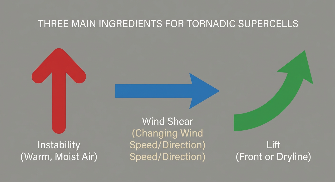
Sunday is when things get serious. A potent low-pressure system is going to eject out of the Rockies and strengthen over the Plains. The SPC has already outlined an Enhanced Risk from central Nebraska up into southwest Minnesota.
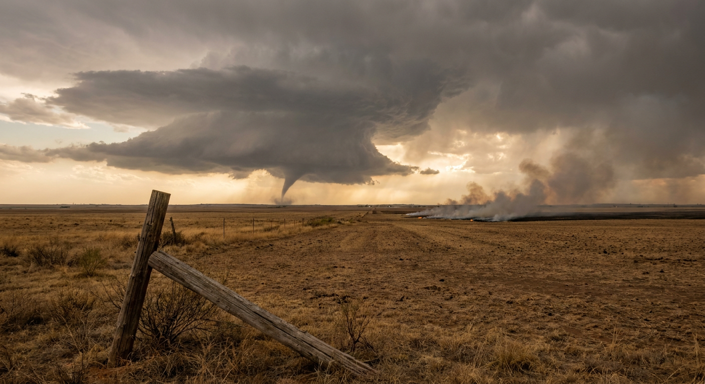
Here is the thing. We have a 10 percent hatched area for tornadoes in this zone. That means if storms form, they could produce strong, EF2 or greater tornadoes. Cities like Grand Island, Sioux City, and Sioux Falls need to be on high alert. The atmosphere is also primed for very large hail, with hailstones potentially exceeding two inches in diameter.
Sunday's Extreme Fire Danger
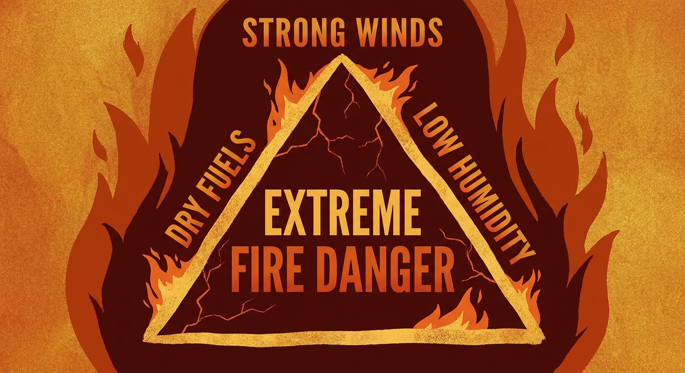
While the northern Plains deal with severe storms, the southern High Plains will face a completely different, but equally dangerous, threat. The dryline is going to mix east, and the winds behind it will be absolutely howling.
The SPC has issued an "Extremely Critical" fire weather outlook for eastern New Mexico, southeast Colorado, southwest Kansas, and the Texas and Oklahoma panhandles. We are talking about 45 to 55 mph wind gusts overlapping with relative humidity around 5 percent. If a fire starts in this environment, it will spread incredibly fast and be nearly impossible to control.
The Rockies Snow Surprise
On the cold side of this system, we have a major late-season winter storm brewing. An unseasonably cold trough is plunging into the Rockies. Denver normally sees high temperatures in the low 70s this time of year. By Sunday and Monday, they will be dealing with temperatures 15 to 20 degrees below normal and accumulating snow in the higher elevations. Heavy, wet snow will pile up in the mountains of Wyoming, Utah, and Colorado, which will definitely cause some travel headaches along I-80 and high mountain passes.
Key Factors We Are Watching
- Storm Initiation on Sunday: We are watching exactly when and where storms fire along the front in Nebraska and Iowa. Early discrete storms will carry the highest tornado threat.
- Wind Speeds in the Panhandles: The strength of the low-level jet will dictate just how bad the fire weather gets in Texas and Oklahoma.
- Snow Levels in the Rockies: We are monitoring how low the freezing line drops, as valley floors could see accumulating snow and hard freezes.
The Bottom Line
If you live anywhere from Nebraska up to Minnesota, Sunday is a day to stay close to home and keep your phone charged with alerts turned on. Have a safe shelter space cleared out just in case. If you live in the Southern High Plains, avoid any outdoor activities that could cause a spark, secure loose objects, and be ready for blowing dust to reduce visibility on the highways. We will keep watching the data and update you as this massive system takes shape.