Blog Article
Severe Storms Shift East, Heat Dome Builds: June 30 Forecast
After a 131 mph wind in South Dakota, today's severe risk moves to Wisconsin, the U.P., and the Northeast while a heat dome builds and Four Corners fire weather continues.
After the 131 MPH Wind in South Dakota, the Storm Threat Slides East and the Heat Locks In
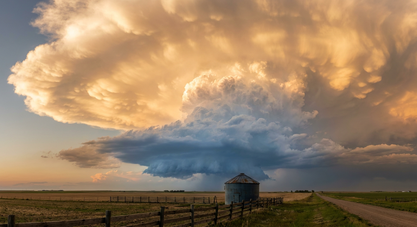
Alright y'all, let's start with what just happened, because it was a big one. Yesterday a severe storm cluster ran across the Northern Plains and put down a measured wind gust of 131 mph near Highmore, South Dakota. That's not a typo. Straight-line winds, not a tornado, peeling roofs and snapping power poles. The same system marched into the Upper Midwest and Great Lakes, dropped multiple tornadoes in northwestern Minnesota, and dumped 4.81 inches of rain on Northport, Michigan, washing out roads along the Tunnel of Trees.
That's the backdrop. Now here's where things go today. The threat doesn't disappear, it just moves the chess pieces east. And quietly underneath all of it, the heat we talked about yesterday keeps building.
Where the storms set up today
The Storm Prediction Center has a Slight Risk (that's level 2 of 5) posted in two separate zones for today. They're not connected, so let me walk through both.
Northern Wisconsin and the Upper Peninsula of Michigan. This is the spot to watch closest. Strong instability paired with effective shear around 40 to 50 knots is enough to build supercells. If storms get going here, you're looking at large hail, damaging wind, and the chance of an isolated tornado. The hail could get serious too. SPC has a small hatched area where stones could reach 2 inches, hen-egg size.
Parts of New York and Vermont, including Albany, Utica, and Burlington. Northwesterly flow aloft over a juicy warm sector gives the Northeast its own shot at severe storms this afternoon and evening. Damaging wind is the main concern, with hail and an isolated tornado not off the table.
There's also a broad Marginal Risk (level 1) that sweeps in a lot of folks, from Omaha and Minneapolis to New Orleans and Rochester. Marginal means a stray strong storm or two, not an organized outbreak. Keep an eye on the sky, but don't rearrange your day over it.
For the baseball crowd: the Tigers at Yankees game in the Bronx and the Nationals at Red Sox in Boston both sit near that Northeast risk zone tonight. First pitch is in the evening, right when storms could be firing. If you've got tickets, watch for a delay. The Padres at Cubs game in Chicago is on the southern edge of the Marginal area, so a passing storm is possible but less likely to be a problem.
The wind threat looked just like this yesterday
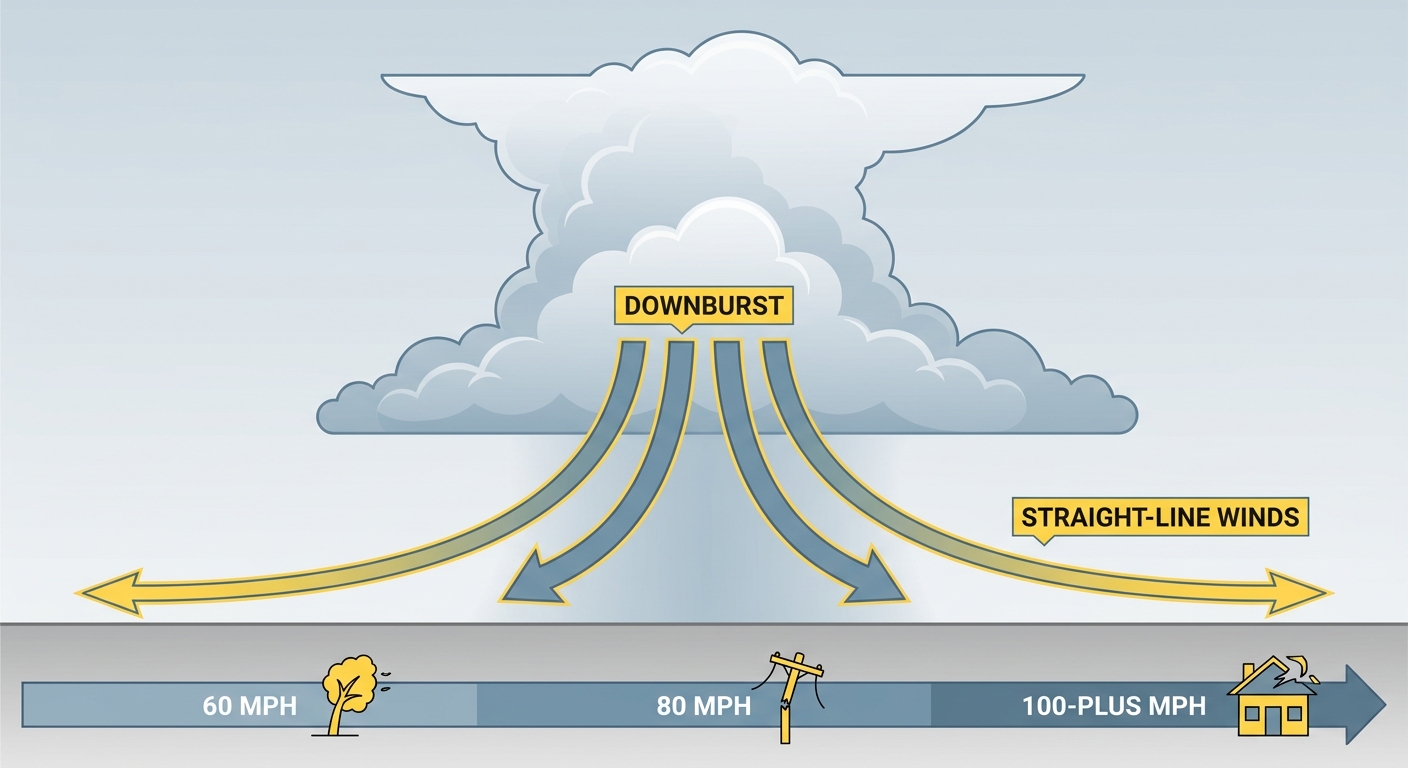
Here's the thing about what happened in South Dakota. That kind of extreme straight-line wind comes from air rushing down out of a storm and spreading out hard when it hits the ground. We call it a downburst, and when storms organize into a long line or cluster, those downbursts can stack into a corridor of damage.
Northern Minnesota has seen this movie before. The 1999 Boundary Waters derecho is the classic local example, and June 17, 2010 brought another high-end Minnesota severe day. Late June is squarely in the active season up there, so yesterday's event, while extreme, wasn't out of season. The 131 mph reading is the rare part. That's a number you usually see with a strong tornado, not straight-line wind.
The heat dome keeps building
We flagged this yesterday and nothing has changed to back it off. A strong upper-level ridge is parked over the eastern two-thirds of the country. Air sinks under a ridge, sinking air warms and dries the upper levels, skies clear, and the sun cooks the surface day after day.
The forecast discussions are pointing to heat indices in the 105 to 115 range pushing into the Mid-Atlantic and Ohio Valley as the week goes on. For context, a normal late-June high in Nashville is 88 and in New York it's around 80. When the air feels like 110, that's a real strain on anybody working or playing outside. Summerfest in Milwaukee, Boston Harborfest, and the lead-up to the Fourth all land inside this pattern.
If you're headed to a ballgame or a festival this week, treat the heat like the main event. Water, shade, and pacing yourself matter more than the storm chance most days.
Fire weather in the Four Corners, day after day
While the East bakes and the Upper Midwest storms, the Four Corners stays dangerously dry. SPC has a Critical fire weather area up for northeast Arizona, eastern Utah, western Colorado, and far northwest New Mexico. Flagstaff, Grand Junction, and Farmington are in it. We're talking relative humidity down in the single digits to low teens with gusty afternoon winds.
That's the same setup that grew the Cottonwood Fire in Utah past 93,000 acres this week, a fire that has already cost three firefighters their lives. Any new ignition in that kind of air can run fast. If you're out there, no open flames, no dragging chains, no parking a hot vehicle over dry grass.
What I'm watching
- Upper Peninsula and northern Wisconsin storms this afternoon and evening, the highest-confidence severe zone today. Large hail and damaging wind lead the way.
- Northeast storms near Albany, Utica, and Burlington, with damaging wind the main concern around the evening ballgames.
- An early-morning storm cluster possible Wednesday in eastern South Dakota into southern Minnesota, which the SPC Day 2 outlook already flags with a Slight Risk for the Minneapolis area.
- The heat dome expanding east, with heat indices climbing toward 105 to 115 through the holiday week.
- Four Corners fire weather for a second straight day, with critical conditions in the same areas already burning.
The tropics and the sun, briefly
No named storms anywhere right now. The National Hurricane Center has a low-pressure area off the Southeast coast with only a 10 percent chance of development over the next week, so that's a non-event. Out in the eastern Pacific, Invest 95E is a weak disturbance well offshore, no threat to land.
On the space weather side, NOAA expects G1 minor geomagnetic storm conditions today as a coronal mass ejection arrives, with a chance of brief G2 levels. That can nudge the aurora a little farther south than usual, but it's not the kind of event that disrupts daily life.
Bottom line
The big damaging wind event is behind us, but the same pattern keeps producing. Today the severe risk is split between the Upper Peninsula and northern Wisconsin, where large hail and damaging wind are the main worry, and the Northeast around the evening ballgames. If you're in either Slight Risk zone, have a way to get warnings and a plan to get inside fast. Everybody east of the Plains should plan around the heat this week: hydrate, find shade, and don't push it outdoors in the hottest part of the afternoon. And out West in the Four Corners, treat every spark like it matters, because right now it does.