Blog Article
Deep Freeze Update: Florida Cold Records & Lake Effect Snow
The bomb cyclone is gone, but dangerous cold hits Florida and black ice threatens the South. Plus, lake-effect snow buries NY and rain hits the PNW.
After the Bomb: The Deep Freeze, Black Ice, and What's Next
Alright folks, take a deep breath. We made it through a wild 24 hours. Yesterday was one for the history books with that bomb cyclone exploding off the East Coast and that mess of ice down South. I know a lot of y'all are waking up to power outages—especially in the Mid-South—and my heart goes out to everyone dealing with the cold in the dark today.
But here is the thing. Just because the snow has stopped falling in the Carolinas or the freezing rain has quit in Tennessee doesn't mean the danger is over. We have shifted gears from "active storm" to "deep freeze," and that brings its own set of problems.
The Big Refreeze & Florida's "Winter"
If you are in the Mid-Atlantic, the Tennessee Valley, or even down into parts of Texas, listen up. The sun might be out today, but do not let it fool you. Temperatures are tanking tonight. Any slush, puddles, or wet spots on the road are going to turn into solid sheets of black ice. If you are heading out to the Richmond Chocolate, Wine & Whiskey Festival next week or just commuting on Monday, you need to drive like you're on skates.
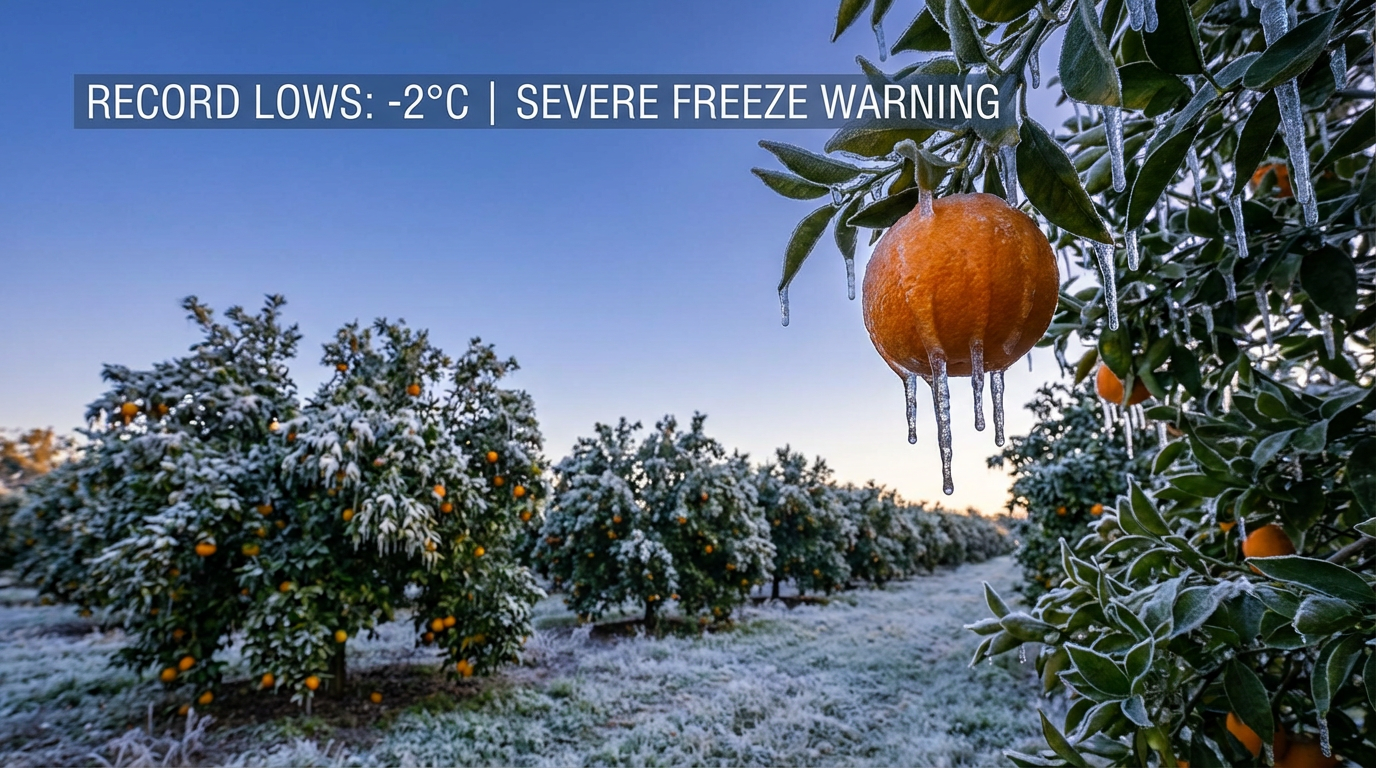
And get this. The cold air is plunging so far south that Florida is seeing temperatures we haven't seen since 1989. We are talking about Hard Freeze Warnings for the peninsula. If you are in Tampa for the Shipwrecked Music Festival today, bundle up. Seriously. The wind chills are going to be in the teens and 20s. This isn't "cool" weather for Florida. It is dangerous cold for folks not used to it. Protect your pipes, your plants, and bring the pets inside.
The Great Lakes Snow Machine is Roaring
While the main storm system has moved off toward Canada (clipping Cape Cod with some wind and snow on the way out), it left the door wide open for Arctic air to rush over the Great Lakes. Since the lakes are relatively warm compared to this bitter air mass, the lake-effect snow machine is cranking at full power.
We are seeing snowfall rates that are absolutely bonkers east of Lake Ontario. We are talking about the Tug Hill Plateau and areas near Watertown, NY. The data suggests localized spots could pick up feet of snow, not inches. If you live in these snowbelts, you know the drill, but this is a high-intensity band. Visibility is going to be near zero at times.
The West Coast: Atmospheric River Returns
We can't just look at the East Coast. We have to turn our eyes West. A massive plume of moisture is setting up in the Pacific, and it is aiming right for the Pacific Northwest.
Starting late this weekend into next week, we are looking at an atmospheric river event for Washington and Oregon. This means heavy rain for the lowlands and heavy snow for the Cascades and Olympics. If you are traveling through the mountain passes, get ready. The ground is already saturated in spots, so we have to watch out for localized flooding again.
A Clipper for the Midwest
For my friends in the Northern Plains and Midwest, like those attending the Minnesota Brewsology event in St. Paul, you are looking at a classic "Alberta Clipper." This is a fast-moving system dropping down from Canada. It is going to spread a quick burst of light snow—generally 1 to 3 inches—across the Dakotas, Minnesota, and into the Great Lakes by Sunday. It won't be a blockbuster storm, but it will keep things slick.
Bottom Line
- Watch for Ice: If it melts today, it freezes tonight. Roads will be treacherous tomorrow morning from Texas to Philly.
- Florida Freeze: This is historic cold for the Sunshine State. Take it seriously.
- Upstate NY: Heavy lake-effect snow continues. Travel is dangerous in the snowbelts.
- Pacific Northwest: Prepare for heavy rain and mountain snow starting mid-week.
Stay warm and check on your neighbors, y'all.
https://ryanhallyall.com/blog/after-the-bomb-the-deep-freeze-black-ice-and-whats-next