Blog Article
Deep Freeze & Lake Effect Snow: Weather Update Jan 26, 2026
Dangerous cold and black ice threaten the South and East while lake-effect snow buries NY. Plus, a new atmospheric river targets the Pacific Northwest.
After the Storm: The Deep Freeze, Lake Effect, and What's Next
Alright folks, take a deep breath. We made it through a wild 24 hours. Yesterday was one for the history books with that mess of ice down South and heavy snow up North. I know a lot of y'all are waking up to power outages—over a million of them at last check—and my heart goes out to everyone dealing with the cold in the dark today.
But here is the thing. Just because the snow has stopped falling in D.C. or the freezing rain has quit in Tennessee doesn't mean the danger is over. We have shifted gears from "active storm" to "deep freeze," and that brings its own set of problems.
The Big Refreeze
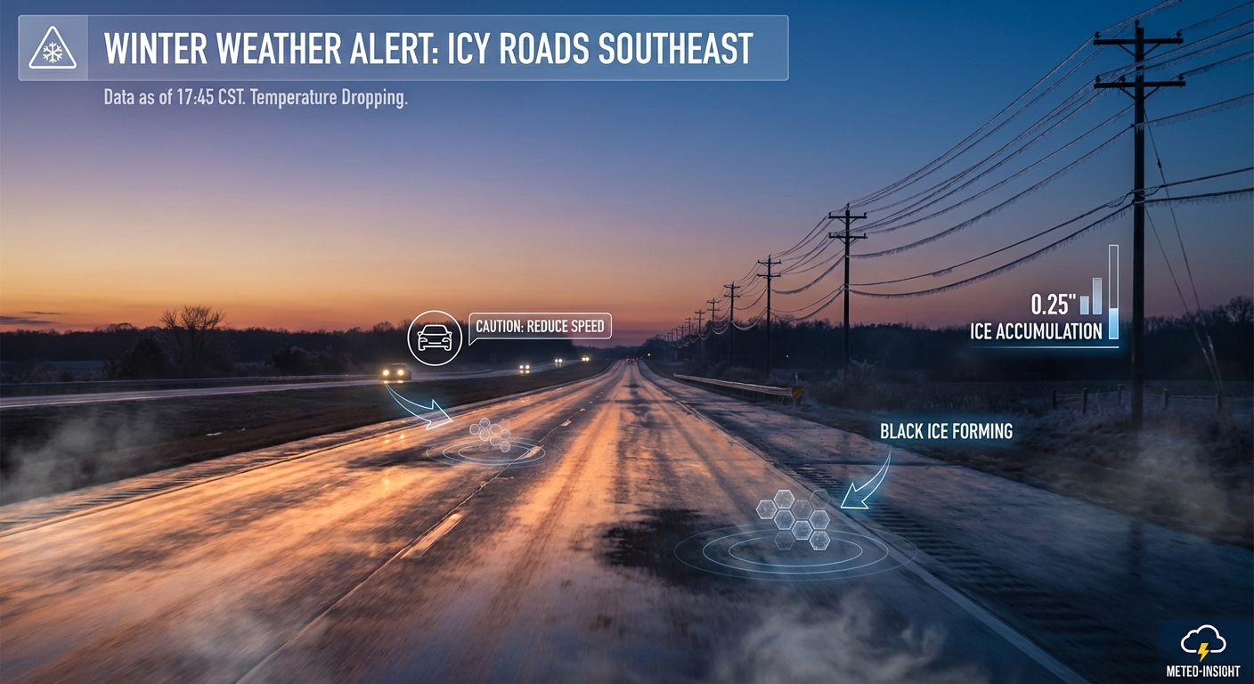
If you are in the Mid-Atlantic, the Tennessee Valley, or even down into parts of Texas like Round Rock or Austin, listen up. The sun might be out today, and you might get a little bit of melting on the roads. But the minute that sun goes down, temperatures are going to tank.
We are looking at lows dropping into the single digits and teens tonight. Any slush, puddles, or wet spots on the road are going to turn into solid sheets of ice. This is that "black ice" scenario that catches commuters off guard. If you are heading out tomorrow morning, especially in places like Nashville or the D.C. metro, treat anything that looks wet like it is ice.
For folks heading to the KidsLinked Children's Festival in Round Rock later this week, the good news is you are thawing out, but watch your step on untreated sidewalks until then.
The Great Lakes Snow Machine is Roaring
While the main storm system has moved off into the Atlantic, it left the door wide open for Arctic air to rush over the Great Lakes. Since the lakes are relatively warm compared to this bitter air mass, the lake-effect snow machine is cranking at full power.
We are seeing snowfall rates of 2 to 3 inches per hour east of Lake Ontario. We are talking about the Tug Hill Plateau, Oswego, and Jefferson counties in New York. The data suggests localized spots could pick up 1 to 2 feet of snow by Thursday. If you live in these snowbelts, you know the drill, but this is a high-intensity band. Visibility is going to be near zero at times.
Florida: Dry and Windy
Down in Florida, you missed the snow, but you are getting the dry side of this front. The humidity has plummeted, and the winds are gusty. The Storm Prediction Center actually has an "Elevated" fire weather risk for the western Florida peninsula today and tomorrow.
If you are getting ready for the Shipwrecked Music Festival in Tampa this weekend, the weather looks dry, but keep an eye on those burn bans if you are doing any camping beforehand. It is jacket weather for y'all, no doubt about it.
The Next Big Player: Atmospheric River
We can't just look at the East Coast. We have to turn our eyes West. A massive plume of moisture is setting up in the Pacific, and it is aiming right for the Pacific Northwest.
Starting Wednesday into Thursday, we are looking at an atmospheric river event for Washington and Oregon. This means heavy rain for the lowlands and feet of snow for the Cascades and Olympics. If you travel through the mountain passes, get ready. The WPC has already flagged a risk for excessive rainfall, so localized flooding is on the table for the Olympic Peninsula.
Weekend Tease: Another East Coast Storm?
I don't want to scare anybody, but I have to tell you what the data is showing. The long-range models are hinting at another system trying to crawl up the East Coast next weekend.
Right now, it is just a signal. It could go out to sea, or it could hug the coast and bring another round of wind and wintry mix to the I-95 corridor. We are watching the energy coming out of the Gulf late this week. It is too early to lock in details, but just keep it in the back of your mind if you have Saturday plans.
Bottom Line
- Watch for Ice: If it melts today, it freezes tonight. Roads will be slick tomorrow morning from Texas to Philly.
- Upstate NY: Heavy lake-effect snow continues. Travel is dangerous in the snowbelts.
- Pacific Northwest: Prepare for heavy rain and mountain snow starting mid-week.
- The Cold: Wind chills in the Northern Plains are still life-threatening (-40°F range). Limit time outside.
Stay warm and check on your neighbors, y'all.
https://ryanhallyall.com/blog/after-the-storm-the-deep-freeze-lake-effect-and-whats-next