Blog Article
Nashville Storms Loom Over Alan Jackson's Final Concert
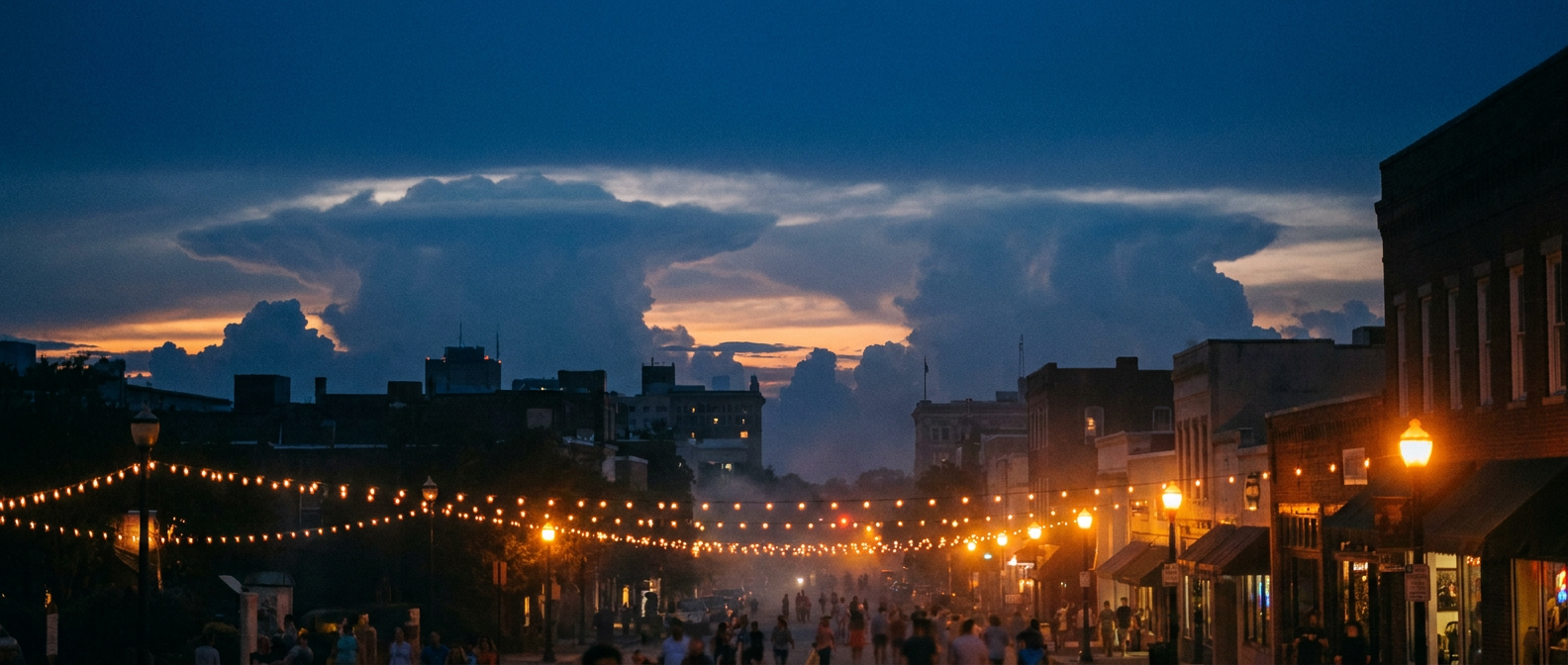
Alan Jackson's last Broadway show and a Water Lantern Festival sit under a Slight Risk for severe storms in Nashville. Here's the forecast and what to know.

Alan Jackson's Last Broadway Night and the Storms Circling Nashville
Alright folks, here's the thing about tonight in Nashville. Alan Jackson is playing his final concert, and the city's set up a free viewing right on Broadway so folks can be part of it. Get this: there's also a Water Lantern Festival happening on the water the same evening. Two outdoor moments, one country music capital, and a sky that isn't entirely on its best behavior.
Because here's what the data says. Nashville sits inside a Slight Risk for severe thunderstorms today. That's a Level 2 out of 5 from the Storm Prediction Center, drawn across the Tennessee Valley and into the Carolinas. It's not the headline-grabbing setup we saw out west this week. But it's enough to matter when you've got thousands of people standing shoulder to shoulder on a downtown street or floating lanterns by a lakeshore.
What a Slight Risk actually means for your night
Let's be clear about the language, because "slight" sounds like "don't worry about it," and that's not quite right.
A Slight Risk means scattered storms are possible, and a few of them could turn severe. For the Tennessee Valley today, the main concern is wind. The SPC has the region under a 5 percent damaging wind threat, which translates to isolated gusts of 60 mph or better if a storm gets organized. That's the kind of gust that snaps tree limbs and knocks out power, not the kind that levels a neighborhood.
Think about last night for a second. Storms rolling through the Carolinas and Kentucky dropped trees across roads from Steeds, North Carolina, to Big Creek Road in Kentucky. Same general flavor of setup. Quick-hitting, locally rough, gone in twenty minutes. That's the template for tonight.
Why summer storms in the Valley pop like this
Here's the meteorology, plain as I can make it. A big ridge of high pressure is parked over the eastern half of the country. That ridge is what's about to crank the heat up across the central and eastern US over the next few days. But around the edges of a ridge like that, the air stays unstable and moist, and little disturbances can ride along and set off storms in the late afternoon and evening.
Nashville's normal high for late June is 88 degrees with a low around 67. When you load that warm, sticky air with Gulf moisture and give it a nudge, you get pop-up storms. They feed on the heat of the day, build fast, and tend to fall apart once the sun goes down and they lose their fuel. That's why your risk window for tonight is mostly the evening hours, right when folks are gathering.
The good news for lantern-watchers and concert-goers: these storms are hit-or-miss. You might get a downpour over one part of town while three miles away stays dry. The bad news: you can't outrun one if you're standing in an open field by the water when it hits.
What to actually do tonight
If you're headed to Broadway for the Alan Jackson viewing or out to the Water Lantern Festival, a few simple things:
- Check the radar before you leave and again when you get there. Storms here move quick. A clear sky at 6 can turn into a downpour by 8.
- Know where you'd go. Open water and open streets are the worst place to be in lightning. Have a building or a vehicle in mind.
- Watch the wind, not just the rain. A 60 mph gust will turn an unsecured tent or a stack of chairs into a problem in a hurry.
- Lightning is the real story at outdoor events. When thunder roars, head indoors. There's no safe spot outside.
None of this means cancel your plans. It means keep one eye on the sky. Most of the evening across Middle Tennessee will probably be fine, warm and muggy with a storm threat that's real but scattered.
The bigger pattern moving in
While Nashville deals with garden-variety summer storms tonight, the rest of the country's map is busier. The northern High Plains, eastern Montana into the Dakotas, is under an Enhanced Risk with the potential for very large hail and 80 mph winds. The Ohio Valley spent today under a Moderate excessive rainfall risk, the same neighborhood that's been getting hammered all week, and at least one death has been reported in Kentucky flooding.
And that heat I mentioned? It's expanding. Over the next several days, heat indices across the central and eastern US climb toward 105 to 110 degrees. So if you're planning anything outdoors heading into the new week, the bigger concern shifts from storms to straight-up dangerous heat.
But tonight, in Nashville, it's about a legend playing his last show and a sky full of floating lanterns. Keep your phone charged, your radar app open, and your plans flexible. The music's worth it. So is staying dry.
https://ryanhallyall.com/blog/alan-jacksons-last-broadway-night-and-the-storms-circling-nashville