Blog Article
Moderate Flood Risk Hits Saturated Plains, Severe Storms Too
WPC posts a Moderate flood risk over the central and southern Plains on already-soaked ground, with an SPC Slight Risk for severe wind and hail into tonight.
Another Round for the Saturated Plains: Heavy Rain and Severe Storms Aim at Ground That's Already Had Enough
Alright y'all, here's the headline this morning, and it's a flooding one. The Weather Prediction Center has a Moderate Risk of excessive rainfall up over parts of the central and southern Plains today. That's the second-highest category they issue, and it doesn't get posted casually. When WPC paints Moderate, they're telling you the ingredients are stacked for rain that overwhelms the ground.
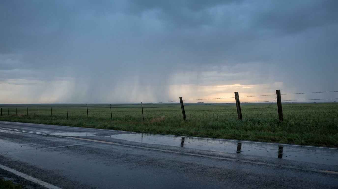
And that's the part that matters most. This is not falling on dry dirt. We've watched the Plains take a beating all week. Tulsa needed swift water rescues just yesterday, including an airboat rescue of a child. Haynesville, Louisiana picked up over 7 inches. Atoka County, Oklahoma got a Particularly Dangerous Situation Flash Flood Emergency on Tuesday after 4 to 8 inches. The sponge is full. When the next round comes, the water has nowhere to go but across the roads.
Why The Ground Matters So Much
Think of soil like a sponge in your kitchen sink. A dry sponge soaks up a good bit before it starts dripping. A sponge that's already saturated? The next cup of water runs right off the counter. That's where a lot of central and southern Plains soil sits this morning after days of repeated heavy rain.
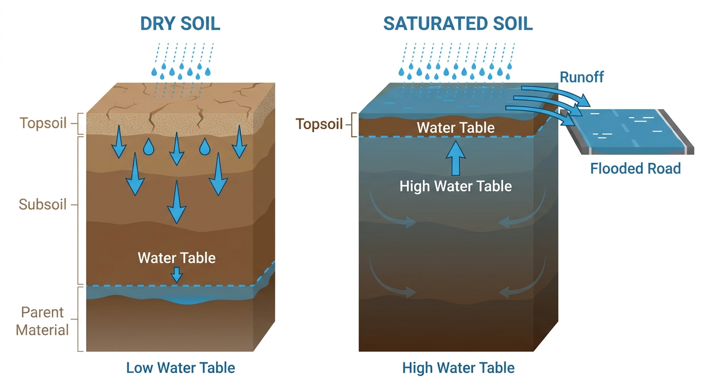
The WPC discussion points to a northwest-to-southeast axis from the central High Plains into the southern Plains, with the kind of training storms that line up and pass over the same towns again and again. Forecast precipitable water values are sitting around 1.7 to 2.0 inches, which is a lot of moisture to wring out. Locally, 3-plus inches is on the table. That's how you get water over roads in a hurry.
The Severe Side Of The Same System
The Storm Prediction Center has a Slight Risk of severe thunderstorms posted today across the Texas South Plains up through the central Great Plains. We're talking Tulsa, Wichita, Lubbock, Amarillo, and Springfield in that zone.
Here's what SPC is watching:
- Damaging wind is the main player. There's a 30 percent wind probability over part of the area, which is a Level 3 "numerous" threat. If storms organize, 60-plus mph gusts are on the table.
- Hail up to quarter-size or bigger with a 15 percent severe hail area in the mix.
- An isolated tornado or two can't be ruled out, with a small 5 percent area and a hatched zone where any tornado could reach EF2 strength. That's the lower-probability piece, but it's there.
The timing on the strongest storms is late afternoon into tonight. One or two organizing clusters are expected to develop and track across the region, and a few storms may fire ahead of that activity across north central Oklahoma and south central Kansas.
A Familiar Echo
If this setup feels familiar, it should. Late June in the High Plains has a long history of producing tornadoes. Northeastern Colorado put down multiple confirmed tornadoes just yesterday near Fleming and Keota, plus baseball-size hail in Fort Morgan. A Slight Risk is not a panic-level day, but the recent track record says don't shrug it off either. Have a way to get warnings, especially if storms roll through after dark.
What This Means For Your Day
If you're in eastern Oklahoma, southern Kansas, or the Texas Panhandle, the message is simple: don't drive into water. Most flood deaths happen in vehicles, and on already-soaked ground it doesn't take much. If you hit a flooded road, turn around. You can't tell how deep it is or whether the roadbed underneath is still there.
There's baseball watching in the path too. The Diamondbacks are at the Cardinals in St. Louis tonight, and the Royals are at the Rays in St. Petersburg, which is indoors and safe regardless. St. Louis sits on the eastern edge of the day's heavy rain potential, so a delay isn't out of the question if a storm clusters overhead.
The Rest Of The Country
Good news if you're up north. The Upper Midwest is the standout today, with a retreating front and Canadian high pressure delivering genuinely beautiful weather from the Dakotas through the Twin Cities into southern Wisconsin. If you're heading to Summerfest in Milwaukee or out at a festival up that way, today's the day to enjoy it.
One thing on the radar for tomorrow: SPC has flagged an Extremely Critical fire weather area for central Utah into northwest Arizona and extreme southeastern Nevada on Friday, with winds of 25 to 35 mph and humidity dropping into the single digits to mid teens. That's the most significant fire weather setup in the forecast period, and we'll dig into it more tomorrow.
Bottom Line
Today's story is water on ground that can't take much more. If you're in the central or southern Plains, watch for flash flooding, never drive through a flooded road, and keep a way to get warnings through the afternoon and overnight when the strongest storms develop. Damaging wind is the top severe threat, with hail and an isolated tornado possible. Up in the Upper Midwest, it's about as nice a late-June day as you'll find. Out West, keep one eye on the fire weather ramping up for Friday.