Blog Article
Moderate Flood Risk: Iowa to Appalachians, Aug 14 2026
WPC posts a Moderate Risk of excessive rainfall from Iowa to the Appalachians today, with saturated ground raising flash flood concerns again this week.

Another Round: Moderate Flash Flood Risk Sets Up From Iowa to the Appalachians
Alright y'all, if you feel like you've read this headline before this week, you kind of have. WPC has a Moderate Risk of excessive rainfall posted today running from Iowa through the mid-Mississippi Valley and on into the Appalachians. That's the top tier below WPC's highest category, and it's landing right on top of ground that's already had about as much rain as it can drink.
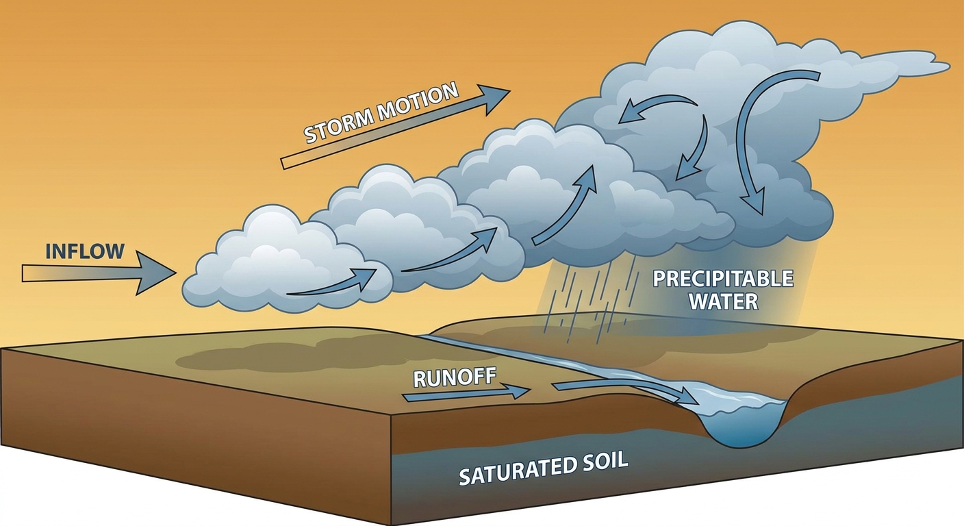
Remember, this is the same stretch of the country that gave us 13.7 inches of rain near Muncie, Indiana on August 12, and the Flash Flood Emergency in Knott County, Kentucky just yesterday. The soil hasn't had time to recover. When new heavy rain falls on ground that's already saturated, it runs off fast instead of soaking in, and that's exactly the setup we've got again today.
What's Fueling This
Here's the thing about this pattern. A broad upper ridge has been anchored over the central US, and storm complexes keep riding along its northern edge, tracking from the Plains into the Midwest and Ohio Valley night after night. Today's flash flood threat comes from a flash flood-favorable environment sitting on the periphery of that ridge, with a surface front draped nearby to help focus the heaviest rain.
AI-assisted forecast guidance is flagging precipitable water values near 2.2 inches and CAPE above 2000 J/kg for the Saturday overnight setup, which is about as juicy as August air gets in that corridor. Translation: any thunderstorm that fires has a deep reservoir of moisture to work with, and if storms train over the same spot more than once, rainfall rates can overwhelm drainage in a hurry.
Timeline and Regions
- Today (Day 1): Moderate Risk covers Iowa eastward into the mid-Mississippi Valley and Appalachians. Storms are already ongoing early today from Nebraska into Indiana and spreading toward West Virginia. Activity over Illinois and Indiana should generally weaken as it slides southeast, but WPC is watching for a continuous localized flash flood threat wherever training sets up.
- Saturday (Day 2): The focus narrows a bit and holds at Slight Risk from Illinois eastward through Indiana, Ohio, West Virginia, western Pennsylvania, and western Maryland. WPC actually coordinated directly with the Des Moines forecast office on upgrading south-central Iowa given how saturated that ground already is.
- Sunday (Day 3): Slight Risk shifts toward the Mid-Atlantic (Pennsylvania, Maryland, New Jersey, Delaware, southeast New York) as a shortwave and cold front move through, with a separate Slight Risk area popping up over northeast New Mexico and southeast Colorado.
Cities in the crosshairs over the next 24 to 48 hours include Des Moines, Davenport, Chicago, Indianapolis, Columbus, Cincinnati, and Dayton.
Severe Storms Are Along for the Ride
SPC has a Slight Risk of severe thunderstorms today covering Omaha, Des Moines, Cedar Rapids, Peoria, and Davenport, with a 15 percent (Level 2) chance of damaging wind gusts over 60 mph in that same zone. A broader Marginal Risk stretches out to Chicago, Indianapolis, Denver, Louisville, and Kansas City. Hail up to quarter size is possible too, though the tornado threat stays low at 2 percent.
Saturday's severe threat shifts east with the rain, bringing a Slight Risk from the central High Plains into the Ohio Valley and Carolinas, including Columbus, Charlotte, Cincinnati, and Fort Wayne.
This matters for anybody with outdoor plans this weekend. The Chicago Air and Water Show is set for Sunday, right on the edge of that shifting rain and storm corridor, so keep an eye on the forecast if you're headed downtown. Cincinnati Reds and Chicago Cubs home games today sit inside the flash flood watch area too, though the bigger risk there is more about ponding and travel delays than the ballgame itself.
Tropics: Nothing Urgent, But Worth Watching
No named storms are active in the Atlantic or Pacific right now. NHC is tracking two Atlantic invests. AL92, a tropical wave about 650 miles east of the Lesser Antilles, has actually become less organized as it runs into stronger upper-level winds and dry air, so development chances are trending down even though folks in the islands should keep half an eye on it. AL94 farther east in the tropical Atlantic is similarly weak and disorganized. In the Eastern Pacific, Invest 99EP sits far offshore with 30 kt winds and isn't an immediate concern for land.
Space Weather: Minor Geomagnetic Storm Possible
SWPC says unsettled to active geomagnetic conditions are likely today and tomorrow as a corotating interaction region ahead of a coronal hole high-speed stream reaches Earth, with a chance of G1 (Minor) storming. If you're way up north tonight, it's worth a glance outside after dark, though this isn't the kind of event that threatens power grids or GPS in any meaningful way.
What We're Watching
- Whether training thunderstorms set up again tonight over already-saturated ground in Iowa, Illinois, or the Ohio Valley
- Damaging wind potential around Omaha, Des Moines, and the Quad Cities this afternoon
- The rain threat sliding into the Mid-Atlantic by Sunday, including DC, Baltimore, and Philadelphia
- AL92's organization trend in the central Atlantic, even though odds are fading
- Continued critical fire weather in the southern Plains under hot, dry, breezy conditions beneath the ridge
Bottom Line
If you live anywhere from Iowa through the Ohio Valley and into the Appalachians, today is another day to have a flash flood plan ready, especially if you're near a creek, low-lying road, or basement that's already seen water this week. Avoid driving through flooded roads no matter how familiar they look. Folks headed to outdoor events in Chicago, South Bend, or Grand Rapids this weekend should build in a backup plan for pop-up storms and keep tabs on local warnings rather than just the sky overhead.
We'll keep tracking how this corridor evolves through the weekend and get you updated as the rain axis shifts east.