Blog Article
Arctic Reload: Historic Snow in NY & New Southern Storm Threat
Arctic air fuels 4 feet of lake effect snow in NY. A clipper hits the Midwest, while a major winter storm threatens the South and Mid-Atlantic by Friday.
Arctic Reload: Relentless Cold, Historic Lake Effect, and a New Southern Storm Threat
Alright y'all, here's the thing—if you thought Mother Nature was done after dropping snow on the Florida Panhandle and sending wind chills to -70°F in Alaska last week, I've got some bad news. She's just reloading.
This pattern we are in? It is stubborn, it is dangerous, and it is absolutely loaded with winter weather potential for the next 7 days. We are looking at a classic "rinse and repeat" setup where the cold air just doesn't want to leave.
The Lake Effect Machine is Wide Open
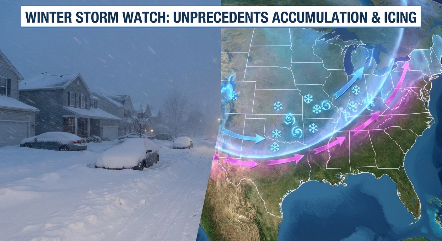
First off, we have got to talk about what is happening downwind of the Great Lakes right now. This is not just a flurry; this is a firehose.
Because the lakes are still largely unfrozen and this Arctic air is so incredibly cold (we're talking 850mb temps of -20C to -25C), the instability is off the charts.
Get this: The data is showing snowfall rates of 2 to 4 inches per hour for places like the Buffalo Southtowns and the Tug Hill Plateau. We are looking at storm totals of 2 to 4 feet—yes, feet—by Tuesday evening. If you are near Watertown or south of Buffalo, this is a "hunker down and stay put" situation. Travel is going to be impossible in those bands.
The Midwest Clipper
While the East deals with that, folks in the Midwest need to keep an eye on a sneaky little system for Tuesday and Wednesday.
A clipper is diving out of the Northern Plains. It's not going to dump a foot of snow, but it's going to lay down a solid 2 to 4 inches of fluffy, blowable snow from northern Iowa across southern Wisconsin and into northern Illinois and Michigan.
If you're commuting around Milwaukee, Rockford, or Chicago on Tuesday night or Wednesday morning, give yourself extra time. It's going to be slick, and with those gusty winds, visibility could drop in a heartbeat.
The Friday Focus: Southern Stream Wakes Up
Now, here is the big headline we are watching for the end of the week.
We have a southern stream disturbance ejecting out of the Southwest, and it's going to run smack into this deep dome of cold air that's already parked over the Central and Eastern U.S.
Here is the setup:
- Friday: Moisture starts surging north from the Gulf.
- The Clash: It overrides the cold air at the surface from the Texas Panhandle through Oklahoma and Arkansas.
- The Result: A growing risk of snow, sleet, and freezing rain.
If you have plans in OKC, Little Rock, or even stretching into the Tennessee Valley for Friday night or Saturday, you need to be paying attention. The WPC is already highlighting a risk area from the Southern Plains to the Mid-Atlantic.
This looks like an "overrunning" event, which is famous for producing icy messes. It's too early to talk specific ice totals, but the signal is there. If you're heading to the Cleveland Brewsology fest or have outdoor plans in the Ohio Valley this weekend, just know that while you might miss the ice, the cold is going to be biting.
Don't Forget the Sky
On a totally different note—look up tonight! We have a severe geomagnetic storm (G4-G5 levels) happening right now thanks to some massive solar flares. If the clouds break (which is a big "if" for many of you), you might see the Northern Lights way further south than usual. It's a little bonus light show amidst the deep freeze.
Bottom Line
- Lake Effect Emergency: Dangerous accumulation continues for Western NY through Tuesday. Avoid travel in the bands.
- Midwest Slickness: Watch for 2-4" of snow Tuesday night/Wednesday from IA to WI/MI.
- The Big Freeze: Dangerous cold persists. Wind chills of -20°F to -40°F in the Northern Plains. Even the South is shivering—if you're at the Miami vs. Indiana game tonight, bring a jacket. It's not your typical Miami heat.
- Weekend Storm: Prepare for a potential winter storm from the Southern Plains to the Mid-Atlantic Friday into Saturday. The exact track will wobble, but the ingredients are there.
Stay warm, check on your neighbors, and keep your pipes wrapped. We'll keep watching the data and let you know if that weekend system shifts.
Y'all stay safe out there!