Blog Article
Southwest Flood Risk and Plains Severe Storms: Nov 1 Forecast
A Moderate flood risk grips the Four Corners as an atmospheric river soaks saturated ground, while severe storms return to the southern Plains tonight and Monday.
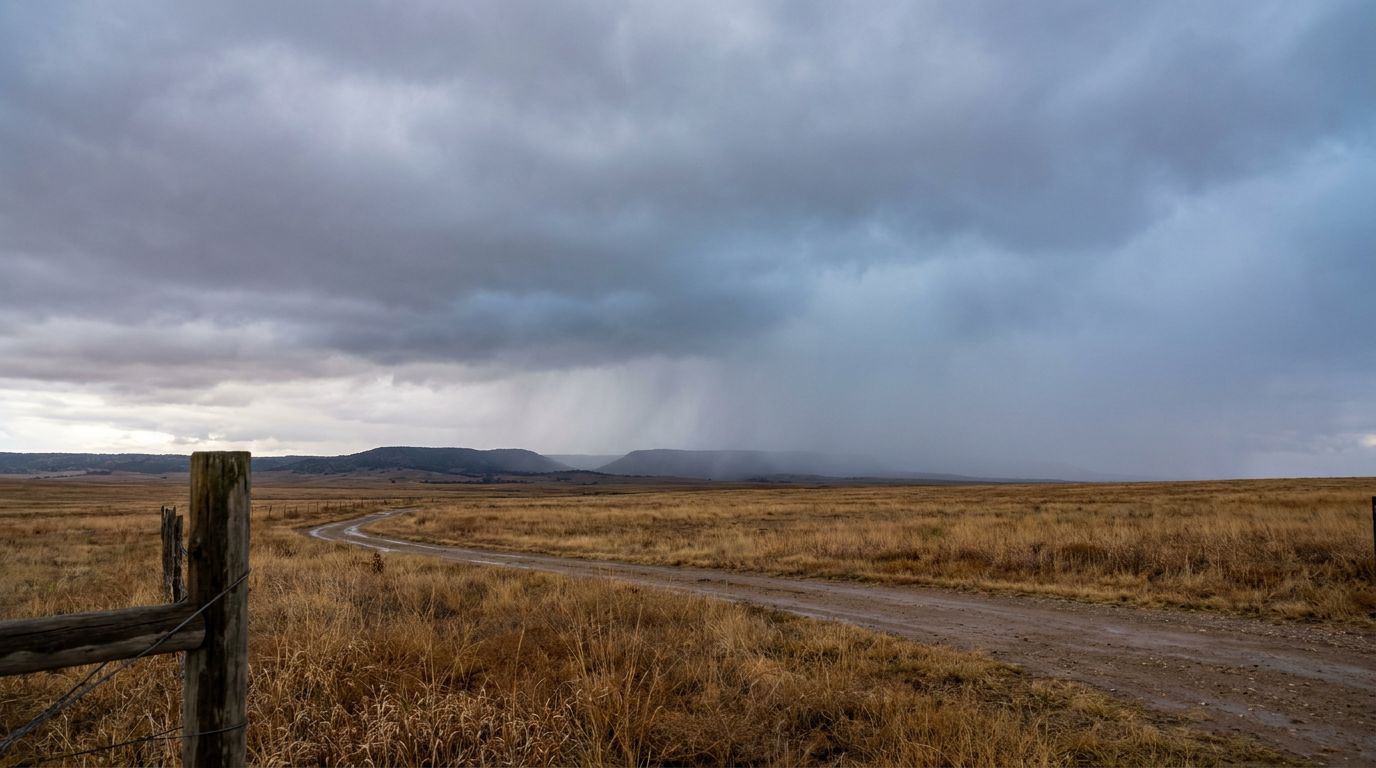
Atmospheric River Keeps Hammering the Southwest While Severe Storms Swing Back Into the Plains
Alright y'all, happy November 1st. We've got two separate weather stories worth your attention today, and neither one of 'em is playing around.
The Big One: Southwest Flooding Risk Isn't Done Yet
If you've been following along this week, you know the Desert Southwest has taken a beating. Phoenix had water rescues near 40th and Stanford yesterday morning after 1 to 3 inches of rain. That wasn't a one-off. WPC has a Moderate risk of excessive rainfall posted today for the Four Corners region, and that's their second-highest category.
Here's the setup. An unusually strong atmospheric river is pulling moisture straight out of the Pacific and funneling it into the Southwest. WPC says precipitable water values are running 4 to 6 sigma above normal for this time of year, which is a fancy way of saying the atmosphere is about as moisture-loaded as it ever gets out there in November. We're talking 3/4 inch to 1.5 inches of total column water vapor, concentrated right over ground that's already full from days of rain.
That combination, saturated soil plus another heavy rain push, is exactly the recipe for debris flows on burn scars and flash flooding in washes. The AI forecast discussion is flagging central Arizona, the Mogollon Rim, southern Utah, and southwestern Colorado's San Juan Mountains as the spots to watch, with locally around 3 inches possible in the hardest-hit zones. High terrain will see more snow piling on top of that, with 12 inches to 2 feet possible in the favored ranges, though snow levels are starting out high enough to limit accumulation below around 8,000 feet.
If you live anywhere near a wash in Maricopa County, southern Utah, or the San Juan Mountain burn scars, today's not the day to test a flooded crossing. You know the drill by now after this week.
Severe Weather Comes Back Tonight, Then Expands Monday
While the Southwest deals with water, the Plains are dealing with wind and storms.
Tonight (Day 1): SPC has a Slight Risk up across the southern High Plains, centered on Amarillo, Roswell, Alamogordo, Artesia, and Clines Corners. A mid-level disturbance is digging into the region, and storms should fire this evening into tonight with damaging wind gusts and a tornado threat as the primary concerns. There's also a broader Marginal Risk stretching from Phoenix and Tucson over to El Paso, Albuquerque, and Lubbock, mainly tied to isolated storms this afternoon ahead of the main event. SPC's hatched area inside that risk zone suggests any tornado that does form could be strong, EF2 or better, and wind gusts in the most intense cells could reach 75 mph plus.
Monday (Day 2): This is the bigger, more populated threat. SPC has expanded Monday's Slight Risk to cover much of Oklahoma, northern Texas, and south-central and eastern Kansas, putting Dallas, Fort Worth, Oklahoma City, Tulsa, and Wichita in the zone. A Marginal Risk wraps around that for Austin, Kansas City, Omaha, Waco, and Abilene. The setup is a deep upper trough moving out of the Rockies with a fast-moving speed max riding along ahead of it. Storm initiation is favored after roughly 4 PM local, with coverage increasing through the evening. The main threats are a few tornadoes (potentially strong ones, per the forecast discussion), damaging gusts of 60 mph or more, and isolated hail around an inch. There's also mention of a possible overnight QLCS, a line of storms that can spread damaging winds across a wide swath after the initial storms mature.
If you're in the OKC-to-Tulsa-to-Wichita corridor, Monday afternoon and evening is your window. Have a way to get warnings even if you're asleep.
Tuesday (Day 3): The threat shifts east into the Mississippi Valley. SPC has a Marginal Risk for Memphis, Little Rock, Shreveport, Jackson, and Jonesboro as the trough pushes east. Main concern there is scattered storms with a few capable of damaging gusts, nothing on the scale of Monday.
Temperature and Pattern Context
The nice weather outlook today keeps the best air confined to the interior Northeast and the Pacific Northwest, both landing in the "NICE" tier with seasonably cool highs. Everybody else is dealing with clouds, wind, or active weather holding scores down. That's relevant if you're watching the New York City Marathon today, runners should get a solid, cool morning without major weather interference.
Looking toward midweek, a persistent subtropical ridge keeps a narrow strip of pleasant weather across the southern tier (southeastern Arizona, New Mexico, and the southern High Plains) through Friday, even reaching the BEAUTIFUL tier Tuesday in spots like southeastern Arizona and southwestern Texas. That's well-timed for anyone with outdoor plans in that corridor, though keep an eye on the storm track described above, since a developing Plains-to-East-Coast cyclone will widen the wind field later in the week.
What Else We're Watching
- Tropical Pacific: NHC is tracking a broad area of low pressure likely to form well southeast of Hawaii early next week. It's a Medium risk system, 0% for development in the next two days but 40% by day seven. Too far out and too disorganized right now to be a near-term concern, but we'll keep an eye on it.
- Space weather: A G1 (Minor) geomagnetic storm is expected today, the tail end of the coronal hole stream that pushed things to G2 (Moderate) levels overnight. If you're at high latitude, there's a shot at aurora tonight, though nothing like the disruptive stuff we've seen with bigger storms.
- Winter weather: Out in Days 4-7, SPC's winter desk is only flagging a 15% chance of light high-elevation snow for the Pacific Northwest and northern Rockies. Nothing major, just a reminder that mountain passes are starting to see winter's first touches.
- Florida: WPC has a Slight Risk of excessive rainfall for Florida's east coast Monday into Monday night, tied to persistent easterly tropical moisture. The urbanized I-95 corridor there could see some ponding issues.
Bottom Line
If you're in the Four Corners region, especially central Arizona, the Mogollon Rim, southern Utah, or southwestern Colorado, today is another day to stay out of washes and keep a weather eye on burn scar areas. The ground is full and more rain is coming right on top of it.
If you're in the southern High Plains tonight or anywhere from Oklahoma City to Wichita to Dallas-Fort Worth on Monday, this is a real severe weather setup. Damaging winds and a few tornadoes are on the table both days, with Monday carrying the higher population exposure. Make sure you've got a way to get warnings overnight, since Monday's storms could run into the evening and beyond.
Everybody else: enjoy what's a relatively calm start to November, because the pattern is clearly still active and we've got more to track as the week goes on.