Blog Article
Aurora and Storms Collide: Tonight's Wild Weather Split
A G1 geomagnetic storm could bring aurora to the northern Plains tonight, right as severe storms threaten the same region and floods return to the Southeast.
Aurora Up North, Déjà Vu Down South: Tonight's Weather Has Two Different Personalities
Alright folks, get this. Tonight the sky itself is putting on two shows at once, and they've got nothing to do with each other. Way up in the atmosphere, a piece of the sun might paint the northern horizon green. Way down at ground level, in that same general neighborhood, storms could be dropping hail the size of hen eggs. And seven hundred miles south, folks in the Carolinas are looking at the same flooding nightmare they just crawled out of yesterday. Let's talk about it.
When the Sun Shows Off
NOAA's Space Weather Prediction Center says a G1, that's "minor," geomagnetic storm is likely tonight. The driver is a coronal hole high speed stream, basically a fast river of solar wind, with maybe a little extra push from CME material that left the sun back on July 20 and 21. Kp index is forecast to touch 4, which isn't a big number in the grand scheme of space weather, but it's enough that folks up along the international border, think North Dakota, northern Minnesota, could get a look at aurora tonight if clouds cooperate.
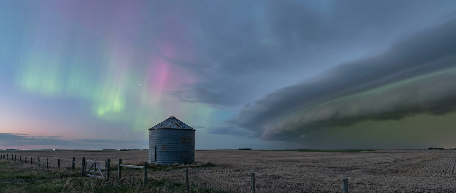
And wouldn't you know it, that's the exact same patch of country the Storm Prediction Center has under a Slight Risk for severe thunderstorms tonight. Fargo, Bismarck, Baudette, Bemidji, Detroit Lakes. SPC says supercells capable of large to very large hail and damaging winds are ongoing along a differential heating boundary near the border, with a Level 2 tornado threat (5 percent) in the mix. There's even a hatched area where hail could reach two inches, hen egg size, and gusts could hit 75 mph.
So if you're one of the thousands of pilots still hanging around Oshkosh for AirVenture, or you live anywhere near that border tonight, you might catch the strangest split screen of the year. Green light rippling in a clear patch of sky in one direction, and a shelf cloud rolling in from the other.
Meanwhile, Down South, It's Groundhog Day
If the northern tier's story is a light show, the Southeast's story is more like a rerun nobody asked for. Yesterday, a stalled frontal boundary parked over the Carolinas and dumped enough rain to close I-40 near Hillsborough, flood Hope Mills under 18 inches of standing water at one point, and send crews out to pull a vehicle from floodwaters in Buncombe County near Asheville. Swift Creek in Cary and Apex rose above flood stage. This wasn't a one-off. It was training thunderstorms, meaning storm after storm rolling over the exact same ground, which is about the worst setup you can ask for if you're trying to keep water off the roads.
Well, that front hasn't gone anywhere. The Weather Prediction Center has a Moderate Risk of excessive rainfall, their highest category, across portions of the Southeast tonight into Saturday morning, centered on that same stalled front from northern Georgia to coastal North Carolina. Precipitable water values are running 2.0 to 2.4 inches, which is about as saturated as the atmosphere gets, and WPC specifically flags Charleston and Savannah for training convection with rain rates that could top three inches an hour.
Here's why that matters if you're in that corridor. Ground that's already soaked doesn't drain, it floods faster and with less rain than it takes to flood dry ground. So the same three inches that caused headaches on dry soil three weeks ago can cause real trouble tonight on saturated soil. If you live anywhere between the Charleston coast and the Outer Banks, tonight is not the night to drive around a flooded road, even one that looks shallow.
The Heat Never Left, It Just Stopped Making the News
While aurora and floods are grabbing the spotlight, the Southern Plains and Desert Southwest are quietly running their own show, and it's just hot. Dallas and San Antonio sit under a persistent ridge that's kept temperatures well into the ridge's comfort zone, which for Dallas this time of year means an average high near 97. Phoenix's July norm is a scorching 106, and neither city is getting relief anytime soon according to the extended outlook. It's not dramatic. It's not going to trend. But ask anyone who's had to load a truck at 3 p.m. in Oklahoma City this week, and they'll tell you the heat is the real story, it just doesn't come with a warning siren.
The Takeaway
Tonight's weather map, if you could see it all at once, would look like three completely different countries stitched together. Up north, watch the sky for a green glow, but keep half an eye out for a shelf cloud too, because both are possible in the same hour. Down in the Carolinas, treat any flooded road like it's worse than it looks, because the ground already knows what's coming. And across the southern tier, the heat isn't asking for attention, but it deserves some anyway. Different sky, same night, same country.