Blog Article
Texas Weekend Weather: Severe Storms Threaten Festivals
Outdoor events like the Dallas Art Fair and Red Dirt BBQ face a severe weather threat this weekend. Learn how the dryline could spark large hail and high winds.
Barbecue, Art Fairs, and Dryline Supercells: Texas Weekend Weather
Get this, y'all. Spring in Texas means three things are pretty much guaranteed. Good barbecue, outdoor festivals, and a healthy respect for the dryline.
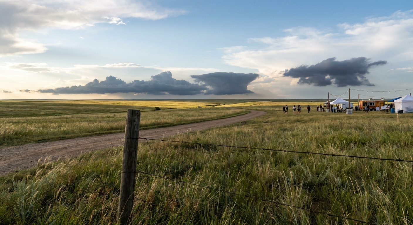
This weekend is packed with events across the Lone Star State. Dallas is hosting The Other Art Fair right now, and tomorrow, Tyler fires up the smokers for the Red Dirt BBQ & Music Festival. If you are heading out to look at paintings or eat your weight in brisket, you need to keep one eye on the sky.
We have a classic Southern Plains severe weather setup unfolding, and it is going to crash a few outdoor parties.
The Dryline Reality Check
The Storm Prediction Center has a Slight Risk for severe thunderstorms tonight across North Texas, Oklahoma, and far southeast Kansas. Dallas and Fort Worth are sitting in a Marginal Risk for tonight, but that threat level bumps up to a Slight Risk by Sunday.
Here's the thing about these spring storms. They are driven by a boundary called the dryline. You have bone-dry air pushing in from the desert southwest crashing into thick, humid air flowing up from the Gulf of Mexico. That collision forces the moist air up into the atmosphere incredibly fast.
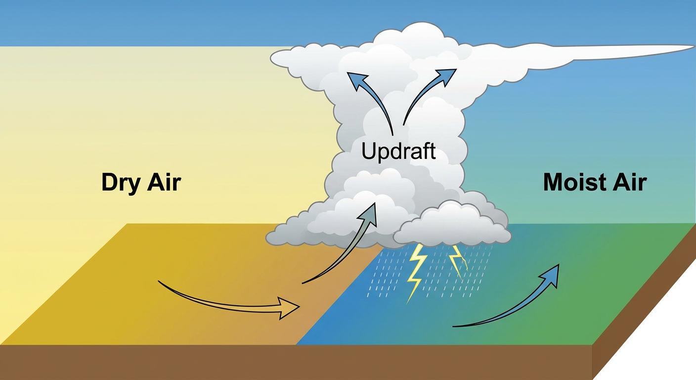
When those storms fire up along that boundary, they love to turn into supercells. The main threats tonight are 60 mph wind gusts and large hail. In fact, there is a hatched area in the outlook for parts of Oklahoma and North Texas where hailstones could reach two inches across. That is hen-egg size. If you are parked outside for a festival, that is exactly the kind of hail that will ruin your day and your windshield.
Water Troubles Down South
While the Plains are watching the skies for hail, the Central Gulf Coast is watching the ground.
The Weather Prediction Center has a Slight Risk for excessive rainfall over southeastern Louisiana and southern Mississippi tonight and into tomorrow. We are talking about training thunderstorms. That means storms line up and move over the exact same areas like train cars on a track.
Places right along the I-10 corridor near New Orleans could see a quick two to three inches of rain. The ground is already saturated down there from recent storms, so flash flooding is a real concern if you are driving tonight.
The Weekend Gameplan
Normal high temperatures for Dallas this time of year sit right around 84 degrees. We are going to be right in that warm, muggy sweet spot all weekend. It is great weather for a festival until those afternoon clouds start bubbling up.
If you are out at The Other Art Fair or heading east to Tyler tomorrow, just have a plan. Know where your car is and know where a sturdy building is. A pop-up tent is not going to protect you from a 60 mph wind gust or two-inch hail. Keep your weather radio or app handy, and don't let a severe thunderstorm warning catch you by surprise.
https://ryanhallyall.com/blog/barbecue-art-fairs-and-dryline-supercells-texas-weekend-weather