Blog Article
Friday Severe Weather: Hail Threat for Missouri Valley
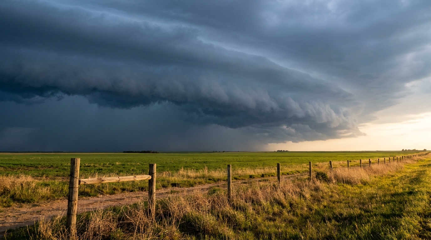
A potent storm system brings extreme instability, hen-egg hail, and damaging winds to the Lower Missouri Valley just in time for Friday evening baseball.
Baseball, Barbecues, and Hen-Egg Hail: Friday's Missouri Valley Setup
Get this, y'all. The Kansas City Royals are heading across the state to play the Cardinals in St. Louis tomorrow night. It is a classic Friday night baseball matchup. But if you are heading to Busch Stadium, or really doing anything outdoors from Missouri up through Iowa and Nebraska, we have a messy weather setup crashing the start of the weekend.
You might have seen the videos yesterday of semis flipping over on Interstate 15 in Utah. We had measured wind gusts of 93 mph out there. Well, that same storm system is marching east. Instead of kicking up dust in the desert, it is tapping into a whole lot of heat and moisture in the Plains.
The Fuel and The Spark
Let's look at the science. We measure storm fuel using something called CAPE. Tomorrow afternoon, the atmosphere over the Lower Missouri River Valley is going to have over 3,000 units of it. That is extreme instability. Think of it like a high-performance engine revving at a red light. The approaching cold front is the green light.
The Storm Prediction Center has a Slight Risk in place for Friday covering Omaha, Lincoln, and Des Moines. Kansas City and St. Louis are sitting right on the edge in the Marginal Risk zone.
If storms form in that Slight Risk area, they will mean business. Here is what we are looking at:
- Giant Hail: Inside the main threat area, hailstones could reach two inches in diameter. That is hen-egg size. You definitely want to park the car in the garage if you live in that zone.
- Damaging Winds: As the sun goes down, those individual storms are expected to merge into a big, organized line. Meteorologists call this a mesoscale convective system.
- The Nighttime Shift: When storms group up like that, they push a wall of cold air out in front of them. That shifts the main hazard from giant hail to wind gusts over 60 mph.
The Texas Panhandle Dries Out
Now, if you look south toward the Texas Panhandle and southeastern New Mexico, the problem is completely different. We have a Critical Fire Weather area for Friday.
The humidity is dropping into the single digits. Combine that with 25 mph downslope winds, and the fire danger is incredibly high. The vegetation out there is bone dry. If a fire starts on the Caprock tomorrow, it will move fast.
Keep your radar app handy tomorrow evening. If you have outdoor plans, you need to know exactly where these storms are firing. Make sure you have a way to get warnings that will actually wake you up if that line of storms rolls through your town overnight.
https://ryanhallyall.com/blog/baseball-barbecues-and-hen-egg-hail-fridays-missouri-valley-setup