Blog Article
Missouri Night Storms & Monday's Plains Hail Threat
An MCS is bringing 60 mph winds to Missouri tonight, while the Central Plains brace for 2-inch hail on Monday. Here is what to expect.
Y'all, there are few things better than a Sunday night baseball game. The Cubs and the Cardinals are playing in St. Louis right now, and the rivalry is as good as ever. But if you are watching that game, or if you live anywhere along the I-70 corridor in Missouri, you need to keep one eye on the radar tonight.
Here is the thing. We have a Level 2 Slight Risk for severe storms stretching from eastern Kansas right into central Missouri. What we are watching tonight is the formation of an MCS.
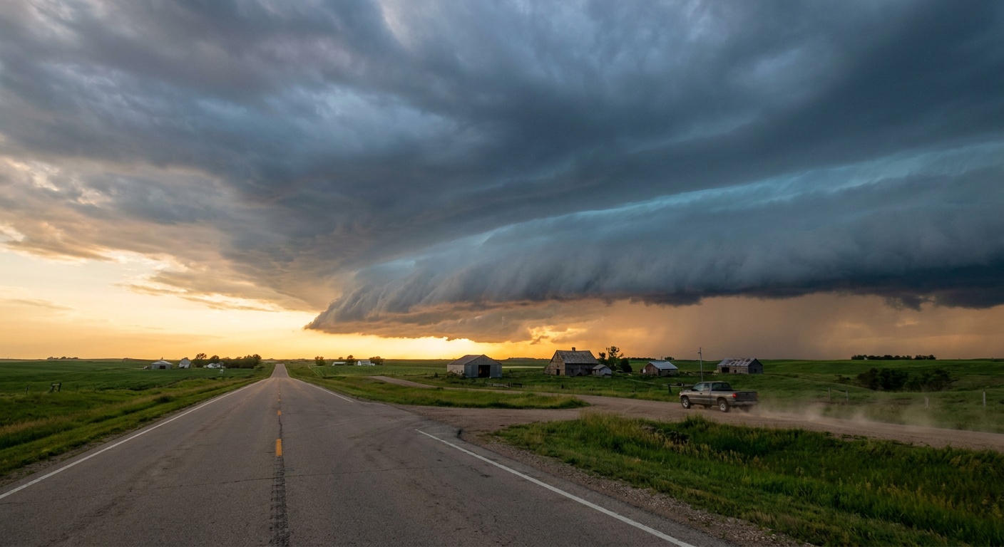
The Night Shift in Missouri
An MCS stands for Mesoscale Convective System. That is just a fancy way of saying a very large, organized cluster of thunderstorms. Instead of a single storm popping up and fading away, these storms join forces. They share cold air outflow and push forward together.
It has been a warm, muggy Sunday across Missouri. Temperatures have been sitting right around that normal late-May high of 76 degrees in St. Louis. That heat and humidity is exactly what this storm system is using for fuel.
For Kansas City, Topeka, and eventually pushing toward St. Louis, the main concern tonight is wind. The Storm Prediction Center has outlined a 15 percent chance for scattered damaging winds up to 60 mph. We are also looking at a Slight Risk for excessive rainfall. The Weather Prediction Center expects a quick 1 to 2 inches of water over central Missouri. That means localized flash flooding is absolutely on the table for your morning commute.
Monday's Hail Threat
Once the sun comes up Monday, the main severe weather engine shifts back west. We have a Day 2 Slight Risk for the Central High Plains. That includes places like Greeley, Colorado, and Dodge City, Kansas.
Out there, we expect discrete supercells to fire up along the Front Range before they merge into a line. The atmosphere is primed for some massive hail. The data shows a hatched area for significant hail, meaning hailstones could reach 2 inches in diameter. That is hen-egg size, folks. If you park outside in western Kansas or Nebraska, you will want to find a garage tomorrow afternoon.
Looking Ahead to the Southeast
Meanwhile, the Southeast is still dealing with the leftover boundaries from all this weekend's rain. If you are heading to Nashville later this week for the start of CMA Fest, they are still in a Marginal Risk tomorrow for some pop-up wind and hail. The remnants of today's storms might regenerate along outflow boundaries across Tennessee, Mississippi, and Alabama.
If you are tracking the baseball score or just trying to get some sleep before Monday morning, make sure you have a way to get warnings tonight. Those high winds can knock down tree limbs and cause power outages in a hurry.
https://ryanhallyall.com/blog/baseball-boundaries-and-a-big-wind-threat-for-missouri-tonight