Blog Article
Severe Storms Threaten Midwest Baseball & Texas Hail Risk
Tracking severe weather impacts for tonight's MLB games, a significant 2-inch hail threat in Texas, and the cold front breaking Boston's heat record.

Get this, y'all. We have a lot of people trying to enjoy a Tuesday night baseball game, and the atmosphere is just not cooperating. The Cleveland Guardians are in Detroit tonight to play the Tigers. If you are heading out to the ballpark, you need to keep one eye on the radar.
Detroit sits right in the middle of a Level 2 Slight Risk for severe thunderstorms tonight. A cold front is pushing through the lower Great Lakes and the Ohio Valley. That boundary is kicking off scattered storms capable of producing 60 mph wind gusts and quarter-size hail. We are already seeing things light up. If you are tailgating or sitting in the bleachers, have a plan to get to the concourse if a warning gets issued.
The Texas Hail Threat
Down south, the setup is a bit different, but the impacts are just as serious. We are looking at a persistent severe threat across central and southwest Texas.
Cities like San Antonio and Austin are in a Level 2 Slight Risk today. By tomorrow, that threat shifts slightly west toward Del Rio and Eagle Pass. Here is the thing you really need to know about this Texas setup. The Storm Prediction Center has highlighted a hatched area for hail.
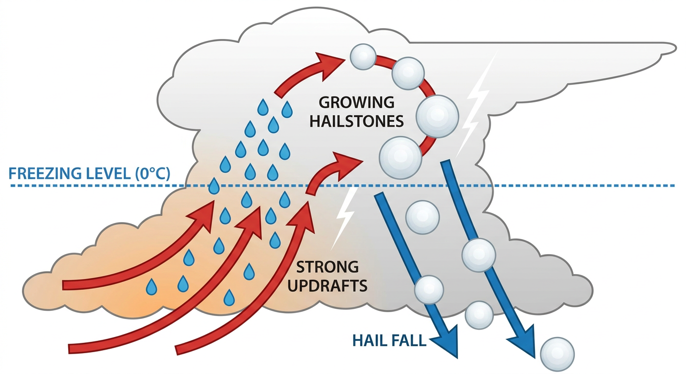
When meteorologists talk about a "hatched area," we are talking about intensity. It means if a storm forms, it has the potential to drop hailstones two inches in diameter or larger. That is hen-egg size. That will dent your truck and bust your windshield. If you live in the Edwards Plateau region, park the car in the garage tonight and tomorrow night.
On top of the hail, a low-level jet is pumping deep Gulf moisture straight into the rugged terrain of the Edwards Plateau. The Weather Prediction Center has a Slight Risk for excessive rainfall through Thursday morning. The data shows we could see rainfall rates approaching two inches per hour. That water runs off fast in the Hill Country. Turn around, don't drown is not just a catchphrase. It saves lives.
Boston's Heat and the Northeast Shift
Let's talk about the East Coast. If you looked at social media today, you probably saw a lot of buzz about Boston weather. They set a new heat record today. To put that in perspective, the normal high for Boston in mid-May is 67 degrees. Today felt like the middle of July.
But change is coming. That same cold front causing trouble in the Midwest is heading east.
Tomorrow, the Storm Prediction Center has a Level 1 Marginal Risk stretching from Washington D.C. up through Philadelphia, New York, and Boston. As that cooler air crashes into today's record heat, we could see isolated severe storms pop up. The main threat there is localized damaging wind gusts. It is not a widespread outbreak, but a quick 60 mph downburst can easily take down a weak tree branch and knock out power to your neighborhood.
We are coming off a wild Monday that brought a tornado emergency to Nebraska and a blizzard to Wyoming. The atmosphere is still highly active.
Check your local forecast before you go to bed tonight. Have a way to get warnings that will actually wake you up if a storm rolls through your county. We will keep watching the data and updating you right here.
https://ryanhallyall.com/blog/baseball-busted-windshields-and-bostons-heat-record