Blog Article
Severe Weather Outbreak Impacts MLB Games and Travel
A Level 4 severe weather threat brings giant hail and tornado risks to the Central Plains, disrupting MLB games in Kansas City and flights in the Midwest.
Baseball, Ground Stops, and a Level 4 Severe Threat
Y'all, the Boston Red Sox are in Kansas City tonight to play the Royals. First pitch is scheduled for just after 6 PM local time. Normally, that means grabbing a hot dog and enjoying a warm May evening. The average high this time of year in KC is around 75 degrees. But tonight, the atmosphere has other plans.
If you look at the departure boards at O'Hare in Chicago or DTW in Detroit, you will see a lot of red. Ground stops and delays are piling up. The reason for all this headache is a massive, highly organized severe weather system moving through the Central Plains.
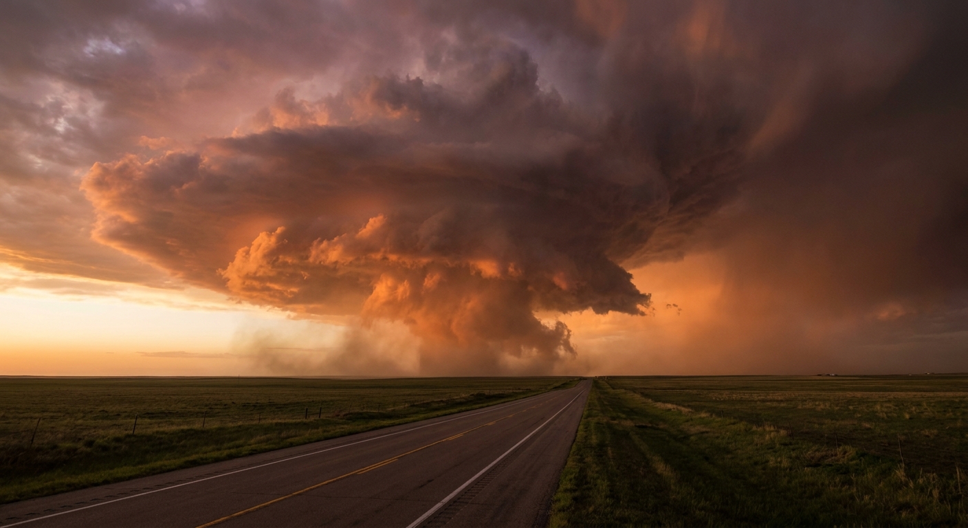
The Level 4 Threat
The Storm Prediction Center has issued a Moderate Risk for severe weather today. That is a Level 4 out of 5. The bullseye covers central and northeastern Kansas, far southeastern Nebraska, northwestern Missouri, and southwestern Iowa.
We are looking at a highly volatile environment. The data shows a 45 percent probability for severe hail in the main threat area. Inside that zone, hailstones could reach 3.5 inches in diameter. That is softball size. It will easily total a car windshield.
There is also a 15 percent probability for tornadoes. The environment supports strong, long-track tornadoes. Any tornadoes that form in the hatched risk area could reach EF3 intensity or stronger. If you live in Topeka, Manhattan, or St. Joseph, you need to have your weather radio loud and your phone charged.
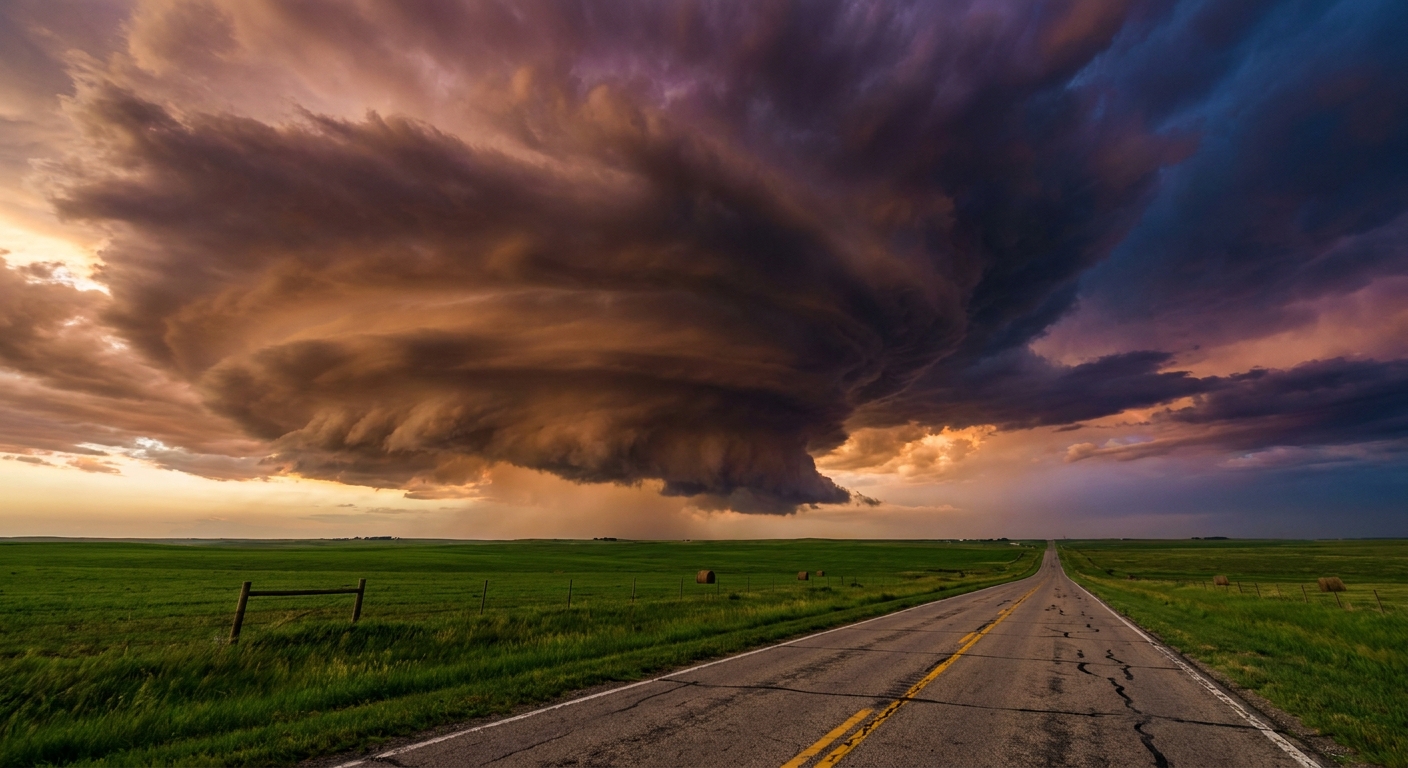
The Flood Risk
The severe storms are just the first act. As the night goes on, these discrete supercells will merge into clusters. When that happens, the heavy rain threat takes over.
The Weather Prediction Center has a Moderate Risk for excessive rainfall over Missouri, Iowa, Nebraska, and Kansas. We are expecting storms to backbuild. That means new storms form right behind the old ones, tracking over the exact same ground. Some localized spots could pick up 5 to 9 inches of rain very quickly. Flash flooding is highly likely in low-lying areas and urban centers.
Fire on the High Plains
While the Central Plains deal with water, the Southern High Plains are bone dry. We have an Extremely Critical fire weather area covering parts of eastern New Mexico, southeastern Colorado, southwestern Kansas, and the Texas and Oklahoma panhandles.
The setup here is incredibly dangerous for fire crews. A dryline and an advancing cold front will sweep through the area. This will cause a sharp, 180-degree wind shift. Any ongoing fires will suddenly change direction. If you are near Amarillo or Liberal, avoid any activity that could throw a spark.
Primary Day Impacts
Tomorrow morning, a lot of folks will wake up and head to the polls. Tuesday is a big primary election day across several states.
The severe weather threat will shift east with the cold front. A Slight Risk, which is a Level 2 out of 5, stretches all the way from San Antonio, Texas, up to Detroit, Michigan. The main hazards tomorrow will be scattered damaging winds over 60 mph and hail up to 2 inches in diameter. If you are standing in line outside a polling place in Dallas or Indianapolis tomorrow afternoon, keep an eye on the radar.
Weather does not care about our schedules. It ignores baseball games, flight connections, and elections. Have multiple ways to get warnings tonight, especially if you live in the Plains.
https://ryanhallyall.com/blog/baseball-ground-stops-and-a-level-4-severe-threat