Blog Article
Midwest Severe Weather Threatens Baseball Opening Week
Severe storms, including tornadoes and squall lines, are targeting the Midwest. See how the Enhanced risks in Illinois and Missouri will impact baseball games.
Baseball, Hot Dogs, and... Squall Lines? What the Midwest Severe Threat Means for Opening Week
Get this, y'all. Baseball is finally back. We have the crack of the bat, the smell of roasted peanuts, and the blind hope that your team might actually make it to October. But if you are heading out to the ballpark in the Midwest this week, you might hear something else entirely. Tornado sirens.
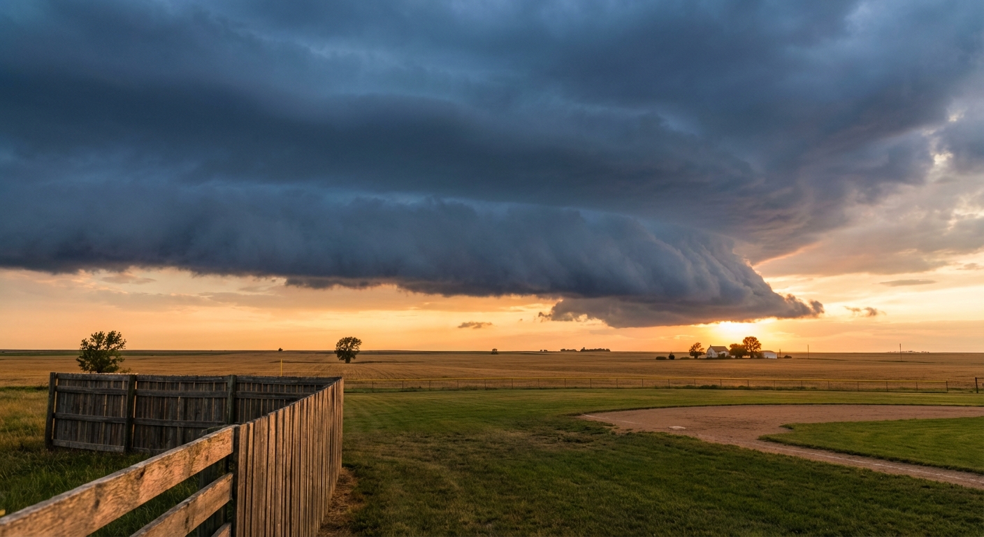
The atmosphere is incredibly volatile right now. We are tracking a multi-day severe weather threat that is going to crash a few opening week parties.
The Threat in Chicago Tonight
The Toronto Blue Jays are in town to play the Chicago White Sox today. The problem is Chicago is sitting right in the bullseye of an Enhanced risk for severe thunderstorms.
The Storm Prediction Center has highlighted eastern Iowa, northern Illinois, and southern Wisconsin for a very active evening. We are looking at a 5 percent chance of tornadoes and a significant threat for damaging winds across the region. The air mass is changing rapidly today. Once these storms fire up, they are going to move fast.
If you are tailgating outside the stadium or grabbing a drink in the city, keep your head on a swivel. A normal high for Chicago in early April is 59 degrees. It is much warmer and more humid than that right now, and that is exactly the kind of fuel these supercells need to rotate.
Friday's Sprawling Squall Line
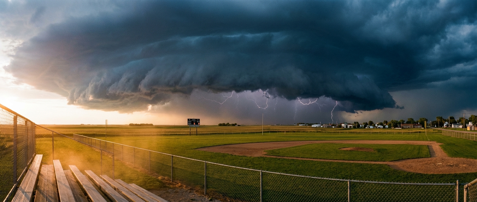
The severe threat does not stop when the stadium lights go out tonight. Tomorrow, the whole system shifts. We have another Enhanced risk on the board for Friday afternoon and evening. This one targets northern Missouri and southern Iowa. Cities like St. Joseph and Kirksville are right in the thick of it.
The data shows these storms will likely merge into a massive line. Meteorologists call this a QLCS, or a quasi-linear convective system. In plain English, it is a giant wall of wind and heavy rain that bulldozes across the map. The main threats here are large hail and straight-line winds that can easily knock down trees and power lines. A few quick spin-up tornadoes are also possible along the leading edge of that line.
Kansas City is sitting in the Slight risk area for this exact same system tomorrow. The Twins are playing the Royals at Kauffman Stadium on Friday. A normal high for Kansas City in early April is around 66 degrees. Just like in Chicago, the warm, unstable air pumping into the region is going to make things bumpy.
If you are sitting in the upper deck or just grilling in your backyard this week, you need a way to get warnings. Storms moving this fast do not give you much time to react. Know exactly where the solid, enclosed shelters are before the first drop of rain falls.