Blog Article
Bertha Nears Louisiana as Carolina Flood Risk Builds
Tropical Storm Bertha approaches Louisiana landfall while its moisture sets up a Moderate excessive rainfall risk for Virginia and North Carolina by Thursday.
Bertha Closes In on Louisiana While a Bigger Rain Threat Builds for the Carolinas
Alright y'all, let's get right to it. Tropical Storm Bertha is knocking on Louisiana's door this morning, and while the storm itself is actually falling apart a little, the moisture it's dragging along is about to become a much bigger story for folks on the East Coast later this week. We'll cover both.
Bertha's Getting Close, But She's Not What She Was
As of the 4 AM advisory, Bertha was sitting about 50 miles east northeast of the mouth of the Mississippi River, packing 50 mph winds and creeping west at just 5 mph. Landfall near New Orleans is expected within the next 8 hours or so, likely around midday.
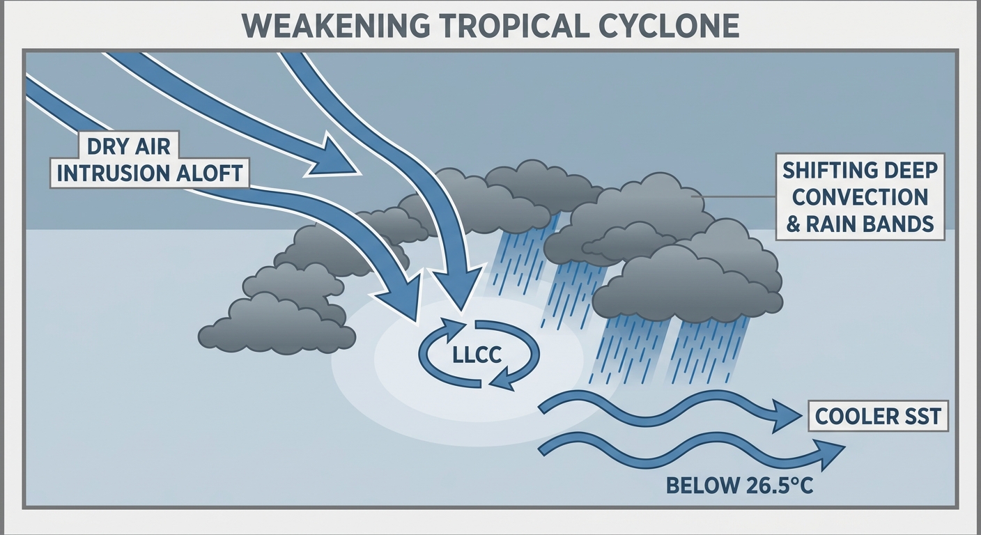
Here's the thing though. NHC's own forecast discussion says Bertha's appearance has "gone downhill" since the last update. The deepest thunderstorm activity has pulled away from the center, and the low-level circulation is now mostly exposed offshore of Alabama. An Air Force Reserve recon flight found the central pressure ticking up slightly to 998 mb, which is a sign of a weakening system, not a strengthening one. There's a real chance Bertha degenerates into a trough over southern Louisiana by tonight.
That doesn't mean nobody needs to worry. Our impact model still has Houma, Morgan City, and central Louisiana in the "take action" tier, with sustained winds near 49 mph possible as the center comes ashore. Freeport and Matagorda Bay in Texas are flagged at "prepare" for Thursday as the remnant moisture slides that direction.
- Main threats: gusty tropical storm winds, storm surge for low-lying bayou communities, and heavy rain
- Landfall target: near the mouth of the Mississippi River, close to New Orleans
- Trend: weakening, possible transition to a remnant low or open trough by Wednesday night
If you're in south Louisiana, today is not a day for boating or being out on the water. Secure loose stuff outside and expect gusty, wet conditions through the afternoon.
The Bigger Story: A Flood Threat Building for the Carolinas and Virginia Tidewater
Here's where it gets interesting. That cold front which caused all the tornado and flash flood headaches across the Ohio Valley and Northeast yesterday (we're still cleaning up from that one, with confirmed tornadoes in Kentucky, Ohio, and West Virginia and a Flash Flood Emergency in Upshur County, WV) is going to stall out across the Southeast.
Once Bertha's leftover tropical moisture gets pulled into that stalled front, you get the recipe for training thunderstorms. That's storm after storm rolling over the same spot like train cars on a track. WPC has already bumped tomorrow's excessive rainfall outlook up to a Moderate Risk, the second highest category they issue, for the Virginia and North Carolina tidewater region. Places like Norfolk, Virginia Beach, Richmond, and the Outer Banks are in the bullseye, with 4 to 9 inches of rain possible over 48 hours in the hardest hit spots.
For today specifically, SPC has a Slight Risk of severe storms posted for the southern Mid-Atlantic, running from Richmond down through Virginia Beach, Norfolk, and into Elizabeth City, NC. Damaging wind gusts are the main concern, not tornadoes, though an isolated tornado can't be totally ruled out. A much broader Marginal Risk stretches from New York City down through Philadelphia, DC, Charlotte, and up into Boston.
- Today (Day 1): Slight Risk for damaging wind over southeast Virginia and northeast NC; Marginal Risk covers a huge chunk of the I-95 corridor
- Tomorrow (Day 2): WPC Moderate Risk for excessive rainfall over VA/NC tidewater as Bertha's moisture meets the stalled front
- Ballgames tonight in New York, Boston, and Philadelphia sit inside that Marginal severe risk zone. Nothing to cancel plans over, but keep an eye on the sky if you're headed to the stadium
If you fly through Norfolk (ORF) or Raleigh-Durham (RDU) over the next two days, budget extra time. Both are flagged for potential ground delays as the heavy rain and thunderstorms set up shop.
What Else Is Going On
- Space weather: SWPC has a G1 (Minor) geomagnetic storm likely today thanks to a coronal hole high speed stream. Nothing that affects your day to day, but aurora chasers up north might get a peek tonight if skies cooperate.
- Fire weather: The Pacific Northwest and Northern Rockies pick up elevated fire weather conditions Thursday, with relative humidity below 20 percent and gusts up to 35 mph.
- Best weather in the country: If you want blue skies and low humidity, look toward the Ohio Valley, Great Lakes, and Northeast by Thursday, where a building Canadian high is going to deliver a genuinely gorgeous stretch. Good timing for the Newport Folk Festival crowd heading up to Rhode Island this weekend.
Key Factors We're Watching
- How much of Bertha's moisture actually gets pulled into that stalled front versus sliding off into the Gulf
- Whether the Moderate Risk rainfall zone in Virginia and North Carolina expands or contracts in tomorrow's WPC update
- Storm surge and wind timing for Houma and Morgan City as Bertha's center approaches
- Whether any of today's Mid-Atlantic storms manage to reach severe limits given the modest instability in place
Bottom Line
If you're on the Louisiana coast, today is about wind and surge, not headline wind speeds. Bertha's a weakening 50 mph tropical storm, but bayou country still needs to be buttoned down through the afternoon. The story that deserves more attention right now is what happens Wednesday into Thursday in Virginia and North Carolina, where Bertha's tropical moisture and a stalled front are setting up for a legitimate flash flood threat. If you live around Norfolk, Richmond, or the Outer Banks, this is the window to know your flood risk and have a plan for moving vehicles off low ground. Everybody else from Boston to Charlotte just needs a normal summer storm mindset today: keep half an eye on the radar this afternoon and evening.