Blog Article
Bertha Nears Louisiana as Enhanced Risk Hits Mid-Atlantic
Tropical Storm Bertha closes in on New Orleans while an Enhanced Risk for damaging wind spans the Ohio Valley to DC and Philadelphia today.

Bertha Takes Aim at Louisiana While an Enhanced Risk Sets Up From the Ohio Valley to DC
Alright y'all, two things are sharing the spotlight this morning, and neither one of them is small potatoes. Down in the Gulf, Tropical Storm Bertha is chugging toward the Louisiana coast. Up in the Ohio Valley and Mid-Atlantic, SPC has an Enhanced Risk posted for today with damaging winds capable of knocking out power to millions. Let's get you caught up on both.
Bertha's Slow Crawl Toward New Orleans
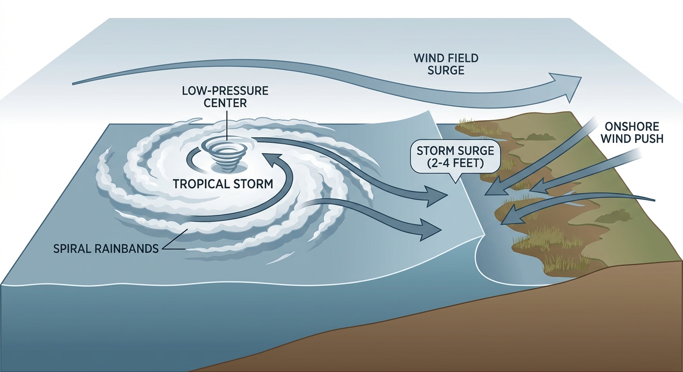
As of the 4 AM CDT advisory, Bertha was sitting about 110 miles south-southwest of Panama City, Florida, with max sustained winds of 52 mph and a central pressure of 998 mb. Air Force reconnaissance flew through the storm overnight and found it still deepening, so this isn't a system that's done strengthening just yet.
Bertha is moving northwest at just 5 mph. That slow forward speed matters because it means more time over warm Gulf water to organize, and more time for rain to pile up once it comes ashore. Our impact model has New Orleans in the highest "action" tier, with landfall expected in roughly 37 hours, putting it around 5 PM CDT Wednesday. Central Louisiana, Morgan City, and Houma are all in "prepare" mode, and Sabine Pass over in Texas is on the list too as outer bands could reach that far west.
Here's what to actually expect: 2 to 4 feet of storm surge along the coast, 2 to 4 inches of rain with isolated totals up to 6 inches, and tropical storm force winds spreading inland behind the front edge of the circulation. That's enough to cause flash flooding and scattered power outages even without a major hurricane on the map. Tropical storm watches and warnings are up right now for portions of the north Gulf Coast, so if you're in that zone, today is the day to finish your prep, not tomorrow.
Enhanced Risk From the Ohio Valley Into the Mid-Atlantic
While Bertha holds the coast's attention, today's bigger population impact is actually up north. SPC has an Enhanced Risk out for a corridor running from the upper Ohio Valley into the Mid-Atlantic, covering Philadelphia, Washington DC, Baltimore, Lexington, and Newark. That zone alone covers almost 36 million people. A broader Slight Risk wraps around it, stretching to New York City, Columbus, Nashville, Louisville, and Raleigh, adding another 52 million people to the outlook.
The setup is a broad area of 40 to 50 knot midlevel west-southwest flow moving across the region, which is unusually strong wind aloft for late July. That kind of flow tends to translate storms into fast-moving, wind-producing systems rather than the pop-up, sit-still storms you'd normally expect this time of year. SPC's own numbers back that up: the wind category tops out at Level 4, with a 45 percent chance of widespread damaging gusts over 60 mph in the Enhanced zone. Hail chances are lower, topping at Level 2 with a 15 percent scattered severe hail threat, and tornado chances sit at Level 2 with a 5 percent chance of a few tornadoes if storms can organize enough to rotate.
This pattern rhymes with something we've seen before. On July 29, 2021, that same Ohio-to-Pennsylvania corridor produced multiple EF2 tornadoes and a Pennsylvania EF3. Pennsylvania's most active July in our records was that same year, 2021, with 14 tornado reports. And on this exact date back in 2003, Pennsylvania recorded an F3 tornado. None of that means today repeats that outcome, tornado potential here is much lower than a classic Plains setup, but it does tell you this corridor has a track record of turning strong wind shear into something more than just downed tree limbs.
That's actually a continuation of a pattern we've been tracking all week. Yesterday's MCS tore through Iowa, Illinois, and Wisconsin with confirmed tornadoes near Kamrar, IA and Elderon, WI, plus an 87 mph gust near Herreid, SD. The atmosphere hasn't calmed down, it's just shifted the bullseye east.
Flooding Rain Stacks on Top of the Wind Threat
WPC has its own Slight Risk for excessive rainfall today, and it overlaps a lot of the same ground. The Ohio and Tennessee Valleys into the Northeast are included, along with the Southwest and Great Basin where anomalous monsoon moisture is streaming north. Tomorrow, that excessive rainfall risk shifts toward northern Georgia through the Tidewater of Virginia and North Carolina, partly fueled by moisture left behind as Bertha's remnants get pulled north. If you're in Hampton Roads or the Carolina coast, keep an eye on Wednesday and Thursday too, not just today.
That New Jersey flood watch that's trending right now, covering 14 counties ahead of tonight's storms, fits squarely into this picture. Same setup, same moisture, same strong flow aloft.
A Quick Word on Space Weather
Nothing alarming here, but worth a mention since it's active. NOAA's Space Weather Prediction Center says a G1 minor geomagnetic storm is likely July 22 as a coronal hole high-speed stream arrives, and there's a 40 percent chance of R1-R2 minor to moderate radio blackouts through July 23 tied to flare activity from sunspot region 4493. G1 storming is genuinely minor, mostly a chance at aurora for far northern viewers, not something that affects your day-to-day.
What This Means for Tonight's Games and Plans
Philadelphia sits right in the middle of today's Enhanced Risk, and the Phillies host the Dodgers tonight at 6:40 PM local. That's a real candidate for a rain delay or worse given the wind threat lining up with first pitch. The Yankees and Pirates in the Bronx, and the Orioles and Red Sox in Boston, both fall in the broader Slight Risk zone, so watch for evening storms there as well. If you've got plans along I-95 between DC and New York tonight, build in some flexibility.
Down on the Gulf Coast, this is the day to lock down outdoor plans through Wednesday. Fishing charters, beach days, anything on the water from the Florida Panhandle to southeast Louisiana should be reconsidered starting this afternoon as conditions deteriorate ahead of Bertha.
Key Things We're Watching
- Bertha's exact landfall point and whether it strengthens further before Wednesday evening
- Storm surge timing along the Louisiana coast, especially around Morgan City and Houma
- Whether today's Enhanced Risk storms organize into a fast-moving derecho-style line or stay more scattered
- Wednesday and Thursday's shift in the excessive rainfall risk toward the Carolina and Virginia coast
- Any tornado warnings out of the Ohio Valley to Mid-Atlantic corridor given its history on this date
Bottom Line
If you're anywhere near the northern Gulf Coast, today is prep day for Bertha, not tomorrow. Watches are up, surge and heavy rain are coming, and the storm is intensifying. If you're in the Ohio Valley, Mid-Atlantic, or Northeast, especially Philadelphia, DC, and Baltimore, keep your phone charged and know how you'll get warnings tonight. Widespread damaging wind is the headline threat, and this corridor has a real history of producing more than just tree damage on this stretch of the calendar. Everybody else, keep an umbrella handy and an eye on the sky through midweek.