Blog Article
Severe Weather Outbreak: Level 4 Moderate Risk in Kansas
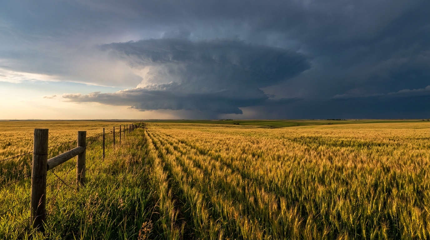
A major severe weather setup threatens Kansas and Nebraska on Monday with EF3+ tornadoes and softball-sized hail. Extremely critical fire weather expected in Texas.
Beyond the Box Scores: A Dangerous Monday Setup Looms for the Plains
Everybody is talking about Caitlin Clark and the Indiana Fever taking on the Seattle Storm tonight. Or maybe you are glued to that wild Cubs and White Sox series up in Chicago. Sports fans are having a heck of a weekend. But while the entire country has their eyes fixed on the Midwest, I need you to look just a little bit further west. We have a very serious weather situation unfolding for Monday.
Indianapolis and Chicago are looking at pretty decent weather right now. But the storm system responsible for this upcoming work week is getting its act together over the Rockies. By Monday afternoon, it is going to cause some major problems.
The Main Event: Level 4 Severe Threat
The Storm Prediction Center has issued a Level 4 out of 5 Moderate Risk for severe weather on Monday. This covers central Kansas up into southeast Nebraska. Places like Salina and Manhattan in Kansas are right in the bullseye.
Here is the thing. The atmosphere is going to be incredibly unstable. We are looking at extreme energy levels. When you have that much juice in the air, the storms that form can get nasty quickly. The data shows a 15 percent hatched risk for tornadoes in this area. That "hatched" word is important. It means if a tornado forms, it could be strong. We are talking about the potential for EF3 or higher tornadoes.
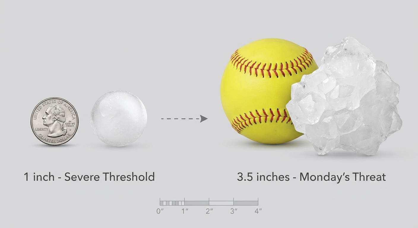
We are also looking at a 45 percent hatched risk for hail. We are not talking about little pea-sized ice. The data indicates hailstones could reach up to three and a half inches across. That is softball size. It will wreck a windshield in seconds. If you live in this Moderate Risk area, you need to park your cars in the garage tonight and have your severe weather plan ready to go for Monday afternoon.
The Hidden Danger: Critical Fire Weather
Down south, the story is completely different but just as dangerous. You have probably seen the news trending about new burn bans impacting forest fires. Well, those bans are in place for a very good reason.
We have an Extremely Critical fire weather area for the Texas and Oklahoma Panhandles, eastern New Mexico, and southwestern Kansas. The air is bone dry. But the real danger comes Monday evening between 6 PM and 9 PM local time.
A strong cold front is going to push through the Panhandles. When it does, the wind is going to sharply shift and start blowing hard out of the north. If a wildfire is already burning, that sudden wind shift will push the fire line in a completely new direction. It is a nightmare scenario for firefighters trying to contain a blaze. If you live in Amarillo or Lubbock, please do not do anything that could spark a fire tomorrow.
A Wild Temperature Swing
Just to show you how wild this system is, the cold air behind it is dumping a foot or two of snow up in Wyoming. The Interstate 80 corridor near Casper and Cheyenne is looking at 70 mph wind gusts and blizzard conditions. We are going to see record cold temperatures in the teens and twenties right behind this storm. Remember, the average high for Denver in May is 71 degrees. This is a massive shock to the system.
So enjoy the basketball games and the baseball rivalries tonight. But if you have friends or family in the Plains, give them a call. Make sure they know what is coming tomorrow. Keep your phones charged and have a reliable way to get warnings.
https://ryanhallyall.com/blog/beyond-the-box-scores-a-dangerous-monday-setup-looms-for-the-plains