Blog Article
US Weather: NW Floods, WY Fires & Northeast Snow
From an atmospheric river in Washington to critical fire weather in Wyoming and snow in New England, we break down this week's extreme weather whiplash.

Alright folks, we need to take a deep breath. This month has been absolutely relentless. We just watched historic blizzards bury the Upper Midwest, destructive tornadoes tear through the Midwest and South, and as we talked about yesterday, Phoenix just hit 100 degrees way earlier than it has any right to.
But the atmosphere is not done with us yet. The extreme weather whiplash is continuing right through the end of the week. Let's break down exactly what is happening and how it might impact your plans.
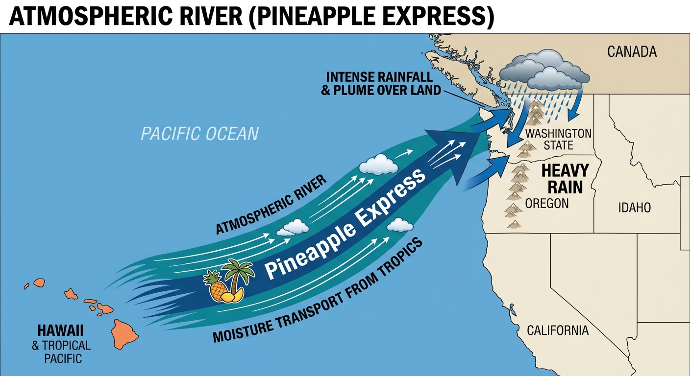
The Pineapple Express Keeps Chugging
Up in the Pacific Northwest, get this, an atmospheric river is still pointing a firehose of moisture right at Washington state. The Snoqualmie River has already been pushed to its absolute limits, tying a record crest of 56.8 feet from way back in 1974.
We are looking at another 1 to 3 inches of rain for the Cascades and Olympics today and tomorrow. The Weather Prediction Center has a Marginal Risk for excessive rainfall in place. If you commute through those lower elevation areas around Seattle or have travel plans in the region, you need to leave early and watch out for water over the roadways.
Critical Fire Danger in Wyoming
While Washington is soaked, the High Plains are bone dry. We have a Critical Fire Weather risk for central and eastern Wyoming today and tomorrow.
Here is the thing. We have a downslope wind setup coming off the Rockies. That means very strong west-northwest winds combined with humidity dropping into the single digits. Places like Casper, Laramie, and Douglas are right in the bullseye. If a fire starts in these conditions, it will spread incredibly fast. Please do not be the spark.
A Sneaky Northeast Clipper
Just when you thought spring was winning, winter is making a comeback in the Northeast. A clipper system is swinging across the Great Lakes and heading straight for New York and northern New England.
We are talking about 1 to 6 inches of snow, especially in the higher elevations like the Adirondacks. If you live up there, do not put the shovels away just yet. Keep the winter coats handy and prepare for some slippery roads.
Weekend Plans and Expanding Heat
That record heat we discussed in the Southwest is not staying put. It is expanding right into the Great Plains. If you are catching the Royals and Rangers spring training game in Surprise, Arizona today, you already know to keep hydrating. But if you are heading out to the Outlaws and Legends Music Festival in Abilene, Texas on Friday, you are going to feel that serious warmth building in.
Here are the key factors I am watching as we head into the weekend:
- Sunday Thunderstorms: Looking ahead to Sunday, a cold front will push through the Ohio Valley and into the Appalachians. The Storm Prediction Center is watching this area for potential thunderstorms, so keep an eye on the sky if you have outdoor plans.
- Northwest Relief: The heavy rain in Washington will finally start to wane late today as the primary low pressure system shifts, giving those swollen rivers a chance to recede.
- Plains Warmth: Expect to swing from hoodies in the morning to full blast AC in the afternoon as that desert heat bleeds eastward.
Bottom Line
Alright y'all, here is what you need to do. If you are in Washington, respect the road closures and flooded areas. Wyoming folks, absolutely no outdoor burning. Northeast, grab the ice scraper one more time. And for everyone else enjoying the early heat, remember that spring weather changes fast. Stay safe and stay weather aware!