Blog Article
Karina Hits Cat 4, Gulf Invest 97AL Threatens Texas Coast
Hurricane Karina reaches Category 4 in the East Pacific while Invest 97AL targets the upper Texas coast with heavy rain, and Utah faces a Moderate flash flood risk.
Cat 4 Karina, a Crowded Tropics, and Utah's Flash Flood Threat Isn't Done Yet
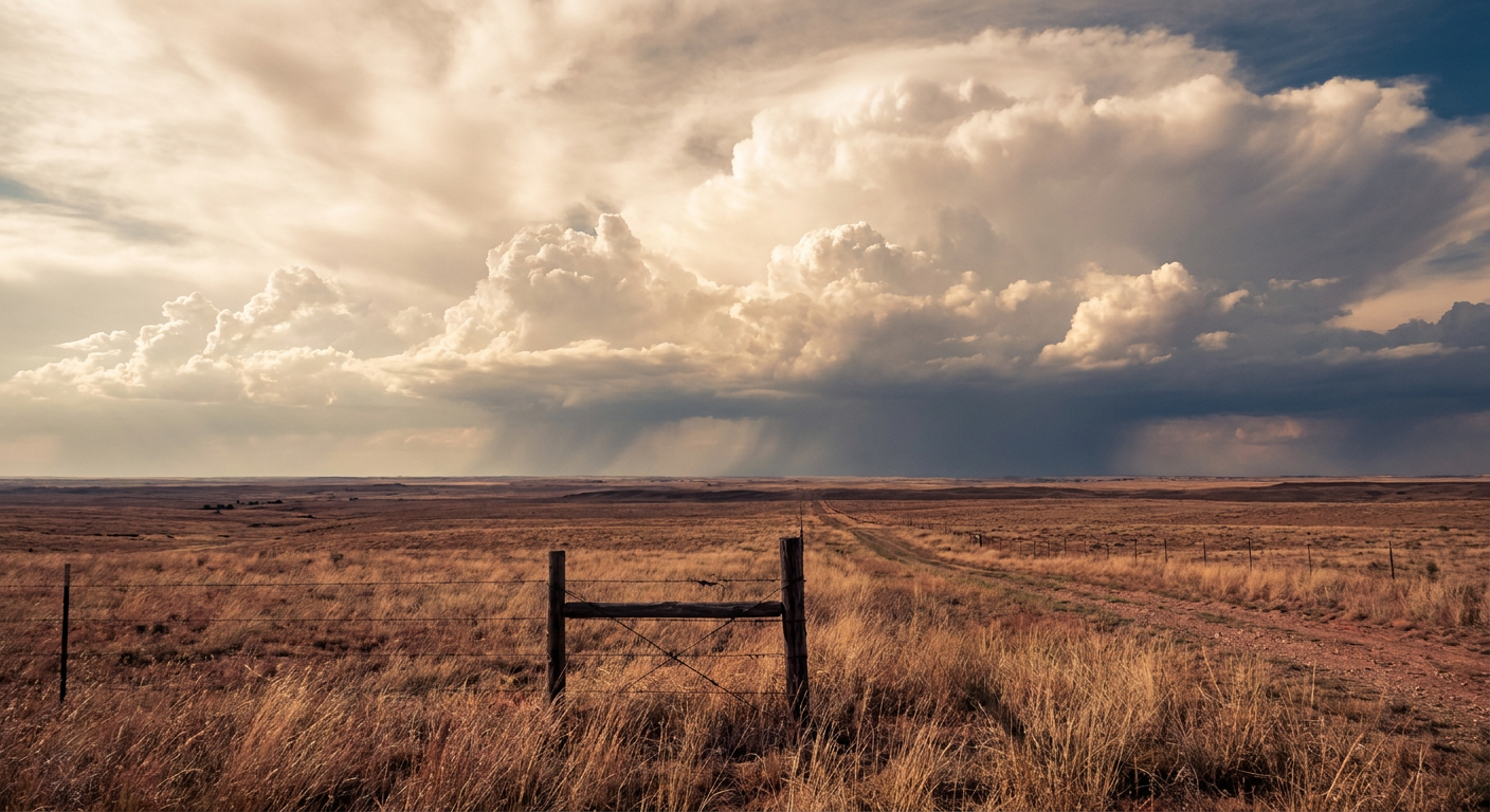
Alright y'all, grab your coffee, because the tropics did NOT take a day off. We've got a Category 4 hurricane spinning in the East Pacific, a tropical storm trailing behind it, and a Gulf system that actually matters for our neck of the woods come Tuesday. And out west, that same monsoon flood pattern that put people in Capitol Reef and the Grand Canyon in danger yesterday hasn't let go one bit.
Hurricane Karina Is a Cat 4, and She's Not Done Growing
Karina kept doing what she was doing yesterday when she jumped from tropical storm to Category 3. Overnight she strengthened again, now sitting at 144 mph sustained winds with a central pressure of 942 mb. That's a strong Category 4 hurricane, and per the National Hurricane Center's discussion, the eye is trying to clear out and intensity estimates are still climbing. This thing is a long way from anybody, though. Karina's about 1,020 miles west-southwest of the southern tip of Baja California, moving west at 9 mph, and there's no coastal watch or warning in effect for mainland Mexico.
The reason we're watching her at all stateside is Hawaii. Long range, experimental impact modeling flags an "aware" level threat for east Maui and several other island coastlines, but that's eight days out and a hurricane's turned less on more notice than that. Nothing to act on yet, just something to keep half an eye on if you've got island travel planned in a week or so.
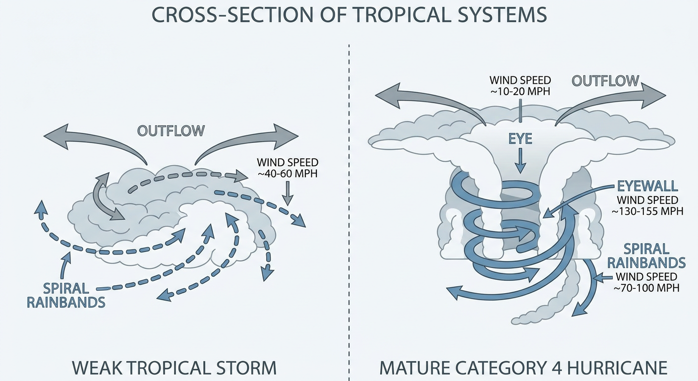
Behind Karina, Tropical Storm Lowell is chugging west at 60 mph winds, about 855 miles east-southeast of Hilo. Same story: Hawaii awareness level, several days out, worth a check-in later this week but not a today problem.
The One That Actually Matters for Us: Invest 97AL in the Gulf
Here's the system with real implications for the Gulf Coast. Invest 97AL, a broad area of low pressure sitting more than 100 miles south of southern Louisiana, is producing a small but persistent cluster of showers and storms with winds around 30 to 35 mph. The National Hurricane Center hasn't upgraded it to a named system yet, but the setup has forecasters watching closely, and WPC has already coordinated directly with the Houston/Galveston and Lake Charles offices.
The timeline: guidance has this system moving onshore near the upper Texas coast Tuesday morning. WPC has placed a Slight Risk of excessive rainfall for the upper Texas coast and far southwest Louisiana Tuesday into Wednesday, with precipitable water values over 2.25 inches and strengthening low-level inflow. Translation: several inches of rain are possible in a compressed window, and that's enough to cause urban flash flooding in Houston, Beaumont, and Lake Charles even without a named storm on the board. If you're in that corridor, Tuesday morning commute could get messy, and outdoor plans for Labor Day weekend prep might need a rain contingency.
On top of that, there's a second area of interest, Invest 95EP, sitting well offshore of southwestern Mexico, but that one's not an immediate US concern.
Utah's Flash Flood Threat: Moderate Risk, and It's Personal Today
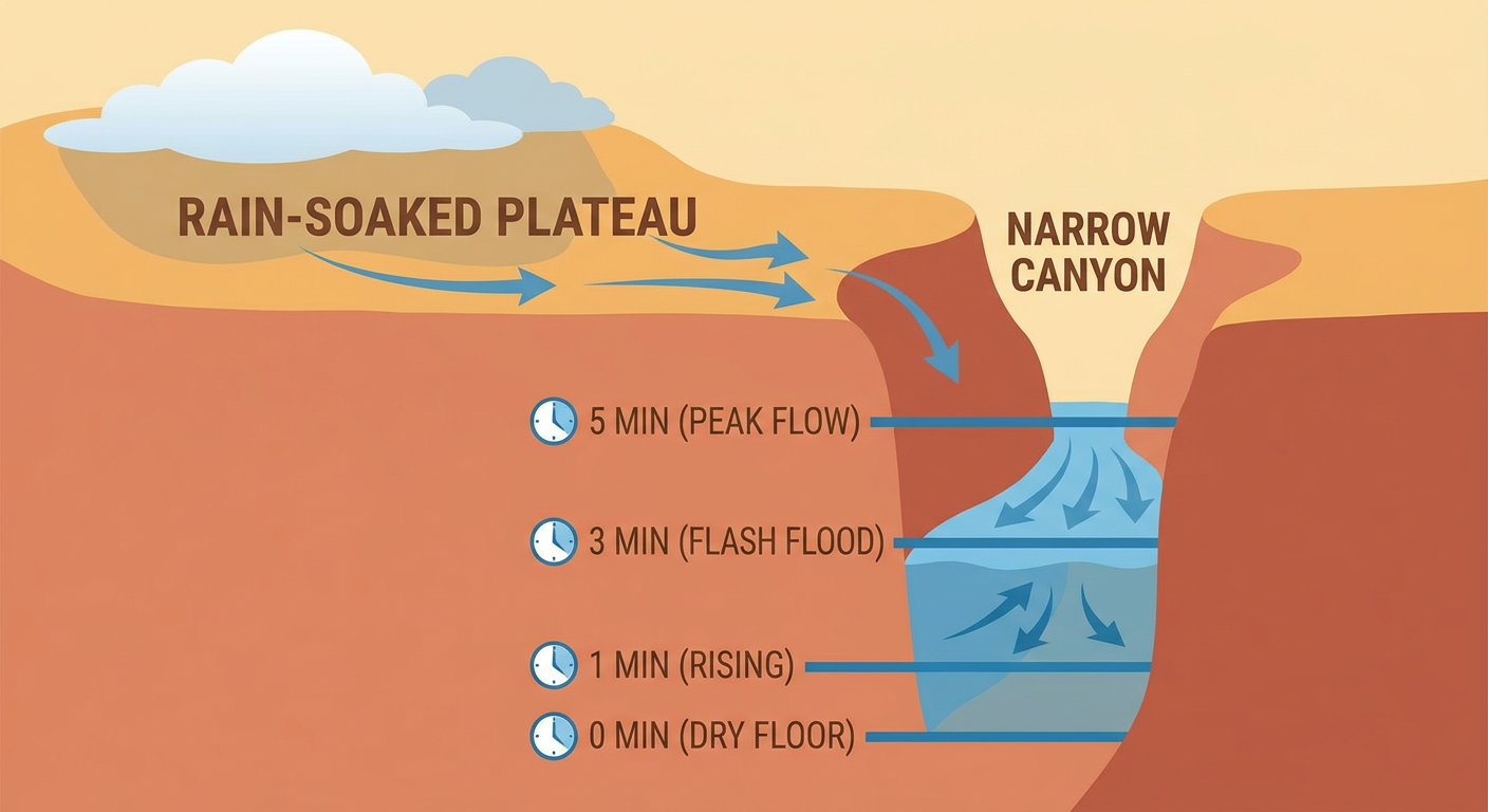
You'll remember from yesterday's rundown, the Desert Southwest had an ugly day. Debris flows crossed Highway 141 near the Turner Gulch burn scar in Mesa County, Colorado. Sulphur Creek and Wahweap Creek flashed in Utah. And this morning brings sobering news out of the Grand Canyon: one person is confirmed dead and 15 more were reported potentially missing after a flash flood, a gut punch that underscores just how dangerous this monsoon pattern has been all month.
Today, WPC has Utah, the Desert Southwest, and the Four Corners region under a Moderate Risk of excessive rainfall, the second-highest category WPC issues. Dual shortwaves, one out of Mexico, one out of California, are lifting north into a region that's already saturated from days of training storms. If you're anywhere near slot canyons, dry washes, or areas with recent burn scars in Utah, Arizona, or western Colorado, today is not the day to push your luck. Water can rise from nothing to dangerous in minutes in this terrain, and this month has already proven that repeatedly.
Severe Weather: Quiet Today, Building Into the Northeast Tuesday and Wednesday
Today's severe risk is modest. SPC has a Marginal Risk stretched from the central High Plains into the Great Lakes, touching Omaha, Des Moines, Cedar Rapids, and Madison, with isolated wind and hail the main concerns and only a 5 percent probability of either.
Tuesday is where it gets more interesting. SPC has upgraded central New York, central and eastern Pennsylvania, and New Jersey to a Slight Risk, with a 15 percent probability of damaging wind and 15 percent probability of large hail, plus a 2 percent isolated tornado probability tied to a diffuse warm front. A broader Marginal Risk fans out to cover New York City, Chicago, DC, and Detroit. Wednesday keeps that Slight Risk parked over the eastern Great Lakes into the Mid-Atlantic coastline, so this is a two-day story, not a one-off.
Our analog data flagged some historical comparisons here, including the August 7, 2023 event that produced an EF3 tornado in Lewis County, New York, and the June 2020 and June 2012 Mid-Atlantic derecho events. Worth being clear: those are geographic and seasonal precedents, not matches for this setup. The current forecast doesn't show comparable instability or shear to those historic days, so treat them as context for the region's history with severe weather, not a prediction of what's coming Tuesday.
Airport travelers should take note too: the Northeast storm threat is expected to bring cascading delays and possible ground stops at New York and DC-area hubs Tuesday afternoon into the overnight hours, right as Invest 97AL is dropping heavy rain on Houston-area airports the same morning.
A Few Other Things on the Radar
- Fire weather: Downslope winds of 15 to 20 mph and afternoon relative humidity near 15 to 20 percent will keep an elevated fire weather threat alive across the Northwest into northwestern Nevada today, with a similar setup expected Tuesday. If you're out at Burning Man in the Black Rock Desert, expect breezy, dry, dusty conditions.
- Space weather: Nothing dramatic. NOAA's outlook shows mostly quiet-to-unsettled geomagnetic conditions, with a G1 Minor storm possible September 25-26, three weeks out. Solar activity is running low with just a slight chance of an M-class flare through Tuesday.
- Nice weather corridor: If you want the best air today, northern New England and the interior Pacific Northwest are your spots, light wind, low humidity, genuinely pleasant. Most of the rest of the country is stuck in fair-to-decent territory thanks to heat and humidity lingering from what's been a brutal August.
For Your Week
MLB fans in Boston, Cincinnati, and DC should have clear skies for tonight's games. Tuesday's slate gets trickier for the Nationals-Braves game in DC and any Northeast outdoor activity as that severe risk ramps up during the afternoon and evening window. Houston-area outdoor plans should build in a rain buffer Tuesday given the 97AL rainfall threat timing right around the morning commute.
Bottom Line
Karina and Lowell are dramatic but distant, Hawaii's only at an awareness level and that's over a week out. The system that actually affects your plans this week is Invest 97AL, expect heavy rain and localized flash flooding along the upper Texas coast and far southwest Louisiana Tuesday into Wednesday. Out west, treat Utah and the Four Corners region flash flood risk as serious today, not a rerun of a story you've already heard, given what just happened at the Grand Canyon. And if you're in the Northeast or Mid-Atlantic, keep an eye on Tuesday and Wednesday for scattered severe storms, this isn't a major outbreak setup, but it's enough to disrupt outdoor plans and air travel both days.