Blog Article
Hurricane Lala Hits Cat 4 as Storms Return to Mississippi Valley
Hurricane Lala strengthens to Category 4 in the Central Pacific while severe storms and flash flood risk return to the mid-Mississippi Valley today.

Category 4 Lala Churns Toward Remote Hawaii While Flooding Rain and Severe Storms Return to the Mississippi Valley
Alright y'all, we've got a lot to cover this morning, so let's get right into it.
Hurricane Lala Jumps to a Category 4
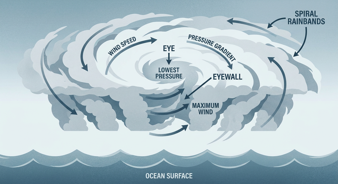
This one moved fast. Yesterday we told you Lala had reached Category 2 status with 110 mph winds. Overnight, it kept right on strengthening, and as of the latest advisory Lala is a Category 4 hurricane with 132 mph sustained winds and a pressure down to 947 millibars. That's a serious storm by any measure, with forecasters noting a very clear eye and cold cloud tops surrounding it, textbook signs of an intensifying hurricane.
Here's the part that matters for real life, though. Lala is sitting way out in the Central Pacific, about 310 miles south of Maro Reef and 450 miles southeast of Lisianski Island. Those names probably don't mean much unless you know your geography, but they're part of the Papahānaumokuākea Marine National Monument, the string of small, largely uninhabited islands and atolls northwest of the main Hawaiian Islands. The Hurricane and Tropical Storm Watches in effect are for that monument area, not Honolulu or Maui or the islands most of us picture when we hear "Hawaii." The storm is moving northwest, which is carrying it away from the main islands, not toward them.
So yes, this is an impressive, dangerous hurricane. But the direct impact to people is limited mostly to a remote research and conservation area. We'll keep watching Lala's track, because these systems can still send big swells toward the main islands even without a direct hit, but there's no indication right now this becomes a story for populated Hawaii.
Meanwhile, out ahead of Lala, the Eastern and Central Pacific are staying busy. NHC has two disturbances flagged at high risk for development over the next week, one south-southwest of Mexico and another closer to the Central Pacific basin, both carrying an 80 percent chance of formation within seven days. Neither is a US mainland concern yet, but it tells you the tropics out there are far from done for the season.
Back Home: Slight Risk for Severe Storms and Flooding Rain Today
On the mainland, today's headline is the mid-Mississippi Valley, and it's a familiar setup after the week we've had. SPC has a Slight Risk for severe storms up from Cape Girardeau, Missouri, through Springfield, Owensboro, Evansville, and Clarksville. A broader Marginal Risk stretches out from there across Indianapolis, Nashville, Memphis, and Louisville, and even reaches into Phoenix on the western edge of the outlook.
The numbers behind that Slight Risk aren't extreme, but they're not nothing either. Damaging wind is the headline threat, with a 15 percent scattered damaging wind chance over the highest-risk zone. Hail chances sit at 5 percent for quarter-size or bigger, and there's a small 2 percent isolated tornado chance mixed in too. Translation: if storms fire this afternoon and evening, some of them will likely turn severe, mainly with wind gusts capable of downing trees and knocking out power, the same story we've been living through all week.
What makes today extra worth watching is the ground underneath. Soils across parts of Illinois and Indiana are still saturated after the Sangamon River at Monticello came within a hair of its flood of record earlier this week. WPC has a Slight Risk for excessive rainfall today covering the central Plains, mid-Mississippi Valley, and Ohio Valley, plus a separate area over southern Arizona tied to ongoing monsoon moisture. Kansas City is specifically named in today's risk zone too, with local forecasters flagging a 15 percent damaging wind probability as storms grow upscale along a frontal boundary this afternoon.
If you've got outdoor plans in that corridor tonight, keep an eye on the sky. That includes ballgames in Kansas City and Cincinnati, where evening storms could bring a delay or two even if the worst stays just south or east of the stadium.
Thursday: The Focus Slides East to the Mid-Atlantic
By Thursday, the severe and flooding threat shifts. SPC's Day 2 outlook drops a Marginal Risk over the Mid-Atlantic, covering Philadelphia, Washington DC, Baltimore, and Raleigh, along with a separate Marginal Risk area from the northern Plains into the Upper Midwest and another over the Mid-South. WPC follows suit with a Slight Risk for excessive rainfall specifically over the Mid-Atlantic Thursday, as a cold front stalls out and squeezes rain out of the Piedmont and eastern Pennsylvania. If you're headed toward Williamsport for Little League World Series games or traveling through the DC-to-Philly corridor Thursday, keep half an eye on the radar. Nothing extreme is expected, but a strong storm or two with gusty wind and heavy downpours wouldn't be a surprise.
Heat is also creeping into the picture. Thursday's forecast heat index values are expected to climb into the 103 to 110 degree range across the Plains, Midwest, and interior West, well above what typical August afternoons feel like even in already-hot cities like Kansas City (normal high 88) and Tulsa (normal high 93). That's a "limit the time outside in the afternoon" kind of heat, even where storms aren't the concern.
Quick Hits
- Space weather: A G1 (Minor) geomagnetic storm is possible again today, driven by a coronal hole high-speed stream, similar to what pushed the Kp index to 5 yesterday. Nothing that affects daily life beyond maybe some aurora chasing at high latitudes tonight.
- Fire weather: The Interior West and Great Basin continue to see above-normal temperatures and dry conditions build into Thursday as an upper ridge strengthens there, keeping fire weather concerns elevated in that region.
- River flooding: Watch the Illinois and Indiana river basins. They're still working through the aftermath of this week's heavy rain, and any new downpours land on ground that has very little capacity left to absorb it.
What We're Watching
- Lala's exact track relative to the main Hawaiian Islands, even with impacts currently expected to stay confined to the remote Northwestern islands
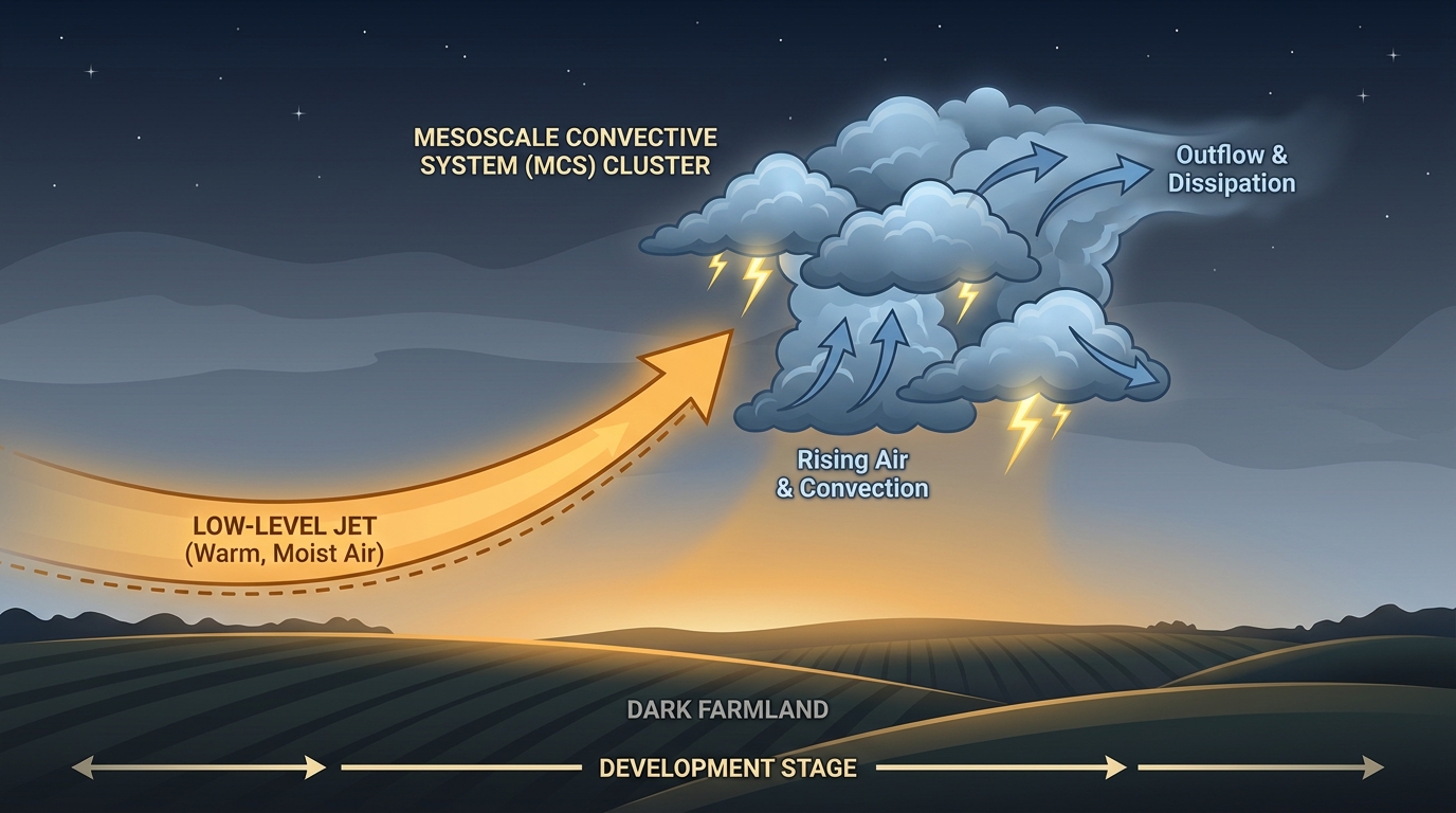
- Whether today's mid-Mississippi Valley storms grow into a larger cluster overnight, similar to the Nebraska MCS that produced 90 mph gusts earlier this week
- River levels in Illinois and Indiana as any new rainfall adds to already saturated basins
- Thursday's Mid-Atlantic severe and flash flood potential as the front stalls out over Virginia and the Carolinas into the weekend
- Development chances on the two high-risk Pacific disturbances, though neither threatens the US mainland at this point
Bottom Line
Hurricane Lala is a legitimate Category 4 hurricane, but its teeth are aimed at a remote, largely uninhabited stretch of the Pacific, not the main Hawaiian Islands. Closer to home, today's story is a slight risk for severe storms and heavy rain from the central Plains into the mid-Mississippi and Ohio Valleys, landing on ground that's already had more than its share of water this month. If you're in that Slight Risk zone from Springfield to Cape Girardeau, have a way to get warnings this afternoon and evening. Everybody else, keep watching Thursday's Mid-Atlantic threat and that climbing heat index if you're outside much this week.
And hey, if you want to watch today's warnings pop up in real time the same way we do, that's exactly what Chaser Dot's live map was built for. Real radar, real polygons, same storms we're talking about right here.