Blog Article
Hurricane Polo, Nolo Threaten Hawaii as Nor'easter Builds
Category 5 Hurricane Polo, Tropical Storm Nolo's Hawaii threat, a developing Nor'easter, and Southwest flash flooding headline Thursday's active weather pattern.

Category 5 Polo, Hawaii's Nolo, and a Nor'easter Taking Shape: Thursday's Tropical Traffic Jam
Alright y'all, grab your coffee because there's a lot going on this morning. We've got four active tropical systems on the board, one of them a Category 5, and Hawaii is staring down a hurricane watch. On top of that, a coastal low is spinning up off the East Coast that's got forecast offices from Boston to DC on alert for Friday. Let's get into it.
The Tropics Are Stacked Four Deep
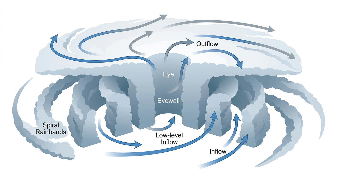
Hurricane Polo is the headline. This thing is a legit Category 5 sitting about 150 miles offshore of southwestern Mexico, with 161 mph sustained winds and a central pressure down at 923 millibars. That pressure reading alone tells you how intense this core is. The eye is clear, symmetric, and surrounded by a tight ring of deep convection, which is about as textbook as a major hurricane gets. Polo is crawling northwest at just 9 mph, and while the core itself is staying offshore for now, outer rainbands are already spreading heavy rain into southwestern Mexico.
The longer range track brings Polo up toward the Baja California peninsula, with NHC guidance showing a closest approach to Santa Rosalía, Baja California Sur, in about five days as a much weaker system, likely down around 80 mph by then. Loreto is flagged as an "action" level concern given the storm's current strength and the distance still separating it from the coast. This is a rapidly evolving forecast, and if you've got family or property anywhere on that peninsula, now's the time to start paying attention, not next week.
Right behind Polo is Hurricane Odalys, a Category 1 with 86 mph winds churning well offshore, over a thousand miles from Baja. It's moving east-northeast and NHC's own guidance keeps it weakening as it approaches, with model intensity dropping to around 35 mph by the time it gets anywhere close to land near San Quintín. This one's mostly an open-water story for now.
The one I'm watching hardest for direct US impact is Tropical Storm Nolo. It's sitting a few hundred miles south of the Big Island with 52 mph winds, but it's expected to strengthen as it turns northward, and NHC has a Hurricane Watch up for Hawaii County. Current guidance shows Nolo approaching Hawaii Island in about two and a half days with intensity climbing toward 95 mph, which would make it a hurricane at closest approach. The impact model flags Hilo, the Kona Coast, and both the south and west sides of Hawaii Island at a "prepare" threat level. The National Hurricane Center's own AFD guidance is even blunter than that, warning of potential 15 to 35 inch rainfall totals on the volcanic terrain, the kind of number that produces catastrophic flash flooding and landslides in steep drainages. If you're on the Big Island or Maui, this is a real storm to take seriously, not a glancing blow.
Rounding out the list, Tropical Storm Fay is out in the central Atlantic with 40 mph winds, moving west, well south of the Azores, and NHC doesn't have it threatening land. There's also Invest 90AL near the Cabo Verde Islands that could briefly organize into a short-lived depression, and NHC's Pacific outlook flags an area south of the Gulf of Tehuantepec with an 80 percent chance of development over the next week. That's the same stretch of ocean that spun up Polo, so don't be surprised if we're talking about another named storm there soon.
A Nor'easter Is Taking Shape for the Northeast and Mid-Atlantic
Here's the thing about Friday: a western Atlantic coastal low is developing, and it's serious enough that NHC-adjacent forecast offices from Baltimore-Washington up through Philadelphia, New York, and Boston have all flagged it for local guidance this week. The setup is prolonged onshore flow wrapping moisture into the coast, with wind gusts above 45 mph, coastal flooding, and heavy rain expected across New Jersey, Delaware, the Chesapeake Bay region, Long Island, Connecticut, Rhode Island, and eastern Massachusetts. WPC's Day 3 excessive rainfall outlook already has a Slight Risk zone tucked into southeast New England tied to this system, on top of the Plains flooding threat we'll get to in a second.
This matters for real plans. All Things Go Music Festival kicks off Friday in Columbia, Maryland and runs through the weekend, and Oceans Calling festival opens Friday in Ocean City, Maryland, right on the coast where surge, rip currents, and beach erosion are the biggest concerns. If you're headed to either one, keep an eye on wind and coastal flood advisories, and don't be shocked if beach access gets restricted at some point Friday into Saturday.
We've seen this movie before this month. Back on September 13, a slow-moving system dumped 3 to 5 inches of rain across northern New Jersey and southern Connecticut in just a couple hours, flooding I-95 and prompting water rescues in Stamford and New Haven. This weekend's coastal low is a different animal, more wind and tidal flooding than flash flood rain rates, but the region's already had a rough month with water.
The Southwest's Flash Flood Threat Isn't Finished
WPC has a Slight Risk of excessive rainfall today across the Texas and Oklahoma Panhandles, central and eastern New Mexico, and separately across the central and southern Appalachians. The concern in New Mexico is specific: soils in the Sacramento Mountains and surrounding drainages are already saturated from earlier rain this week, so it doesn't take much additional rainfall to set off flash flooding in those burn-scarred and steep terrain areas. The risk area gradually shifts northeast into the central Plains and Missouri Valley by Friday and Saturday as a Marginal Risk, so this is a multi-day soggy pattern for the Southern Plains rather than a one-and-done event.
Saturday's Severe Weather Watch: Southern Plains
SPC has a Marginal Risk of severe thunderstorms posted for Saturday across south-central Kansas and north-central Oklahoma, including Wichita, Hutchinson, and Enid. This is tied to a 500 mb cutoff low meandering off the East Coast while a relatively flat flow pattern sits over the central US and southerly moisture keeps feeding in. Isolated severe hail and damaging wind are the main threats, nothing widespread, but if you're in that corridor for the weekend, it's worth a glance at the forecast before you head out.
Aurora Watchers, Tonight Might Be Your Night
A coronal hole high-speed stream is arriving today, and SWPC has isolated G1 (Minor) geomagnetic storming likely tonight into Friday as that faster solar wind pushes past Earth. Kp values are forecast to peak around 5 on the 25th. That's not a huge storm, but G1 conditions can be enough to put a faint aurora glow on the horizon for folks in the far northern US, especially away from city lights. Worth a look outside tonight if you're up in the northern tier.
Fire Weather: Quiet But Watching the Great Basin
An upper trough digging into the Pacific Northwest is bringing increasing southwest winds to the northwest Great Basin today, enough for elevated fire weather concern there. That threat expands a bit Friday into northern Nevada and bordering Oregon and Idaho as a 60 to 70 knot mid-level jet moves overhead ahead of a cold front. Nothing critical flagged yet, but it's an area to watch as we head into the weekend.
Everybody Else: A Pretty Nice Stretch
If you're not in one of the zones above, there's good news. Today's nicest weather sits up in northern Maine, which actually reaches PERFECT tier conditions, with the interior Northeast, Great Lakes, and northern Plains running BEAUTIFUL to NICE. Friday flips the map a bit, with a corridor from Nashville and Atlanta north through Buffalo picking up dry high pressure, dewpoints in the mid-50s, and light winds for a genuinely beautiful fall day. That's good news if you're headed to Bourbon & Beyond in Louisville this week, or catching the front end of the State Fair of Texas, which opens Friday in Dallas. Dallas typically runs a high near 90 this time of year, so it'll feel like summer regardless of the sky.
Key things we're watching:
- Hurricane Polo's exact track and any changes to Baja California Sur timing and intensity
- Tropical Storm Nolo's intensification rate as it closes in on Hawaii Island, given the Hurricane Watch already posted
- Friday's coastal low intensity and how far inland the wind and coastal flood impacts push across the Mid-Atlantic and southern New England
- Continued saturated-soil flash flood risk in southeastern New Mexico and the Sacramento Mountains
- Saturday's Marginal Risk severe setup across south-central Kansas and north-central Oklahoma
- A possible Eastern Pacific system developing south of the Gulf of Tehuantepec behind Polo
Bottom Line
If you're on the Big Island of Hawaii, this is not a storm to shrug off. Nolo is forecast to strengthen into a hurricane as it approaches, and the rainfall numbers being discussed are catastrophic-flood territory. Get your preparations squared away today. If you've got travel or outdoor plans anywhere from the Mid-Atlantic through southern New England this weekend, especially coastal festivals like Oceans Calling or All Things Go, build in flexibility for Friday's wind and coastal flooding. Folks in the Southern Plains should keep half an eye on Saturday's Marginal severe risk, and anyone in southeastern New Mexico needs to stay flash-flood aware given how saturated those soils already are. Everyone else from the Ohio Valley into the Southeast is in line for a genuinely pleasant end to the week.