Blog Article
Severe Weather & Fire Risk Eclipse Northern Lights Hopes
While the internet buzzes about the aurora borealis, a major severe weather outbreak and extreme fire conditions are targeting the Plains and Midwest Sunday.
Chasing Auroras and Dodging Storms: A Wild Sunday on the Plains
Get this, y'all. The internet is buzzing today with news articles about the aurora borealis. We had a G2 geomagnetic storm hit the atmosphere yesterday, and folks across North America are hoping to catch a rare light show tonight.
But if you live in the Upper Midwest, you might want to stop looking for space weather and start checking your local forecast. We have a serious severe weather setup taking shape for Sunday, and it is going to bring a completely different kind of light show to the Plains.
The Upper Midwest Severe Threat
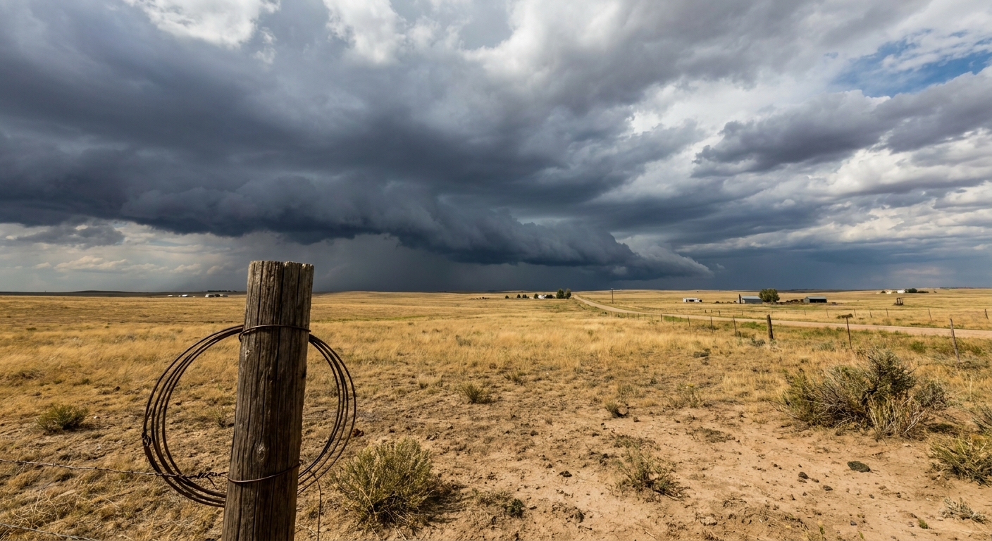
Here is the thing. The Storm Prediction Center has issued an Enhanced Risk for severe thunderstorms on Sunday. That is a Level 3 out of 5, and it covers parts of Nebraska, South Dakota, Iowa, and Minnesota.
The main concern tomorrow is the tornado threat. We have a 15 percent hatched area for tornadoes across northeast Nebraska, southeast South Dakota, and northwest Iowa. That means if storms form in that zone, they could drop EF2 or stronger tornadoes. We are also looking at a 30 percent hatched risk for very large hail. Some of those hailstones could be two inches across, which is roughly the size of a hen egg.
If you are a baseball fan, the Minnesota Twins are hosting the Milwaukee Brewers at Target Field tomorrow afternoon. Minneapolis is sitting right in the Slight Risk area, just on the edge of the worst weather. The average high in Minneapolis for mid-May is usually around 69 degrees, but we are pulling up a lot of warm, muggy air ahead of these storms. If you are heading to the ballpark, keep your phone charged and listen for alerts.
A Giant Atmospheric Vacuum
What is driving all this chaos? We have a strong low-pressure system deepening right over the Plains. It is acting like a giant vacuum. On the eastern side, it is sucking up rich, warm moisture from the Gulf of Mexico. That provides the fuel for our thunderstorms in the Midwest.
But on the western side of that system, it is pulling down bone-dry desert air. That dry air is crashing into the moisture, creating a sharp boundary called a dryline.
Extremely Critical Fire Weather Down South
That dry air brings us to the other major story. The Storm Prediction Center has issued an "Extremely Critical" fire weather outlook for the Texas and Oklahoma Panhandles, southeast Colorado, and southwest Kansas.
Extremely Critical is the absolute highest tier they have. It is rare, and it is incredibly dangerous. We are talking about single-digit humidity and winds howling at 25 to 30 mph.
Just yesterday, we saw non-thunderstorm wind gusts hit 90 mph in Guymon, Oklahoma. We had zero-visibility dust storms shutting down highways in West Texas. Tomorrow is going to bring more of the exact same conditions. The landscape out there is already stressed, and if a fire starts in these conditions, it will spread faster than you can run.
So while the trending topics are all about space weather and music festivals, the weather right here on the ground requires your full attention. Have multiple ways to get warnings on Sunday, and make sure your family knows what to do if a warning is issued for your town.
https://ryanhallyall.com/blog/chasing-auroras-and-dodging-storms-a-wild-sunday-on-the-plains