Blog Article
Chicago Flash Flood and Severe Wind Risk Today, Aug 9 2026
Slight Risk severe storms and flash flooding target Chicago, Milwaukee, and Toledo today, shifting into the Ohio Valley Monday. Full timeline and impacts inside.
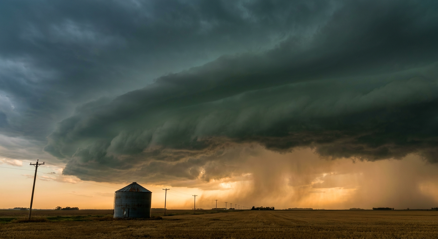
Chicago and the Upper Midwest Face a Wind and Flash Flood Double-Header Today
Alright y'all, good Sunday morning. After a wild Saturday that dropped trees on power lines from West Virginia to Massachusetts (yeah, that Severe Thunderstorm Watch 544 was no joke), the pattern isn't taking a day off. Today the action resets over the Upper Midwest, and it's a two-for-one deal: damaging wind AND flash flooding, in basically the same footprint.
The Setup
SPC has a Slight Risk (Level 2 of 5) posted today for a swath running from southern Minnesota and eastern Iowa across northern Illinois, southern Wisconsin, southern Lower Michigan, and into northwest Ohio and northern Indiana. That covers Chicago, Milwaukee, Toledo, Madison, and Fort Wayne. A batch of storms already ongoing over the Dakotas and northern South Dakota this morning is expected to congeal into a mesoscale convective system (MCS) by midday and push into Wisconsin.
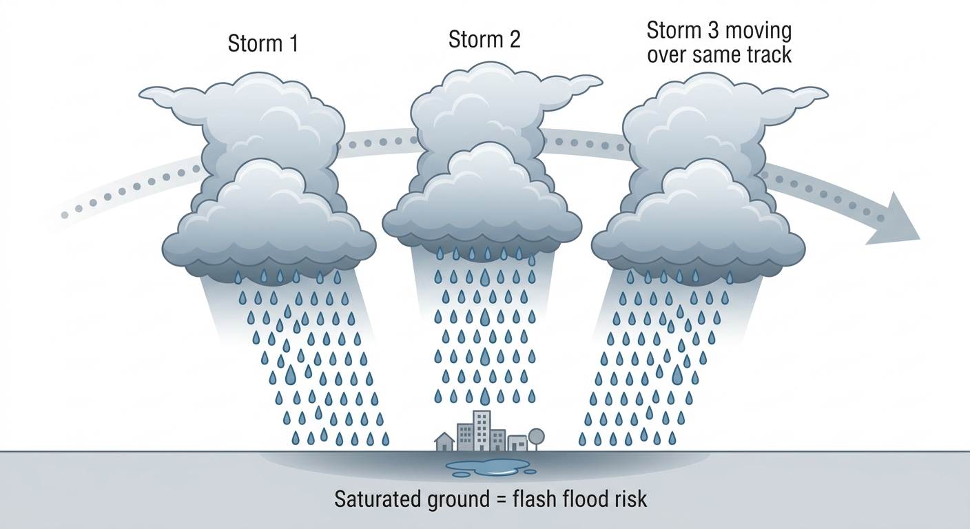
Here's the thing about that first round: it's fast moving, so it's more of a soil-priming event than a flood-maker by itself. But WPC has a Slight Risk for excessive rainfall over that same Upper Midwest corridor today, and the real worry is what comes after. If a second round of storms fires up later and moves over ground that's already saturated, you get what meteorologists call training, storm after storm rolling over the same spot like train cars on a track. That's when urban flash flooding becomes the headline, especially for the Chicago and Milwaukee metros overnight.
On the severe side, the primary threat is scattered damaging wind gusts, with SPC's probabilities putting a 15% (Level 2) chance of 60+ mph gusts over the hardest-hit zone, and a hatched area where isolated gusts to 75 mph aren't out of the question. Hail up to 2 inches is possible in that same hatched pocket. An isolated tornado can't be ruled out, but that's a low-end, 2% threat.
Timeline: This Slides East Through the Week
- Today (Sun, Aug 9): Slight Risk severe weather and Slight Risk excessive rainfall for the Upper Midwest and southern Great Lakes. Chicago, Milwaukee, and Toledo are the names to watch, with the flash flood threat ramping up tonight.
- Monday (Aug 10): The severe threat and the rainfall threat both shift east into the Southern Great Lakes and Ohio Valley. Columbus, Indianapolis, Cleveland, and Cincinnati pick up a Slight Risk for both severe storms (damaging wind gusts are again the main hazard, with dewpoints in the 70s°F and MLCAPE running 2,000 to 3,500 J/kg feeding the storms) and excessive rainfall. A Marginal Risk for severe weather stretches out to the I-95 corridor, meaning New York, Philadelphia, Washington DC, and Baltimore are on the outer edge of concern too.
- Tuesday (Aug 11): The corridor narrows to the Ohio Valley and central Appalachians as another round of thunderstorms with damaging wind gusts moves through.
For a little historical perspective, our analog data flags the August 10, 2020 derecho (the one that tore through Iowa into Indiana with a max gust over 130 knots) as a regional wind precedent for that same corridor Monday. To be clear, nothing in this setup says we're getting another derecho of that magnitude. It's a "this general area has produced historic wind events before" note, not a forecast repeat.
Fire Weather Still Simmering Out West
While the East deals with water, the West keeps dealing with dryness. Elevated fire weather conditions stretch from northern California into the northern Great Basin and central Rockies again today, with isolated dry thunderstorms adding lightning ignition risk on top of gusty, dry conditions. That pattern repeats Monday.
What About the Tropics?
Nothing urgent. NHC is watching two disturbances in the central tropical Atlantic, both tied to a tropical wave southwest of the Cabo Verde Islands. The stronger of the two carries just a 40% chance of development by day 7, and upper level winds are expected to get less favorable as the week goes on. No immediate US impact, but we'll keep an eye on it.
Space Weather Note
SWPC says periods of active geomagnetic conditions are possible today from a glancing CME influence, following the G2 storm that lit up skies Friday night. Nothing at that intensity is expected today, more of an unsettled, quieter G1-level watch, with things calming back down by Monday.
What This Means For Your Day
If you're headed to a White Sox game in Chicago this afternoon or catching the Reds-Nationals series opener, keep half an eye on the sky. Storms are more likely later today and tonight than during the early afternoon, but that timing can shift. Anyone in the Milwaukee, Toledo, or Fort Wayne areas should have a way to get warnings tonight, since the flash flood threat ramps up after dark when it's harder to see rising water.
Meanwhile, if you're lucky enough to be at the Grand Prix of Portland or Outside Lands out in San Francisco, enjoy it. The Pacific Northwest and Intermountain West are sitting under the best weather in the country right now, dry air, light wind, comfortable skies. That pocket of great weather is expected to keep sliding around the West through midweek before it works into the central Plains by the weekend, good news if you've got Iowa State Fair or Illinois State Fair plans coming up on the 13th.
Key Factors We're Watching
- Overnight MCS evolution over Wisconsin, specifically whether training storms develop and cause urban flash flooding in Chicago and Milwaukee
- Cold front timing Monday as the severe and rainfall threat shifts into the Ohio Valley
- Whether the Marginal Risk along I-95 (NYC, Philly, DC) verifies into anything more organized Monday
- Continued elevated fire weather and dry lightning risk in the northern Great Basin and central Rockies
- Atlantic tropical wave development, still low-confidence and multiple days out
Bottom Line
If you live in or near Chicago, Milwaukee, Toledo, or Fort Wayne, tonight is the window that matters most. Damaging wind gusts are the headline severe threat, but the flash flood risk from training storms could be the bigger deal for anyone in a flood-prone spot. Charge your phone, know how you get weather alerts overnight, and don't drive into standing water. The same general storm track pushes into the Ohio Valley and Southern Great Lakes Monday, so if you're in Columbus, Indianapolis, Cleveland, or Cincinnati, this is your heads-up to watch for updates tomorrow morning.