Blog Article
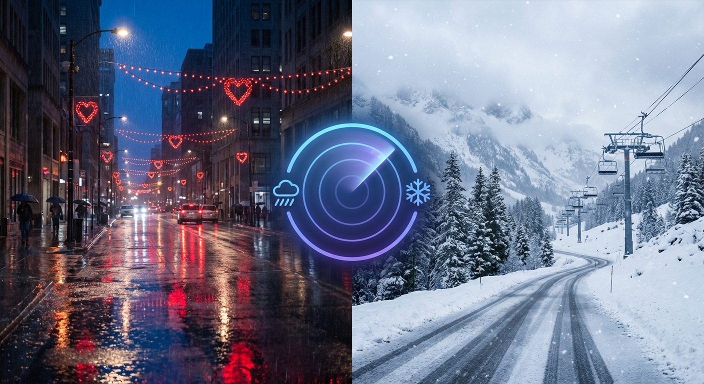
Valentine's Weekend Weather: Severe Storms & Rain Risks
Tracking a Valentine's Day storm system bringing hail and heavy rain to the South, plus renewed snow and high surf for the West Coast.
Cupid’s Arrow vs. The Jet Stream: Your Valentine’s Weekend Storm Tracker
Alright folks, welcome back. It is Thursday, February 12, and if you have been following along with us this week, you know we have been tracking a pattern that just refuses to settle down. We have had ice in the Northeast and flooding in California, but now our attention is turning to the middle of the country just in time for the big date night.
Here is the thing. Valentine's Day is this Saturday, and Mother Nature apparently didn't get the memo about candlelit dinners on the patio. We are looking at a system that is fixin' to crash the party across the Southern Plains and into the Southeast. Let's break down who needs an umbrella and who needs to watch out for something a little stronger.
The "Heartbreaker" Storm: Southern Plains & Southeast
Starting tomorrow (Friday), we are going to see moisture surging back up from the Gulf of Mexico. It feels a little like "False Spring" out there with temps running above normal, but that warmth is basically fuel for the atmosphere.
Friday's Setup:
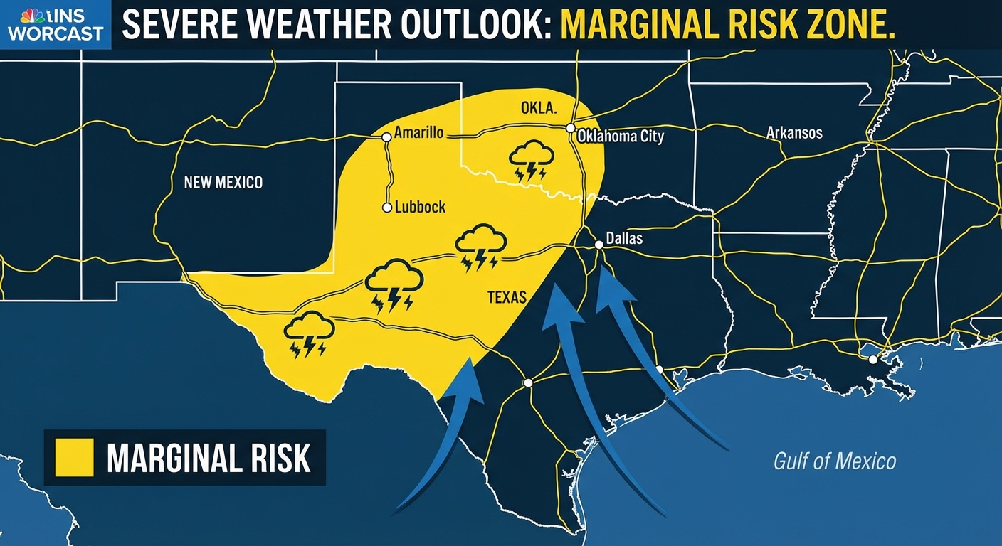
By Friday evening, things get interesting in West Texas and southwest Oklahoma. The Storm Prediction Center has highlighted a Marginal Risk for severe weather here. Now, "Marginal" doesn't mean "ignore it," it just means the storms will be isolated.
However, if you are in places like Lubbock, Abilene, or Midland, you need to be weather aware. The main threat here is going to be hail. So, if you bought your sweetheart a new car for Valentine's Day (or if you just like the one you have), maybe keep it in the garage Friday night.
Saturday (Valentine's Day):
The system moves east. We are watching a Marginal Risk for severe storms expanding into North Texas, including the DFW Metroplex, down to Austin and San Antonio. The Storm Prediction Center is also watching the ArkLaTex region.
But the bigger story for your Saturday night plans might just be the rain. The Weather Prediction Center has slapped a Slight Risk for excessive rainfall from the ArkLaTex over to the Mid-South. If you have outdoor plans or a long drive to a restaurant in Shreveport, Little Rock, or Memphis, expect heavy downpours. It is going to be a "jacket and umbrella" kind of night, not a "top down on the convertible" kind of night.
The West Coast: It Ain't Over Yet
I know y'all out West are tired of hearing about atmospheric rivers, but the Pacific is still active. A deep trough is parking itself off the West Coast, which means more unsettled weather.
- Snow: Heavy snow is returning to the Central and Southern Rockies. If you are hitting the slopes in Colorado or Utah this weekend, the powder will be fresh, but getting there might be tricky. Snow levels are staying high (above 8,000 ft mostly), so the valleys might just see rain.
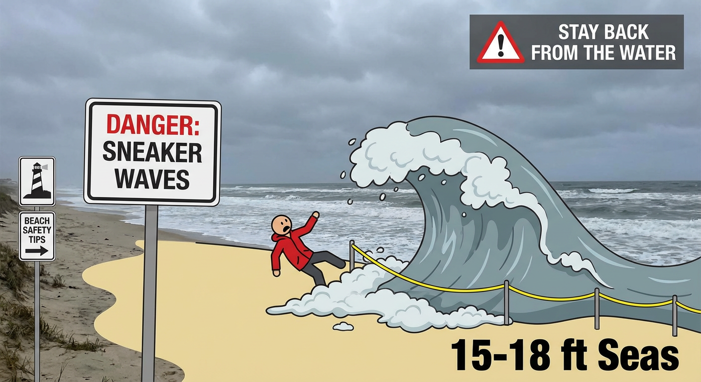
- The Coast: For my friends in the Pacific Northwest and Northern California, watch out for the ocean itself. We are seeing reports of seas building to 15-18 feet. Sneaker waves are a real danger right now. If you are planning a romantic walk on the beach in Oregon or Washington, do not turn your back on the water.
Sunday & Beyond: The East Coast Turn
By Sunday, that Southern system is going to track east. It looks like it will bring enhanced precipitation across the Southeast and up into the Mid-Atlantic.
There is a chance for some wintry mix on the very northern edge of this system, but for most folks in the Carolinas and Virginia, it looks like a cold rain event to close out the weekend.
Bottom Line
- Texas & Oklahoma: Keep an eye on the sky Friday evening and Saturday. Hail and gusty winds are possible.
- The South (AR, LA, MS, TN): Saturday looks wet. Heavy rain could cause some localized flooding issues, especially if you are near the ArkLaTex.
- West Coast: Stay off the jetties and watch for sneaker waves. Mountain passes in the Rockies will be slick.
- Valentine's Plans: If you are in the risk zones, double-check your travel route and maybe bring a backup pair of shoes so you don't track mud into the restaurant.
Stay safe, enjoy the chocolate, and I'll catch y'all in the next one!
https://ryanhallyall.com/blog/cupids-arrow-vs-the-jet-stream-your-valentines-weekend-storm-tracker