Blog Article
Mid-Atlantic Faces Damaging Wind Threat Friday Evening
SPC's Slight Risk targets NYC, Philly, and DC tonight with damaging thunderstorm winds, while a Marginal Risk and flash flood concerns spread across the Plains and Midwest.

Damaging Wind Threat Targets I-95 Corridor Tonight, Marginal Risk Stretches Into the Heartland
Alright y'all, let's talk about the Mid-Atlantic, because that's where today's weather story is centered. SPC has posted a Slight Risk of severe thunderstorms from New York City down through Philly, Baltimore, and DC, and that covers over 34 million people. The main threat is damaging wind, not tornadoes, but it's still a day to keep one eye on the sky if you're in that corridor.
What's Actually Going On
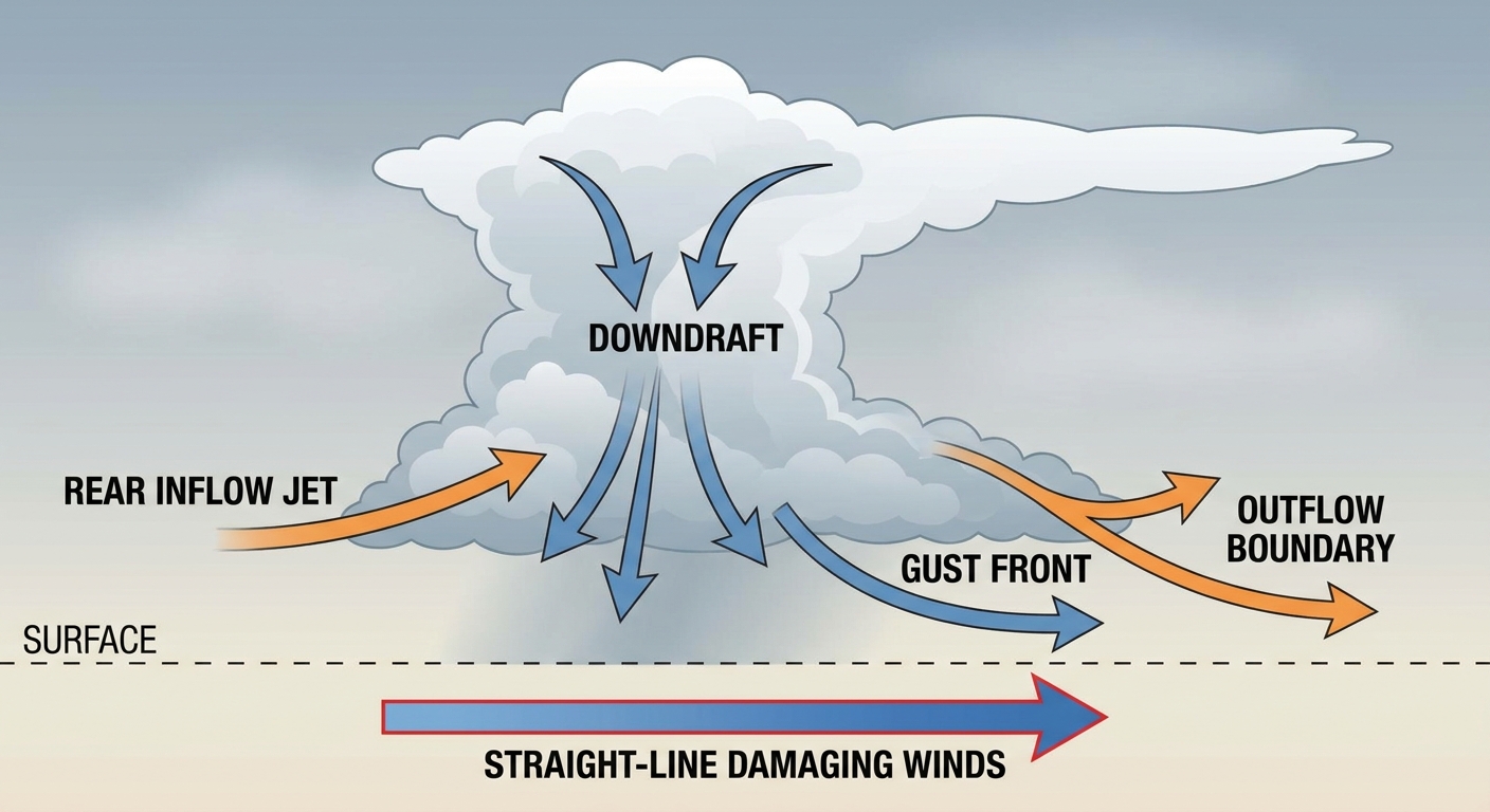
Here's the setup in plain terms. There's enough instability building this afternoon across the Mid-Atlantic for isolated to scattered thunderstorms to go strong to severe. SPC has the wind threat at 15%, which is their Level 2 category, meaning scattered damaging gusts are on the table if storms fire the way they're expecting. There's even a small hatched area, home to about 555,000 people, where gusts could theoretically reach 75 mph or better if the strongest cells organize. That's not the most likely outcome, but it's the ceiling SPC wants folks aware of.
Hail is a lesser concern today, just a 5% isolated chance of quarter-size stones, mostly across that same general zone.
Farther west, there's a Marginal Risk running from the mid-Missouri Valley up into the Lake Superior region and down into parts of the southern High Plains and central Plains. That includes Omaha, Minneapolis, Des Moines, Amarillo, and Cedar Rapids. Isolated severe storms are possible there too, but the probabilities are lower, around 5% for wind.
Tonight's Games and Events Sit Right in the Zone
Get this: a whole lot of tonight's outdoor baseball is happening right inside that Slight Risk footprint. The Braves are at Yankee Stadium in the Bronx, the Blue Jays are in Philly against the Phillies, and the Reds are in DC against the Nationals, all with first pitches between 6:40 and 7:05 pm Eastern. If you've got tickets, keep the radar app handy for the afternoon hours. Storms are expected to develop during peak heating and could be ongoing or approaching as those games get underway. The Elements Music and Arts Festival up in the Poconos at Long Pond, PA is in a similar boat, sitting close enough to that Mid-Atlantic corridor to catch some of the same activity.
Ground Still Soggy From a Rough Week
This isn't happening in a vacuum. Yesterday brought widespread severe storms and flash flooding to Missouri, the Southeast, and Arizona, with water rescues reported in Boone County, MO and 70 mph gusts down in southern Missouri. And this whole week has featured one flood event after another, including that jaw-dropping 7.71 inches of rain that fell on Victoria, VA earlier in the week. So when WPC issues a Marginal excessive rainfall risk today covering a huge swath from the Southwest through the East, Midwest, and South, including Oklahoma, north Texas, Louisiana, and the central Gulf Coast, that's landing on ground that in some spots is already saturated. Any storm that trains or stalls could produce quick flooding even without a huge rain total.
Worth noting too: our analog data flagged August 7, 2023 as a rough day for this exact same Mid-Atlantic corridor, with 645 wind reports, 102 hail reports, and 19 tornadoes recorded that day. Today's setup is nowhere near that level of organization. This is a regional echo, not a repeat performance. Today's threat is narrower and wind-focused, not the mixed-hazard outbreak we saw three years ago.
Looking Ahead to the Weekend
Saturday shifts the severe focus toward the central and northern Plains into the lower to mid Missouri Valley, with Kansas City, Omaha, Des Moines, and Columbia, MO under a Marginal Risk for severe wind gusts as a cold front pushes south through the Dakotas. By Sunday, that threat slides east into the southern Great Lakes, bringing Chicago, Indianapolis, and Madison into a Marginal Risk window too. WPC also has a Slight Risk for excessive rainfall Sunday across the upper Midwest and upper Mississippi Valley, from southeastern Minnesota through northern Indiana, as multiple rounds of storms tap into deep Gulf moisture riding a low-level jet north.
Other Things on the Radar
- Fire weather: The northern Intermountain West stays in an elevated fire weather pattern today, with breezy west winds and low relative humidity over already dry fuels. Red Flag Warnings have been common there all week.
- Space weather: SWPC is watching for a possible G1 (Minor) geomagnetic storm late tonight into Saturday as a CME that left the sun on August 3rd arrives. Aurora chances would be limited to the far northern tier if it materializes, and confidence is only low to medium.
- Southwest monsoon: Afternoon thunderstorms remain likely across southern California, Nevada, and Utah as monsoonal moisture continues to work north.
Bottom Line
If you're anywhere from NYC down to DC today, this afternoon and evening is a "have your plan ready" kind of day. Damaging wind gusts are the headline threat, not tornadoes, but a gust front rolling through a ballpark or a festival grounds can still do real damage and send people scrambling. Keep an eye on the sky, know where you'd shelter, and don't be surprised by a game delay tonight. Farther west, the Plains and upper Midwest carry a lower-end but still real severe risk into the weekend, and saturated soils across a wide stretch of the country mean flash flooding stays a real concern even where storms aren't severe.