Blog Article
Deep Freeze Continues & Atmospheric River hits PNW | Jan 27 Weather
Dangerous cold grips the South and East while lake-effect snow buries NY. Plus, a new atmospheric river targets the Pacific Northwest. Get the latest update.
Deep Freeze Drags On, The "Firehose" Opens Out West, & A Weekend Mystery
Hey y'all, welcome back. If you stepped outside this morning in the Eastern half of the country, you probably wanted to turn right back around. That Arctic air we talked about yesterday? It has parked the bus. We are looking at temperatures 15 to 20 degrees below normal for a huge chunk of the country.
Here is the thing about this pattern: it's not just about being cold. It's about what happens when that cold air interacts with even a little bit of moisture. Let's break down the big picture for today, January 27, 2026.
The South: Freezing Fog and Slick Spots
I want to talk directly to my friends in North Texas and Oklahoma for a second. You might think the storm is over, and technically the big precipitation is gone. But we are seeing "freezing fog" develop this morning.
Get this: even though it's not raining, the moisture in the air is freezing on contact with roads and bridges. If you are in Round Rock or heading towards the Children's Festival later this week, watch your step. The mornings are going to be treacherous. If the road looks wet, assume it's ice. The National Weather Service in Fort Worth is warning about a "weak front" moving through tonight that could re-trigger some of this freezing fog, so don't let your guard down yet.
Upstate New York: The Snow Machine is Broken (in the "On" Position)
Folks, the data coming out of Buffalo and the Tug Hill Plateau is incredible. We are seeing snowfall rates of 2 to 3 inches per hour. This isn't a normal snowstorm; this is the Great Lakes acting like a snow factory because the water is still relatively warm compared to this bitter air.
If you are in Oswego or Jefferson counties, you are looking at localized totals of 1 to 2 feet by Thursday. Visibility is going to be near zero in these bands. It oscillates back and forth, so one town might be clear while the next town over is in a whiteout.
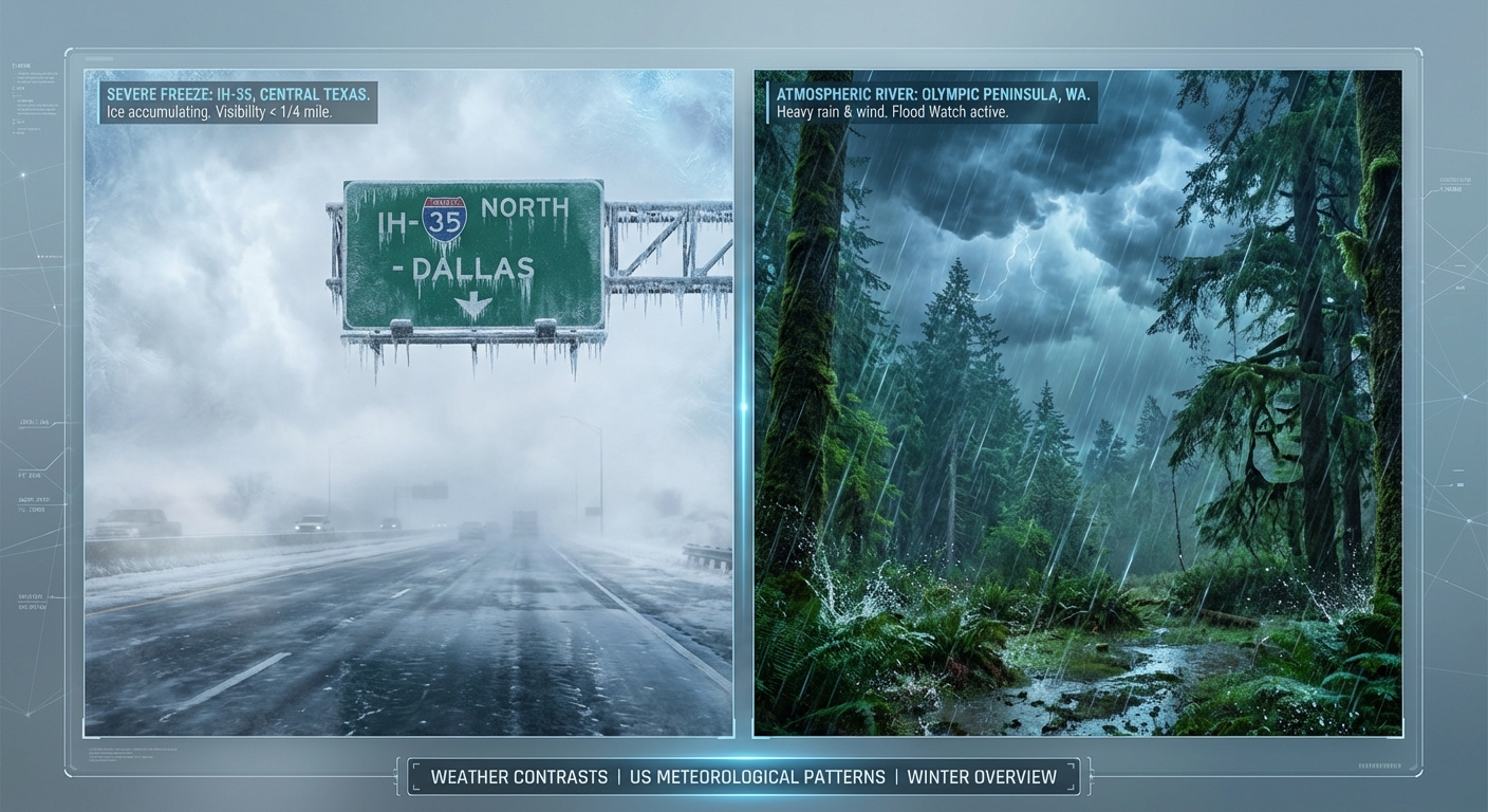
The West Coast: The Firehose Turning On
Now, let's look West. While the East is shivering, the Pacific Northwest is about to get soaked. We are tracking a new atmospheric river aiming right for Washington and Oregon starting tomorrow.
This isn't just a little drizzle. We are talking about heavy rain for the lowlands and heavy snow for the mountains. The snow levels are rising to about 4,000 or 5,000 feet. That means if you are driving through the passes in the Cascades, it's going to be a mess of slush and heavy snow. For folks in Seattle and Portland, it's just going to be a classic, soaking rain event, but watch for ponding on the roads.
Florida: Fire Danger?
It sounds weird to say "fire" when the rest of the country is freezing, but Florida is seeing some critical fire weather conditions. The air is super dry behind that cold front, and the winds are gusty. If you are near Tampa getting ready for the Shipwrecked Music Festival this weekend, just be careful with any outdoor flames or sparks. The brush is drier than you think.
The Weekend Mystery: Will It or Won't It?
Alright, I know everyone is asking about the weekend. The models are hinting at a system trying to form off the Southeast coast and move up toward the Mid-Atlantic.
Some data suggests a "Miller A" type storm, which is technical speak for a classic Nor'easter. However, and this is a big however, there is just as much data saying it kicks out to sea and misses us completely. We are in a "wait and see" mode. Don't cancel your plans for Saturday yet, but keep one eye on the forecast if you live along I-95.
Bottom Line
- Stay Alert in the South: Freezing fog in Texas and Oklahoma is creating invisible ice hazards.
- Lake Effect Continues: Upstate NY travel is dangerous near the snowbelts.
- West Coast Soaker: Heavy rain and mountain snow arrive Wednesday/Thursday for the PNW.
- Space Weather: We are seeing some solar activity that might spark auroras (Northern Lights) tomorrow night, so keep looking up if you have clear skies in the northern tier.
Stay warm, drive slow, and I'll keep watching the data for y'all.
https://ryanhallyall.com/blog/deep-freeze-drags-on-the-firehose-opens-out-west-a-weekend-mystery