Blog Article
Weather Update: Massive Pattern Flip Brings Spring Warmth East
From record snow in the Northeast to 90s in the Southwest, the US weather is extreme. A clipper hits the Midwest while the South soaks. Spring warmth is coming.
Digging Out & Heating Up: The Massive Pattern Flip Is Coming
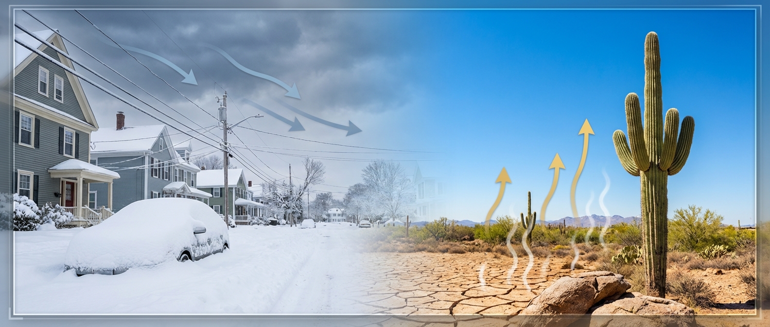
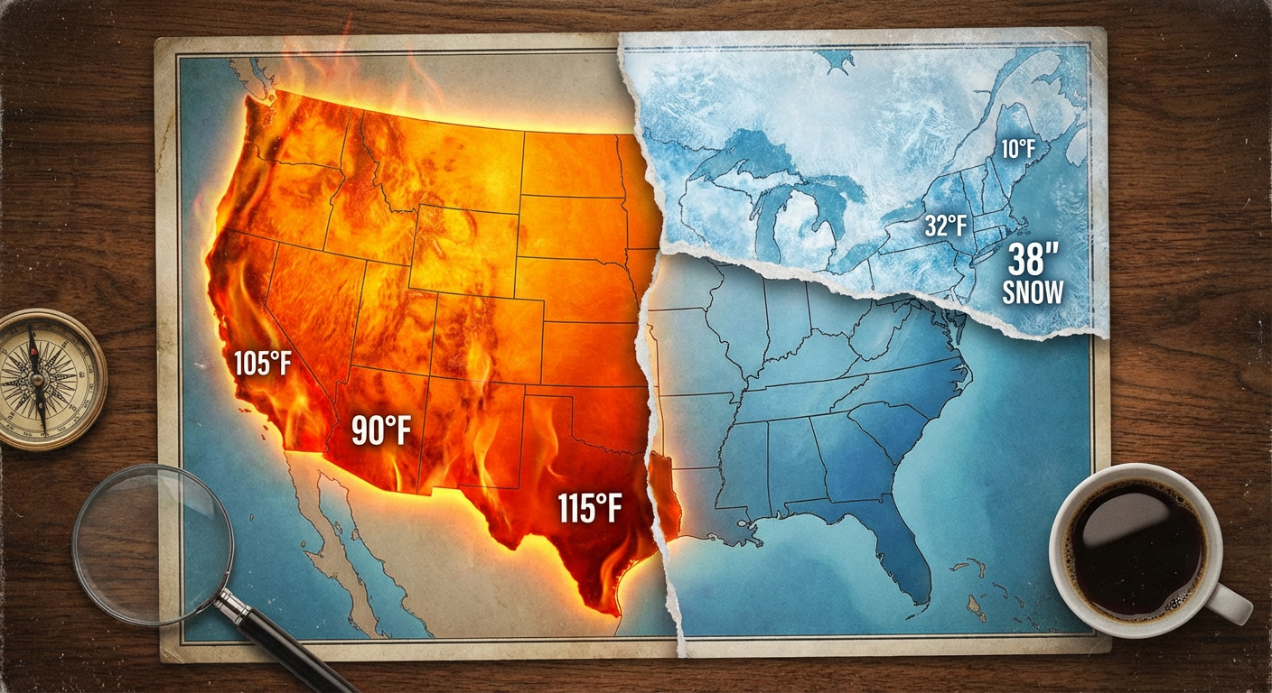
Alright folks, take a deep breath. I know a lot of y'all in Rhode Island and Massachusetts are still trying to find your cars after that monster storm dropped nearly 38 inches of snow. That was one for the history books. But here is the thing about weather in 2026. It doesn't stop to let you catch your breath.
While the Northeast is in recovery mode, the rest of the country is dealing with a serious case of atmospheric whiplash. We have record-breaking heat in the West, fire danger in the Plains, and a stubborn front parking itself over the Deep South. Let's break down what is happening right now and look ahead to a major shake-up next week.
The Nation of Extremes
If you looked at a temperature map today, you'd think we were living on two different planets. In the Desert Southwest and parts of Texas, folks are cranking the AC. We are talking upper 80s and even low 90s. That is not normal for late February.
Meanwhile, up in the Northern Plains and Upper Midwest, a "clipper" system is diving down from Canada. This isn't a blockbuster storm, but it is going to bring a quick burst of snow to the Dakotas and Minnesota over the next 48 hours. If you are driving I-94, watch out for slick spots.
The Southern Soak: Don't Put Away the Umbrellas
Down here in the South, we are watching a cold front that has decided to hit the brakes. It's stalling out right along the Gulf Coast. This means daily rounds of showers and thunderstorms for folks from New Orleans over to Mobile and Pensacola.
Here is what you need to know:
- Rainfall: We could see 1-2 inches of rain through Saturday.
- Severe Risk: There is a Marginal Risk (Level 1 out of 5) for some hail in northern Mississippi and Alabama today. It's not a major outbreak, but keep an eye on the sky.
- Weekend Plans: If you are heading to the 225Fest in Baton Rouge or the Queen City Lemon Drop in Charlotte this weekend, you are going to want to pack a poncho. It's going to be soggy.
Fire & Wind: The Hidden Danger
While the East is wet or snowy, the High Plains are bone dry. We have seen wind gusts over 80 mph in Wyoming recently. That wind, combined with dry grass, is creating a serious fire weather risk for parts of Colorado, Wyoming, and Texas. Please be careful with anything that could spark a flame out there.
The Big Pattern Flip: False Spring or the Real Deal?
Now, here is the good news for those of you tired of shivering in the East. The Climate Prediction Center is showing a massive pattern change heading into the first week of March.
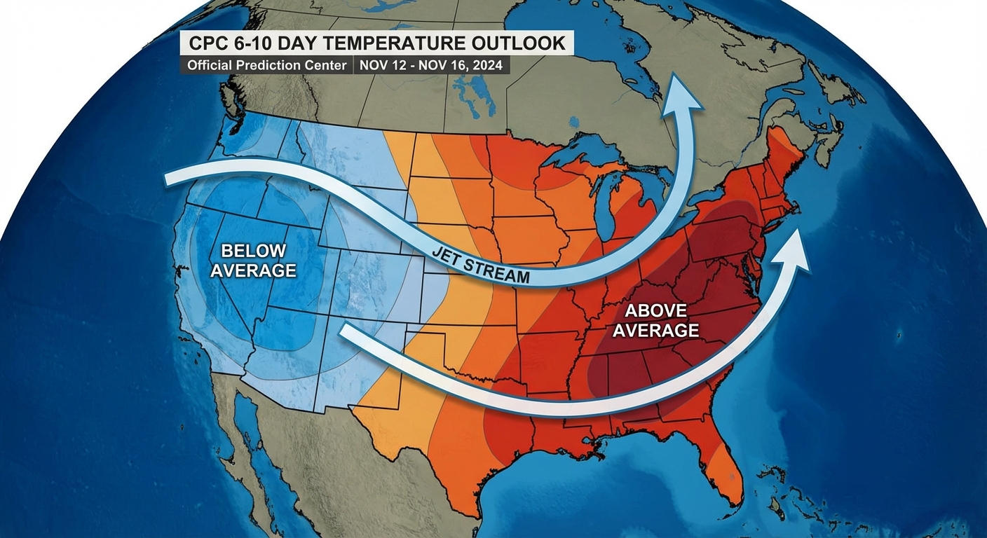
Get this. The jet stream is about to buckle. A trough is going to dig into the West (bringing them cooler temps and rain), which forces a ridge to build over the East. This means a significant warm-up is on the way for the Ohio Valley, the Mid-Atlantic, and the Southeast. We are talking spring-like temperatures replacing that arctic chill.
Bottom Line
- Northeast: Keep digging out. The worst is over, and warmer air is on the horizon.
- Midwest: Watch for light snow from a clipper system through Saturday.
- South: Keep the rain gear handy. It's going to be a wet weekend along the Gulf Coast.
- West: Enjoy the heat now because a cooldown is coming next week.
Stay safe out there, y'all!
https://ryanhallyall.com/blog/digging-out-heating-up-the-massive-pattern-flip-is-coming