Blog Article
High Plains Weather: Blowing Dust, Fire Risk, and Giant Hail
From zero-visibility dust storms in Texas to a giant hail threat in Nebraska and Colorado, the High Plains are facing extreme spring weather this weekend.
Dust Storms and Giant Hail: The High Plains Are Putting on a Show
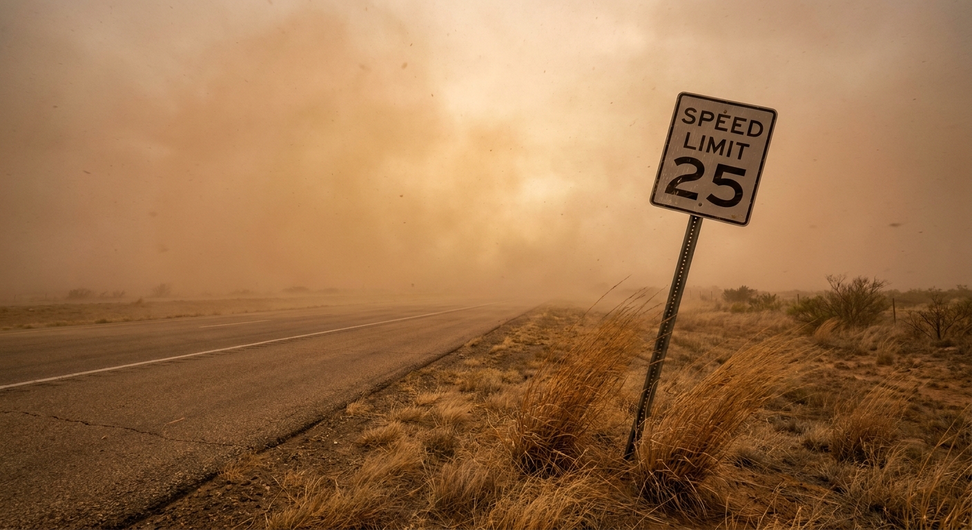
Y'all, if you were trying to keep tabs on that Texas Tech versus Ole Miss softball game today, you probably noticed the wind in West Texas is absolutely howling. The air out there is bone dry, and when you combine that with sustained winds ripping across the dirt, you get a mess. We are seeing blowing dust, critical fire weather, and dry thunderstorms all across the Texas Panhandle and eastern New Mexico today.
This is not just a breezy afternoon. Yesterday, a weather station in Guymon, Oklahoma, measured a non-thunderstorm wind gust of 90 mph. Down in Dimmitt, Texas, the blowing dust dropped visibility to absolute zero. The Storm Prediction Center has a Critical Fire Weather area highlighted for a huge chunk of the Southern High Plains right now. Any spark in this environment can spread out of control in minutes.
The Threat Shifts North on Saturday
While Texas and New Mexico are dealing with dirt and fire, the moisture and storm energy are setting up shop a bit further north for Saturday. Northeast Colorado, southwest Nebraska, and northwest Kansas are under an Enhanced Risk for severe thunderstorms tomorrow.
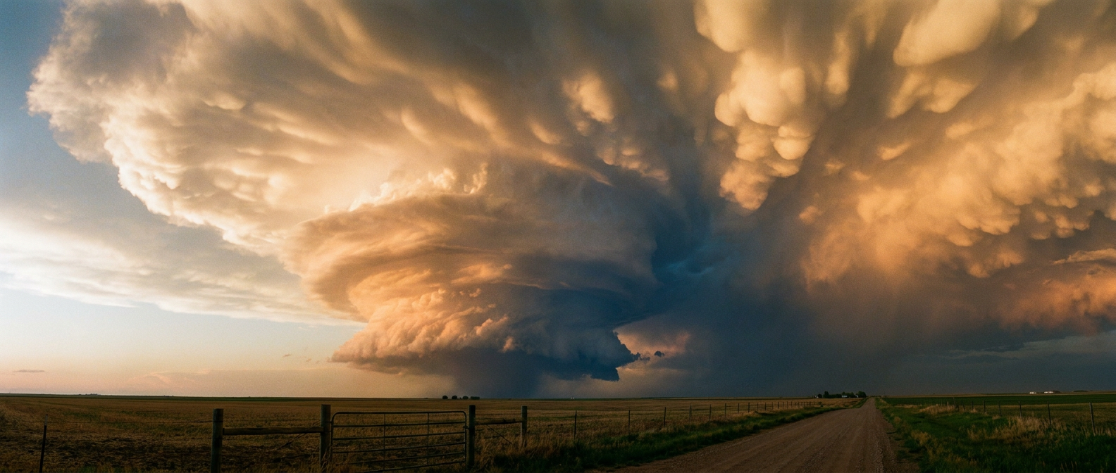
The main event with these storms is going to be the hail. The data shows a 30 percent probability for severe hail in that Enhanced Risk zone. Inside that area, there is a hatched region indicating the potential for hailstones reaching 2 inches in diameter or larger. We are talking about hen-egg size ice falling from the sky. If you live in places like North Platte or Kearney, Nebraska, you need to park your cars in the garage tonight.
A Nighttime Wind Threat
These storms will not just drop hail and fade away. As we get into Saturday evening, the forecast models show those individual supercells merging into a large cluster. That line of storms will then roll eastward across Nebraska and Kansas.
When storms organize like that, the threat transitions from giant hail to damaging straight-line winds. The Storm Prediction Center has highlighted a 30 percent probability for severe wind gusts, with the potential for winds exceeding 75 mph. That is strong enough to snap tree limbs and knock out power.
The middle of the country is experiencing the absolute peak of spring weather extremes right now. While the East Coast gets to enjoy a quiet, comfortable weekend, the Plains are putting in overtime. Keep your phones charged and make sure your weather alerts are turned on before you go to sleep.
https://ryanhallyall.com/blog/dust-storms-and-giant-hail-the-high-plains-are-putting-on-a-show