Blog Article
Deep Freeze East, Record Warmth West: Weather Update Feb 7, 2026
Dangerous wind chills hit the East Coast while the Plains see 70-degree temps. Plus, ocean-effect snow targets Boston and an atmospheric river hits the PNW.
East Coast Deep Freeze, Plains Heat Wave, and a Sneaky Snow Band
Alright folks, grab your coffee and pull that blanket a little tighter. If you are anywhere along the East Coast this morning, you already know what I am about to say. It is bone-chillingly cold out there. We talked yesterday about those Patriots fans fleeing to California for the Super Bowl, and let me tell you, they made the right call.
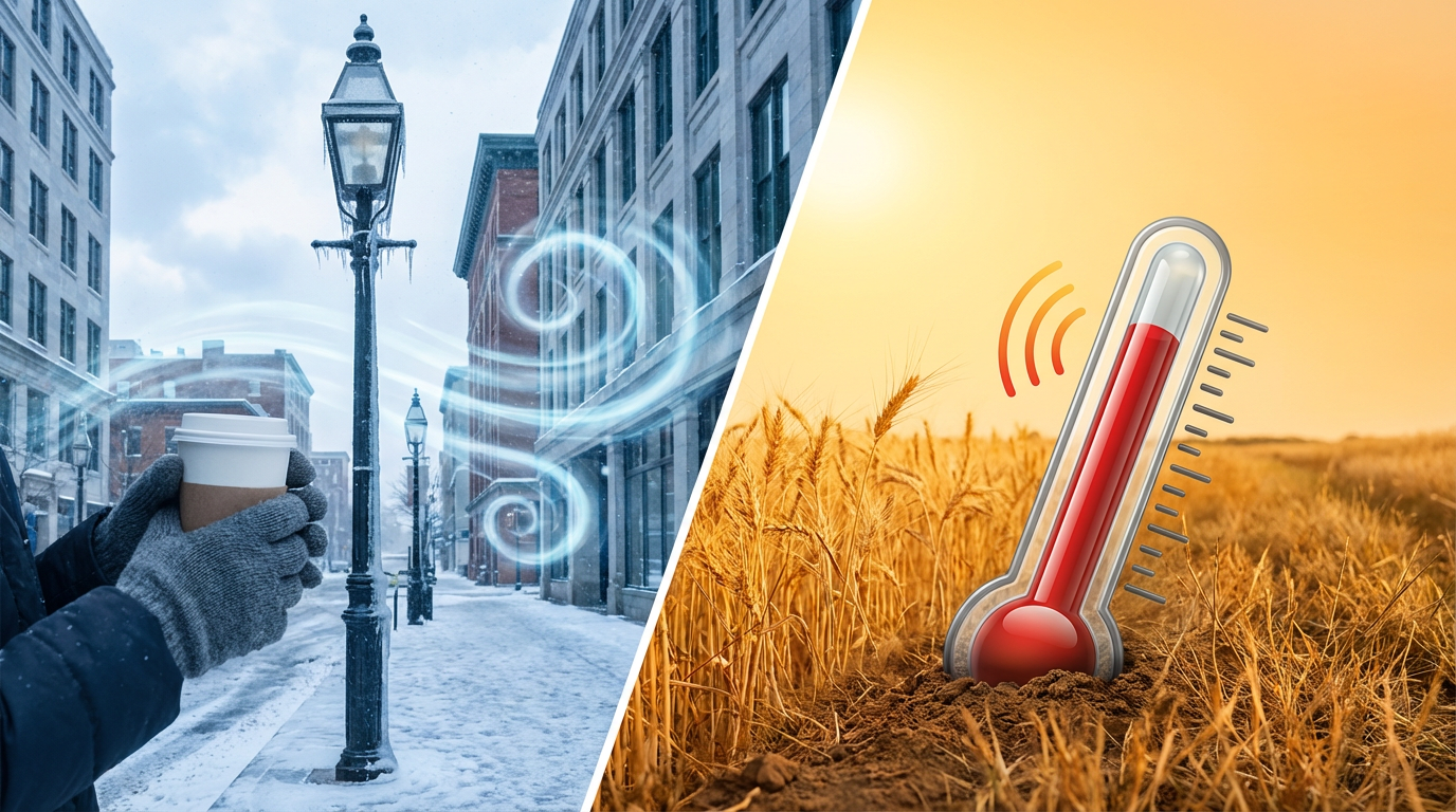
Here is the thing. We have a weather map today that looks like two completely different seasons fighting for custody of the United States. On one side, we have life-threatening winter cold. On the other, folks in Nebraska might be breaking out the barbecue grills. Let's break down what is happening right now.
The East Coast Freezer and "Black Ice" Danger
That Arctic front we watched barrel through yesterday has done its job. It has opened the freezer door wide open. We are seeing wind gusts of 60 to 70 mph in the mountains of West Virginia and Maryland, and wind chills are dropping as low as 30 degrees below zero in the interior Northeast.
If you are heading out to the Richmond Chocolate, Wine & Whiskey Festival or the Charlotte Wine Festival today, you need to layer up like you are going on an expedition. Exposed skin can get frostbitten in minutes with winds like this.
But the biggest hidden danger today is the roads. We had a lot of wet weather yesterday, and temperatures crashed so fast that "flash freeze" conditions set in overnight. Just because the sun is coming up doesn't mean the roads are safe. Bridges and overpasses are likely sheets of ice right now from Philly down to the Tennessee Valley. If the road looks wet, just assume it's ice.
A Sneaky Snow Band for New England
Now, get this. While most of the big storm system is gone, the ocean is acting up. We have a very specific setup happening off the coast of Massachusetts. The air is so cold and the ocean water is relatively warm that it's creating its own weather machine—kind of like lake-effect snow, but off the ocean.
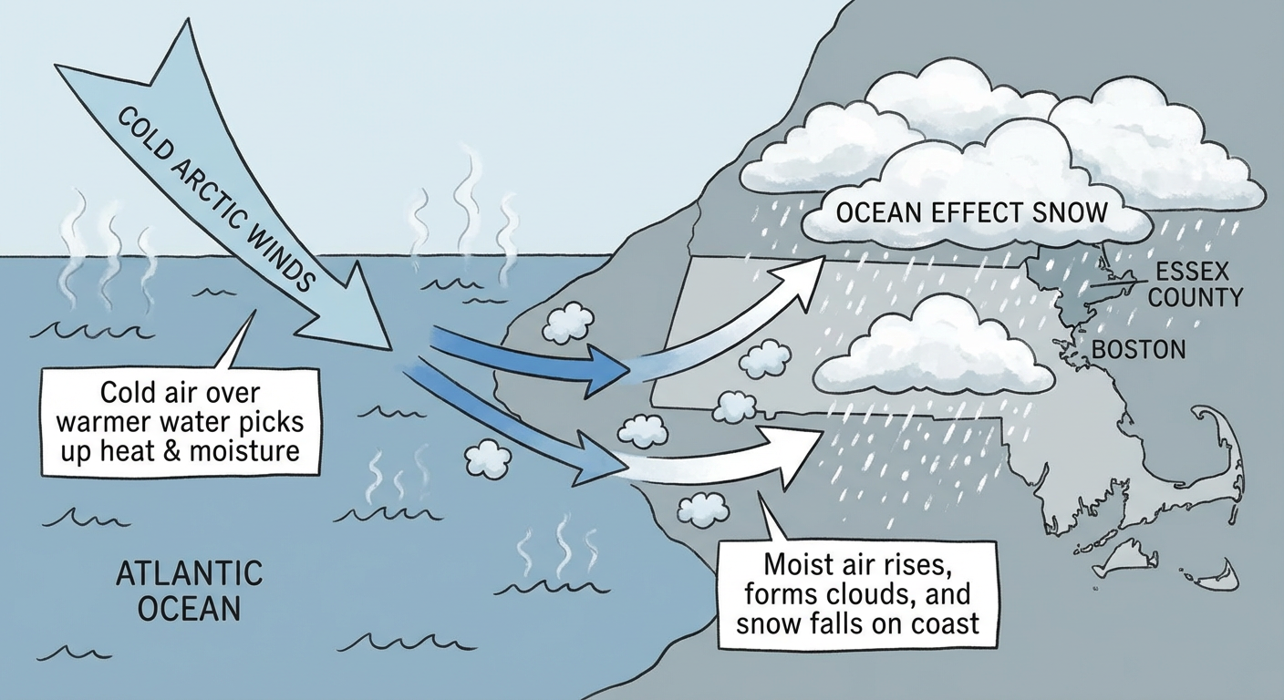
If you are in Essex County, MA, or parts of Rhode Island, keep your head on a swivel. The data shows localized bands of heavy snow could dump 3 to 6 inches, with some spots seeing up to 8 inches today. It's going to be hyper-localized. One town might see flurries, and the next town over is getting buried.
False Spring in the Plains?
While the East is shivering, look at what is happening in the middle of the country. It is absolutely wild. We have a massive ridge of high pressure building that is pumping warm air into the Plains.
We are talking about temperatures 35 to 40 degrees above average. Parts of the Dakotas and Nebraska could see highs in the 50s, 60s, and even low 70s this weekend. It is going to feel like May out there. Enjoy it while it lasts, because we know February doesn't like to stay quiet for long.
The West: Atmospheric River and Super Bowl Prep
Out West, the pattern is active but different. A new atmospheric river is slamming into the Pacific Northwest today. We are looking at heavy rain for Washington and Oregon, which is great for the reservoirs but tough for travel.
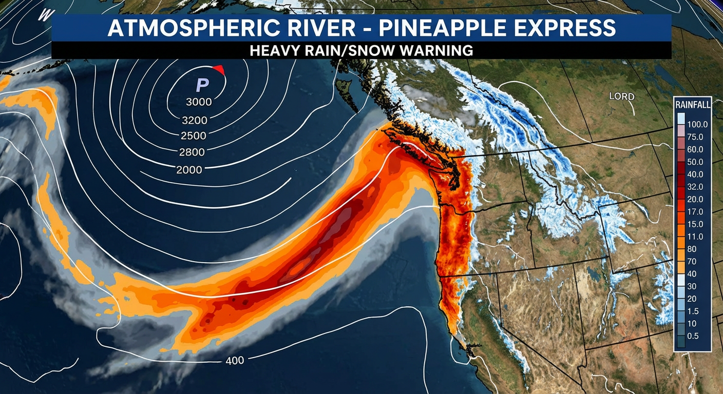
This moisture is also pumping heavy snow into the mountains. Glacier National Park and the Northern Rockies could see 1 to 2 feet of snow by the time this is done. If you are skiing this weekend, the powder will be fresh, but travel through the passes is going to be treacherous.
For everyone heading to Santa Clara for tomorrow's big game, you are sitting in the transition zone. It looks mostly dry for now, but there are some showers creeping into the Southwest Sunday night. It shouldn't wash out the game, but bring a poncho just in case.
A Note on Space Weather
One last thing to put on your radar. We have had some massive solar flares recently. The Space Weather Prediction Center says a G1 (Minor) Geomagnetic Storm is likely tomorrow, Feb 8. If you are in the northern tier states and the skies clear out (sorry, Northeast, you might be too cloudy/snowy), you might catch a glimpse of the Northern Lights Sunday night.
Bottom Line
- East Coast: It is dangerous cold. Limit time outside and watch for black ice on the roads this morning.
- New England: Watch out for sudden bursts of heavy snow in Eastern MA and RI.
- The Plains: Enjoy the 70s, but don't pack away the winter coats just yet.
- The West: Heavy rain and mountain snow continue for the PNW.
Stay safe and stay warm, y'all!
https://ryanhallyall.com/blog/east-coast-deep-freeze-plains-heat-wave-and-a-sneaky-snow-band