Blog Article
Friday Severe Weather Threat Builds Over Upper Midwest
SPC's Slight Risk targets the Upper Midwest Friday with large hail, damaging wind, and isolated tornadoes, while Tropical Storm Lowell fades near Hawaii.
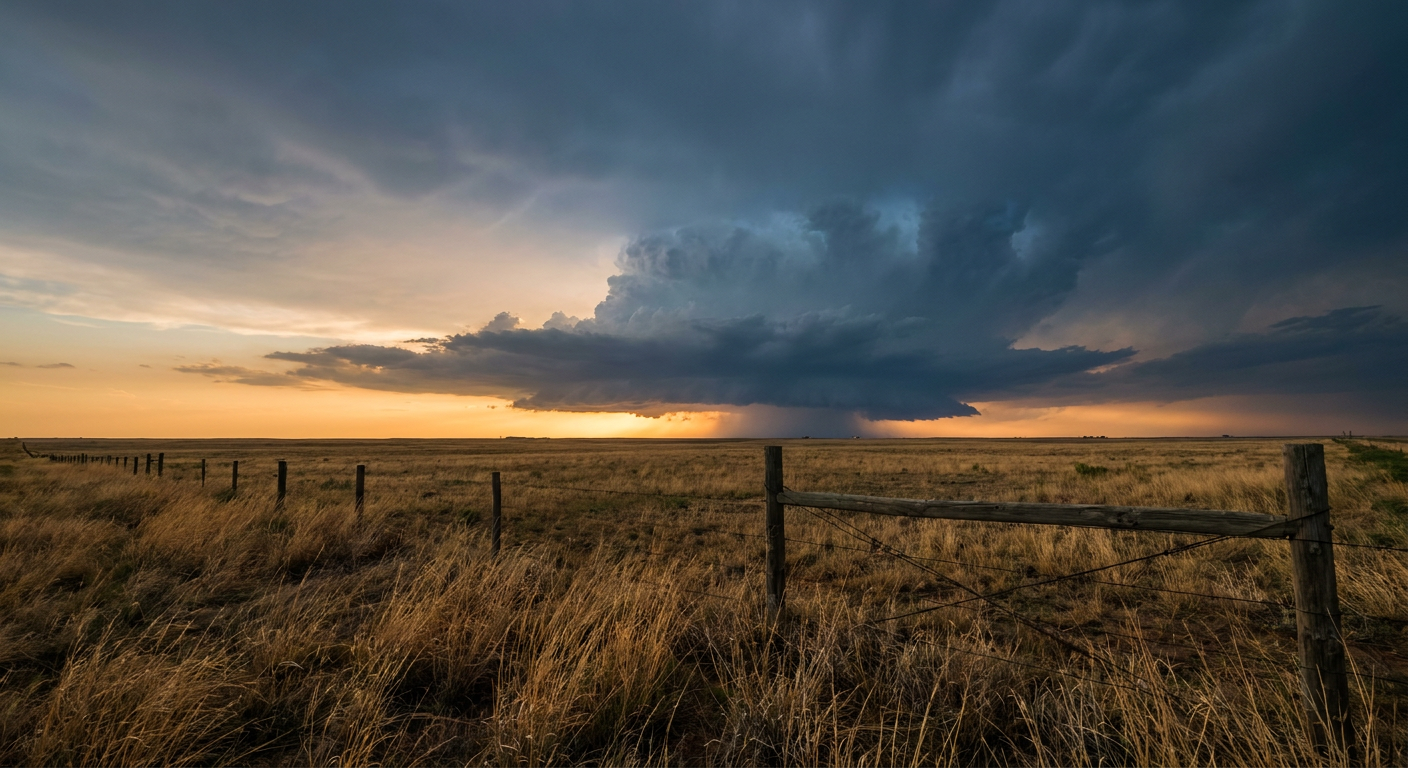
Enjoy the Calm Today, Because Friday's Severe Threat Is Building Over the Upper Midwest
Alright y'all, here's the thing about today. If you're anywhere from southern Wisconsin through eastern Iowa, Minnesota, and eastern Nebraska, you're sitting in what our nice weather outlook is calling a near-perfect afternoon. Dry high pressure, low humidity, comfortable temps. Enjoy it, because that same stretch of real estate is exactly where Friday's severe weather is gonna set up shop.
Today: A Marginal Risk From the Plains to the Mid-Atlantic
SPC has a Marginal Risk drawn from the southern High Plains all the way to the southern Mid-Atlantic coast today, September 10. That's a wide brush, covering Dallas-Fort Worth, Washington DC, Nashville, and Memphis. A shortwave moving through will kick off sporadic damaging wind gusts this afternoon and evening, and there's a smaller pocket over south-central Colorado into northeast New Mexico and the Oklahoma/Texas Panhandles where isolated large hail is possible too.
This is not a big severe day. It's a "know it's out there" day, not a "change your plans" day. Wind probabilities top out around 5 percent for the broad area, which SPC calls an isolated damaging wind threat. If you've got evening plans in the DFW metro or along I-40 through Tennessee, just keep half an eye on the sky.
The Bigger Story: Friday's Slight Risk Over the Upper Midwest
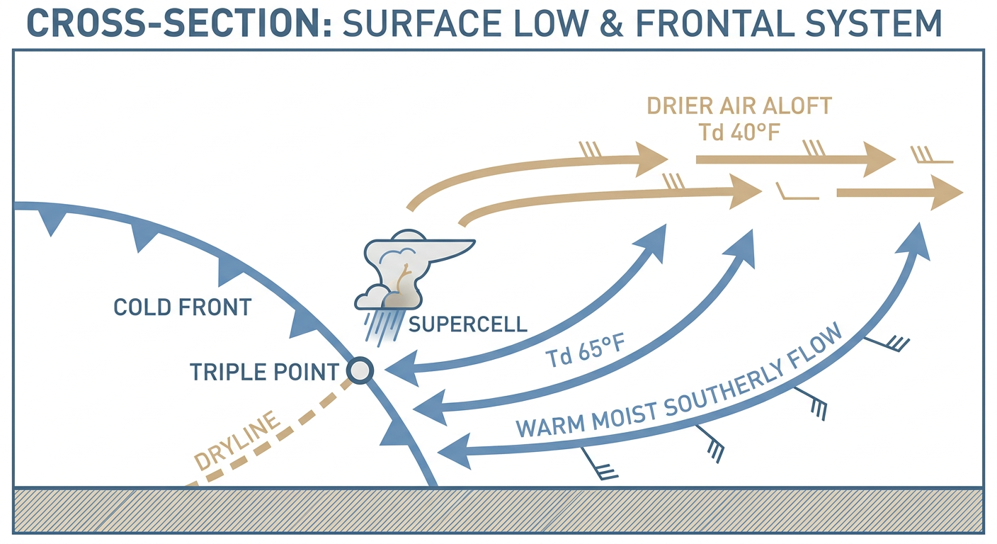
Here's where it gets more interesting. On Friday, SPC has upgraded the Day 2 outlook to a Slight Risk running from central Nebraska through eastern South Dakota, eastern North Dakota, Minnesota, Iowa, and Wisconsin, with a Marginal Risk sagging south into Kansas. A surface low is expected to develop and track east across South Dakota, dragging a cold front and dryline southeastward behind it.
The ingredients are lining up. Southerly low-level flow will pull dewpoints in the 60s northward into the warm sector, while cooling temperatures aloft steepen the atmosphere's lapse rates. That combination sets the table for supercells capable of large hail, including some hail 2 inches or greater, which SPC's hatched zone specifically calls out. Damaging wind probabilities climb as high as 30 percent in spots, the highest tier on the outlook, and there's a focused 5 percent tornado probability near where that surface low, the triple point, and the dryline all come together. Expect the initial supercells to grow upscale into a line or a QLCS overnight as the front sweeps through.
This matters for real life too. The Twin Cities host the Twins against Cleveland Friday night, and Minneapolis sits right inside that Slight Risk zone. If you've got tickets, keep the NWS app handy for Friday evening. Duluth and Sioux Falls are also named cities in the outlook, and Fargo sits in the Marginal band just to the north.
This loops right back to what we saw earlier this week. Des Moines just went through a brutal flash flood event Tuesday night into Wednesday, with storm totals of 5 to nearly 8 inches and Walnut Creek cresting into moderate flood stage. Iowa's ground is saturated. A fresh round of severe storms sliding through Friday, even without the same rainfall totals, is landing on already-stressed rivers and creeks in that corridor.
Rain Threats: Ohio Valley Today, Southern Arizona Tomorrow
WPC has a Slight Risk of excessive rainfall today over the Upper Ohio Valley and Central Appalachians. A jet streak's diffluent right-entrance region is lining up with an approaching cold front, and precipitable water values around 2 inches, well above normal for this time of year, will support locally heavy downpours. Flash flooding is the main concern for low-lying and urban areas in that corridor through tonight.
Looking to Friday and Saturday, the Slight Risk flag shifts to far southern Arizona, where monsoon moisture keeps precipitable water values above 1.5 inches. This is the same general pattern that's been hammering the Desert Southwest all week, and Saturday's focus swings back to the Central Plains, where a strengthening low-level jet meets a frontal boundary from the High Plains into the Mid-Mississippi Valley.
Tropics: Lowell Weakens, Eyes Turn Toward New Development
Tropical Storm Lowell is still spinning about 655 miles northwest of Kauai, but it's a shell of what it was. Winds are down to 63 mph, the center is exposed, and dry air has worked its way in. Lowell is tracking west, away from Hawaii, so there's no lingering threat to the islands from this system. That's a welcome update after Lowell battered Kauai as a Category 2 storm earlier this week with gusts to 85 mph and surge damage in Poipu.
Farther southeast, NHC is watching a broad area of disorganized showers well south-southeast of Hawaii that carries a 70 percent chance of development over the next seven days, plus a weaker disturbance closer to the islands sitting at 30 percent. Neither poses an immediate threat, but it's worth keeping tabs on given how active this Central Pacific season has already been.
Space Weather and Fire Weather, Briefly
The geomagnetic field is quiet to unsettled after Tuesday's minor G1 storm. A small coronal hole high-speed stream could stir things up again around September 11, but nothing beyond minor levels is expected. On the fire weather side, gusty westerly winds and downslope drying will keep elevated fire concerns going across the Northern Rockies and northern High Plains today and Friday, especially southeastern Wyoming and southwestern South Dakota.
What We're Watching
- Friday's Slight Risk severe setup across Nebraska, the Dakotas, Minnesota, Iowa, and Wisconsin, with damaging wind up to 30 percent and a focused tornado threat near the surface low
- Overnight upscale growth into a damaging wind-producing line or QLCS across the Upper Mississippi Valley
- Continued flash flood sensitivity in central Iowa after this week's 5 to 8 inch rainfall event
- Slight excessive rainfall risk sliding from the Ohio Valley today to southern Arizona Friday and the Central Plains Saturday
- Tropical Storm Lowell's continued weakening well northwest of Hawaii, plus a high-potential disturbance farther south in the Central Pacific
Bottom Line
Today is the quiet before Friday's louder day. If you're in the southern Plains through the Mid-Atlantic, keep half an eye on isolated storms this afternoon, but it's not a plan-changer. The bigger deal is Friday across the Upper Midwest, especially Nebraska, the Dakotas, Minnesota, Iowa, and Wisconsin, where large hail, numerous damaging wind gusts, and a few tornadoes are all on the table. If you've got outdoor plans Friday evening in that corridor, including that Twins game in Minneapolis, have a way to get warnings and know where you'll go if the sky turns on you.