Blog Article
Weather Update: Midwest Snow Clipper & Dangerous Southern Ice Storm
A fast-moving snow system hits the Midwest Wednesday, while a significant ice threat targets Texas to the Carolinas this weekend. Get the latest forecast.
Evening Update: Midwest Snow Tomorrow & A Dangerous Ice Corridor Emerging
Alright folks, gather 'round. What a 24 hours it has been, right? We had Auroras showing up in Alabama yesterday thanks to that massive solar storm, and unfortunately, we saw how dangerous winter roads can be with that terrible pileup in Michigan. If you've been following along, you know the pattern is active, and it is not slowing down.
Here is the thing: we have two main weather stories to talk about tonight. One is hitting tomorrow in the Midwest, and the other is a looming threat for the South that has me genuinely concerned about ice.
The Clipper: Tomorrow's Commute Headache
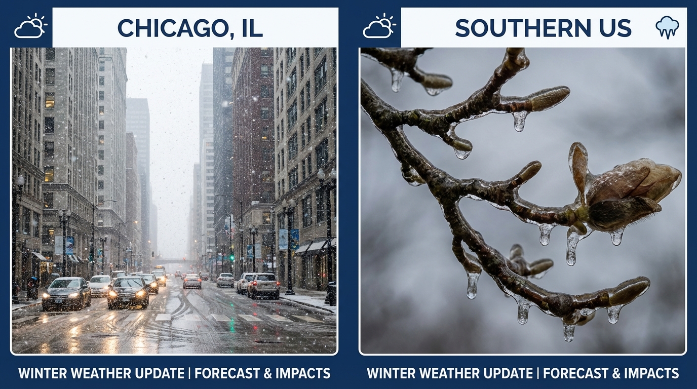
First up, let's talk about the immediate future. We have an "Alberta Clipper" diving down from the Dakotas. Now, usually, Clippers are quick hitters—they come in fast, drop some snow, and get out. But this one is timing itself largely for the Wednesday morning commute across the Midwest.
If you are in Iowa, Northern Illinois (including Chicago), Southern Wisconsin, or Michigan, you need to leave early tomorrow.
- Timing: Snow ramps up tonight and goes through Wednesday midday.
- Totals: We are generally looking at a widespread 2 to 5 inches. It doesn't sound like a mountain of snow, but it's enough to make roads slicker than a greased skillet.
- The Lake Effect: If you are in Southwest Michigan or Northern Indiana, Lake Michigan is going to squeeze out extra moisture. You could see 6+ inches in those snow belts.
For folks heading to the Mac & Cheese Fest in Chicago this weekend, the snow will be done by then, but get this—the wind chills nicely timed for Saturday morning could be near -20°F. You're gonna need that hot comfort food just to survive the walk from the car.
The "Ice Zone": A Dangerous Weekend Setup
Now, let's shift gears to the weekend. This is the big picture threat I've been watching closely. The data is starting to lock in on a corridor of ice—freezing rain and sleet—that stretches all the way from Texas to the Carolinas.
Here is the setup: We have a shallow layer of arctic air sitting at the surface (that's the freezing cold air we are feeling now). But starting Friday, a storm system is going to pump warmer, moist air over the top of it.
When rain falls into that freezing layer, it turns to ice on contact.
Who Needs to Watch This?
- Texas (Friday): Central Texas, I am looking at you. The models are showing a classic freezing rain setup. If you are near the I-35 corridor, travel could get treacherous by Friday afternoon.
- The Deep South (Saturday): That moisture moves east into Arkansas, Tennessee, and Mississippi.
- The Carolinas (Saturday Night/Sunday): This is trending poorly for Charlotte. I know a lot of y'all are excited for the Big Southern Classic Battle of the Bands on Saturday. Please keep a close eye on this forecast. Getting to the event might be okay, but getting home could be a slip-and-slide situation.
Why Ice is Worse than Snow:
Folks, 6 inches of snow is a nuisance. A quarter-inch of ice is a disaster. It weighs down power lines and snaps tree limbs. If you live in this "Ice Zone" from Austin to Charlotte, take tonight to check your flashlights and maybe buy some non-perishable food. We aren't trying to scare you, but we want you prepared for power flickers.
The Deep Freeze Continues
Behind all this? More cold. Serious cold.
We are tracking wind chills dropping to -50°F in the Dakotas by late week. That is life-threatening cold. Even down in Florida, those freeze warnings are likely to pop back up. If you have plants you saved from the last freeze, keep 'em covered.
Bottom Line
- Midwest: Watch out for the Wednesday morning commute. It's going to be snowy and slick.
- Texas to Carolinas: The risk for a significant ice storm Friday and Saturday is increasing. Prepare for difficult travel and potential power outages.
- Florida: Don't put the hoodies away yet; another freeze is possible this weekend.
Stay safe, keep it tuned here, and we will keep watching the data roll in!
https://ryanhallyall.com/blog/evening-update-midwest-snow-tomorrow-a-dangerous-ice-corridor-emerging