Blog Article
Invest 92AL Gulf Watch and Florida Flood Risk, Oct 6
NHC tracks Invest 92AL toward likely tropical depression status in the Gulf while Florida faces another round of excessive rainfall. Full forecast inside.
Eyes on the Gulf: Invest 92AL Could Organize This Week While Florida Keeps Mopping Up
Alright y'all, grab your coffee. We've got a lot of plates spinning this morning, so let's go region by region, starting with the one that matters most for U.S. land.
Invest 92AL: The Gulf System Worth Watching
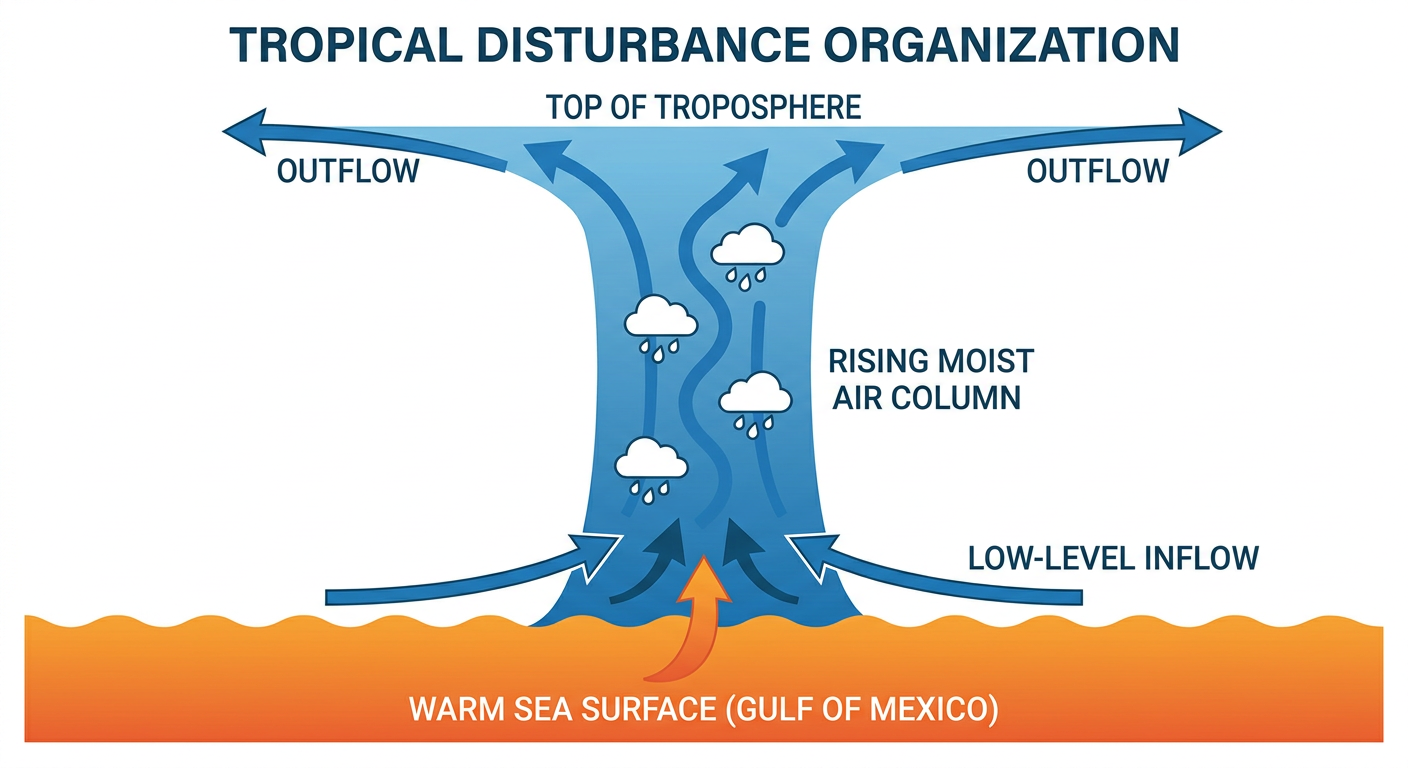
There's a trough of low pressure sitting in the southwestern Gulf of Mexico right now, and the National Hurricane Center has it tagged as Invest 92AL. Here's the thing about this one: conditions are only marginally conducive for development, but NHC still thinks a tropical depression is likely to form within the next couple of days. That's not a hedge, that's what the Tropical Weather Outlook actually says.
The early expectation is that this system drifts east-northeastward through the middle of the week before turning. Houston/Galveston's forecast office is already flagging the possibility that this thing eventually noses toward the upper Texas and Louisiana coasts, bringing deep tropical moisture and heavy rain chances with it. Nothing is locked in yet on exact track or strength, so treat this as a "watch it closely" system, not a "evacuate now" system.
There's also a secondary wrinkle. SPC's extended Day 4-8 outlook has a 15 percent severe weather probability parked over the Mobile, Bay Minette, and Gulf Shores area of Alabama, tied to the possibility that a developing tropical cyclone interacts with a midlevel trough later this week. If that combo comes together, the setup favors low-topped supercells and a tornado risk along the coastal boundary. That's an area covering nearly 2 million people, so it's worth keeping on your radar even though we're still several days out.
Florida's Rinse and Repeat Flood Pattern Continues
Y'all remember yesterday. Havana, Florida picked up 9.03 inches of rain in 24 hours. Apalachicola Airport measured 7.48 inches. Charleston, South Carolina saw 7.66 inches and ran nine water rescues downtown. Coffee County, Georgia canceled school because dirt roads washed out under 15 different bus routes. That was one day.
The front responsible for all that is basically parking itself. WPC has a Marginal Risk of excessive rainfall posted for much of Florida and far southeastern Georgia today, and that same Marginal Risk holds for Wednesday and Thursday too. The reason is simple: dry, refreshingly cool air sits north of the front, and a very tropical, moisture-rich air mass sits south of it. That contrast keeps the boundary sharp, and a sharp boundary means slow-moving showers and thunderstorms keep training over the same spots, especially the I-4 corridor, the Tampa-Clearwater area, and up into Jacksonville and St. Augustine.
We're talking localized rainfall rates of 2 to 3 inches an hour and storm totals in the 2 to 4 inch range through the next few days, with isolated higher amounts possible. If you're in central or north Florida, this isn't a one-and-done rain event. It's a pattern that's gonna keep squeezing out heavy totals in the same general areas for a few more days before that front finally lifts north as a warm front later in the week.
Hurricane Rachel: Offshore and Fading, No Threat to Land
Out in the East Pacific, Hurricane Rachel is a Category 1 storm with 85 mph winds, sitting about 585 miles southwest of the tip of Baja California. The storm's convective structure has degraded over the past several hours, and NHC actually lowered the intensity estimate overnight. Rachel is moving west at 8 mph, pulling away from land, not toward it. There's no coastal watch or warning in effect, and the forecast track keeps the storm's closest approach to any land mass more than 250 kilometers offshore of San Quintín, Baja California, by around October 11, with intensity dropping to roughly 35 mph by then. This one is strictly a fish storm. Worth tracking for curiosity, not for planning.
The Good News: A Genuinely Nice Stretch for Much of the Country
Not everything today is about rain and watches. If you're anywhere from North Texas and the Mid-South up into the Mid-Atlantic, today is shaping up to be a legitimately beautiful day. Nearly clear skies, light winds, and dry air stack up nicely across a corridor that includes Dallas, Jonesboro, Indianapolis, and Washington D.C. That's great timing if you're headed to the Tulsa State Fair today, or if you've got the Carolina Classic Fair on your calendar up in Winston-Salem.
That same dry high pressure holds into Wednesday, stretching from El Paso through North and Central Texas and across the Carolinas into Hampton Roads. If you're making travel plans for Austin City Limits Weekend Two starting this Friday, the extended outlook keeps a western ridge in place through Thursday and Friday, which should keep conditions warm and dry across the southern and central corridor, Austin included. Just know that ridge breaks down by the weekend as a trough digs into the Pacific Northwest and Northern Rockies, so don't assume Saturday looks like Thursday.
What Else We're Watching
- Invest 92AL organizing in the southwestern Gulf, likely to become a tropical depression within days, track and intensity still uncertain
- Florida's stalled frontal boundary, keeping Marginal excessive rainfall risk in play through at least Thursday
- SPC's Day 4-8 outlook flagging a 15 percent severe threat near Mobile, Alabama tied to possible tropical interaction
- Early mountain snow building across the Northern and Central Rockies this weekend, Missoula, Great Falls, Billings, and Bozeman could see the season's first accumulating snow at higher elevations by Saturday and Sunday
- Minor G1 geomagnetic storm potential tonight into tomorrow, aurora chasers at higher latitudes might get a peek, nothing disruptive expected
- Invest 92EP, a second area of interest off southern Mexico in the East Pacific, still disorganized but favorable for gradual development
Bottom Line
If you're on the upper Texas or Louisiana coast, this is the week to start paying attention to Invest 92AL. Nothing is imminent, but the Gulf has a habit of surprising people who wait too long to check the forecast. If you're in Florida, you're stuck in the same soggy pattern that soaked you yesterday, so keep an eye on local flood advisories through midweek, especially around Tampa and Jacksonville. And if you're lucky enough to be in that beautiful-weather corridor from Texas to the Mid-Atlantic today, go enjoy the fair, the festival, or whatever's on your calendar. This window won't last past the weekend.