Blog Article
Alabama Fair Opens as Hurricane Isaias Nears Gulf Coast
The Alabama National Fair opens the same week Hurricane Isaias threatens the Gulf Coast. Here's the science behind the storm and what it means for your weekend.
Fair Weather, Falling Stars, and a Hurricane: Alabama's Split-Screen Weekend
Get this, y'all. Down in Montgomery tonight, folks are riding the Ferris wheel and loading up on fried everything at the Alabama National Fair's opening day. Three hundred miles south, the Gulf Coast is boarding up windows and topping off generators. Same state, same night, two completely different realities. That's October in the South for you.
Here's the thing that ties it all together: Hurricane Isaias.
A Storm That Found Its Eye
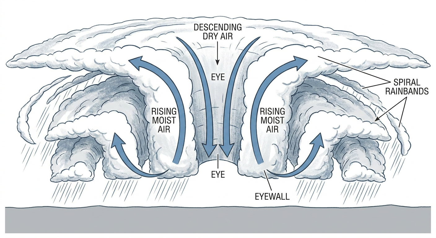
Isaias is sitting in the Gulf right now as a Category 2 hurricane with 98 mph winds, about 215 miles south of the mouth of the Mississippi River. And here's a detail that'll make the weather nerds in the room perk up. Forecasters at the National Hurricane Center say this is the first storm all season in the Atlantic basin where an actual eye showed up clearly on satellite. That matters because a well-defined eye usually means a storm has gotten its structure together, pulling warm air down through the center while the eyewall spins up the strongest winds.
Hurricane Hunters flying through it Thursday afternoon confirmed the intensity, even if the central pressure hasn't dropped as fast as the satellite picture suggests it might. That's the kind of detail the folks at NHC chew on for hours. Somebody there is staring at loop after loop of satellite imagery right now, trying to figure out exactly how strong this thing gets before it reaches land, because the forecast hinges on it.
The target is Pensacola, with landfall expected late Friday night into early Saturday. A Hurricane Warning stretches from the Mississippi coast to Mexico Beach, Florida, and Navarre is sitting in the bullseye with better than a 90 percent chance of seeing tropical storm force winds. Mobile, Dauphin Island, and New Orleans are all in some flavor of warning too, though the odds drop off the farther you get from that direct path.
What the Rain Totals Could Look Like
The Weather Prediction Center has a Moderate Risk of excessive rainfall up for southern Alabama and the western Florida Panhandle on Friday into Saturday. That's their second-highest category, and it covers a stretch running from near the landfall point over toward the Big Bend and into southwest Georgia. Expect widespread totals of three to seven inches with some spots pushing toward ten. If you've been watching the news out of Florida the past few days, you already know what that kind of rain does. Just this week, Havana and Apalachicola both saw multi-day totals over seven inches, and Jacksonville had street flooding bad enough to need water rescues. This storm is bringing a fresh round of that same threat, just shifted west.
Storm Prediction Center also has a Slight Risk for Saturday covering the Panhandle, Big Bend, and into eastern Alabama and Georgia, with a 5 percent chance of tornadoes. That's the outer rainbands doing their thing, spinning up quick, hard-to-see tornadoes well ahead of the main circulation. If you're in that zone this weekend, keep your phone charged and your weather radio on, even after the center of the storm has passed.
Meanwhile, Back at the Fair
Montgomery sits far enough inland and far enough north that fairgoers tonight are dealing with normal early October weather, the kind that typically runs in the mid-70s for highs and the low 50s overnight this time of year across central Alabama. That's a world away from what Pensacola and Mobile are bracing for. By Saturday, Isaias will be inland and weakening, and there's a real chance its outer wind field and leftover moisture reach up into central Alabama. Fair organizers and anybody with outdoor weekend plans in that corridor should keep one eye on the forecast even if the skies look fine right now.
Look Up Tonight, If You Can
There's a meteor shower peaking tonight that's been trending in search all day, and the good news is you don't have to stay up until 3 a.m. to catch it. The bad news, if you're anywhere near the Gulf Coast, is that Isaias's outer cloud bands are already smearing across the northern Gulf states. Your best shot at clear skies tonight runs through a corridor from Chicago down through Pittsburgh and into the Texas Hill Country, where skies are clearing out and rain is off the table. If you're in that stretch, step outside for a few minutes after dark.
The Takeaway
One state, one night, two completely different weather stories. That's not unusual for the Gulf South in hurricane season, but it's a good reminder that 'the weather's fine where I am' doesn't mean much a few hundred miles away. If you've got outdoor plans anywhere from Mobile to the Big Bend this weekend, check the forecast one more time before you walk out the door. The fair will still be there Saturday. Just make sure the weather lets you get to it safely.