Blog Article
Weather Update: Sneaky Ice in VA/NC & Arctic Blast Returns Friday
A warm-up is masking an ice threat for VA and NC, while the Northeast braces for dangerous snow squalls and a return to Arctic cold this weekend.
False Spring, Sneaky Ice, and the Snow Squall Danger Zone
Alright folks, grab your coffee and let's have a chat. If you've been following along, you know this week has been absolutely bonkers. We've had a historic freeze in Miami, solar flares causing radio blackouts, and waves the size of buildings in Hawaii. Just yesterday, we were talking about that mess in the South, and while the sun might be peeking out in some spots today, don't let your guard down.
Here's the thing. We are in a classic "Whiplash Winter" pattern. The data this morning is showing a setup that tries to trick you into thinking it's warming up, only to slam the door shut with more Arctic air by Friday. Let's break down where the trouble spots are.
The Sneaky Ice Threat: Virginia & North Carolina
I want to speak directly to my friends in Southern Virginia and Northern North Carolina right now. You might be seeing some rain or just cloudy skies today, but there is a shallow layer of cold air refusing to budge at the surface.
According to the WPC, as moisture overrides that cold air tonight into Thursday morning, we are looking at a risk for freezing rain and freezing drizzle. We aren't talking about ice storm warnings that snap trees in half, but we are talking about that thin, invisible glaze on bridges and overpasses.
If you are commuting around the Richmond area or heading down I-85 towards the Triangle early Thursday, take it slow. Even a hundredth of an inch of ice makes the road a skating rink. If it looks wet and your thermometer is near 32 degrees, assume it's ice.
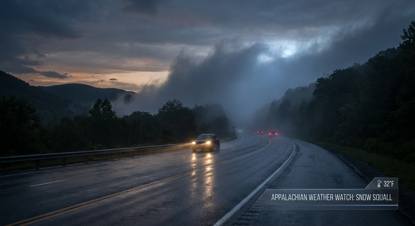
The "Arctic Reload" and Snow Squalls
For folks up in the Great Lakes, Ohio Valley, and the Northeast, you are about to ride a rollercoaster. A warm front is lifting north today, which might make it feel a little milder (relatively speaking), but it's a trap.
By Friday, a powerful Arctic cold front is going to dive south. This is the big story for the end of the week. When this cold air hits the relatively warmer lakes, the atmosphere is going to explode with energy.
Here is what you need to watch for:
- Snow Squalls: These are like winter thunderstorms. They hit fast, drop visibility to zero instantly, and coat the roads in minutes. The data highlights Michigan, Western NY, PA, and West Virginia as the bullseye for this Friday afternoon and evening.
- Travel Impact: If you are driving I-90 or I-80 Friday, keep your head on a swivel. You can go from sunshine to a whiteout in a mile.
Temperatures behind this front are going to crash. We are talking 15 to 25 degrees below average by the weekend. If you have plans for the Richmond Chocolate, Wine & Whiskey Festival on Saturday, bundle up because that wind chill is going to bite.
The South: Rain Now, Freeze Later
Down South, that low-pressure system we tracked yesterday is moving east. It's bringing widespread showers and some rumbles of thunder across the Gulf Coast and Southeast today. It's not a major severe weather outbreak, but it's enough to make the roads slick.
Once this system clears out, the cold air chases it. The Florida Panhandle is looking at another freeze by Friday morning. If you are heading to the West Palm Beach Antique Festival this weekend, the mornings will be crisp, but the afternoons should rebound nicely.
A Note on Space and Surf
Get this. It's not just the weather down here acting up. The Space Weather Prediction Center says we have a G1 (Minor) geomagnetic storm likely tomorrow, Feb 5th, thanks to a massive solar flare earlier this week. You probably won't feel it, but it's just another layer to this wild week.
Also, out West, the Pacific Northwest is dealing with high winds in the Columbia River Gorge and another atmospheric river setting up for the weekend. If you are in Portland or Seattle, enjoy the brief dry spell today because the hose turns back on Saturday.
Bottom Line
- VA/NC: Watch for slick spots and black ice tonight into Thursday morning. Don't trust the puddles.
- Northeast/Great Lakes: Prepare for a rapid temperature drop Friday and dangerous snow squalls. If you see a snow wall ahead, slow down immediately.
- Florida: Keep those plants covered one more time; freezing temps return to the Panhandle Friday morning.
- The Weekend: It's going to be dangerously cold in the East again. Limit your time outside if you're in New England.
Stay safe, stay warm, and I'll keep watching the data for y'all.
https://ryanhallyall.com/blog/false-spring-sneaky-ice-and-the-snow-squall-danger-zone