Blog Article
Severe Weather in Ohio Valley & Fire Danger in Plains: Feb 19 Update
Severe storms target Indy and Cincy today while critical fire danger continues in the Plains. Plus, a reality check on the Northeast snow forecast.
False Spring's Ugly Turn: Tornado Risk, Fire Danger, & The Snow Reality Check
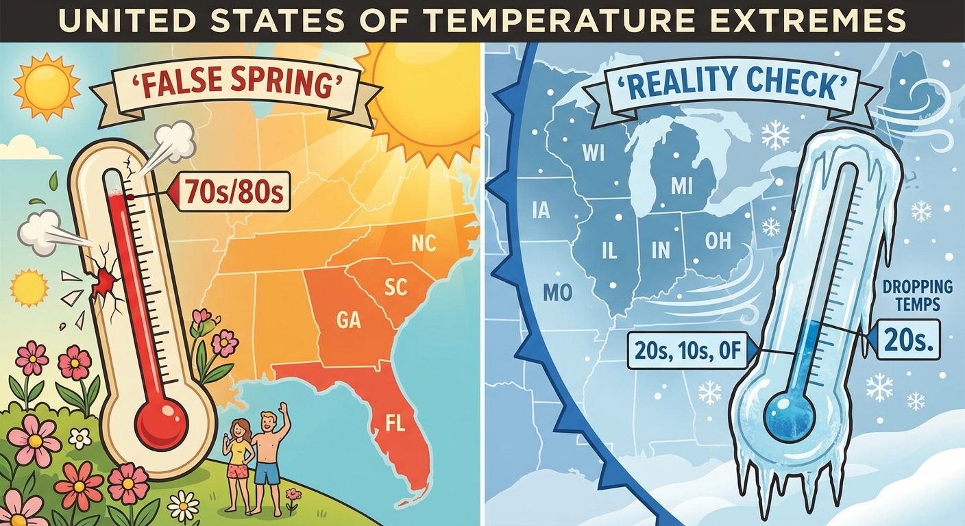
Alright folks, grab your coffee. We need to have a serious chat about what is happening outside your window right now. If you are in the East, you might be tempted to put away the heavy coats because it feels like late April out there. But here is the thing. That warmth is exactly what is fueling a nasty little setup for today.
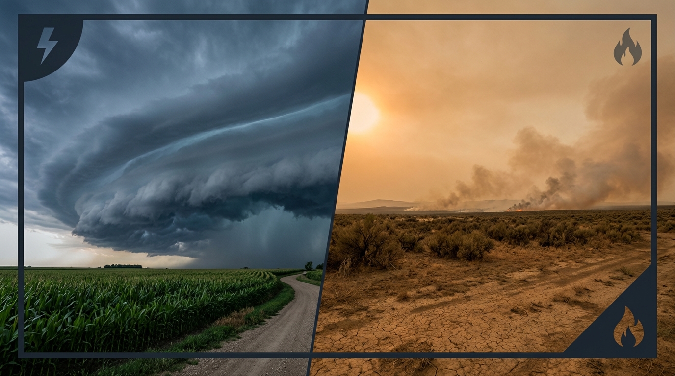
Yesterday we talked about those viral snow maps being "wishcasting." Well, today the reality is setting in. The same energy that dumped feet of snow on the Sierra Nevada is now moving across the country, but instead of a winter wonderland for everyone, it is creating a messy clash of seasons. We have fire on one side, severe storms in the middle, and winter trying to sneak in the back door.
The Ohio Valley: Don't Let The Calendar Fool You
Let's start with the immediate threat. The Storm Prediction Center has issued a Slight Risk (Level 2 out of 5) for severe weather today across parts of Indiana, Ohio, and Kentucky. This includes major metro areas like Indianapolis, Cincinnati, and Louisville.
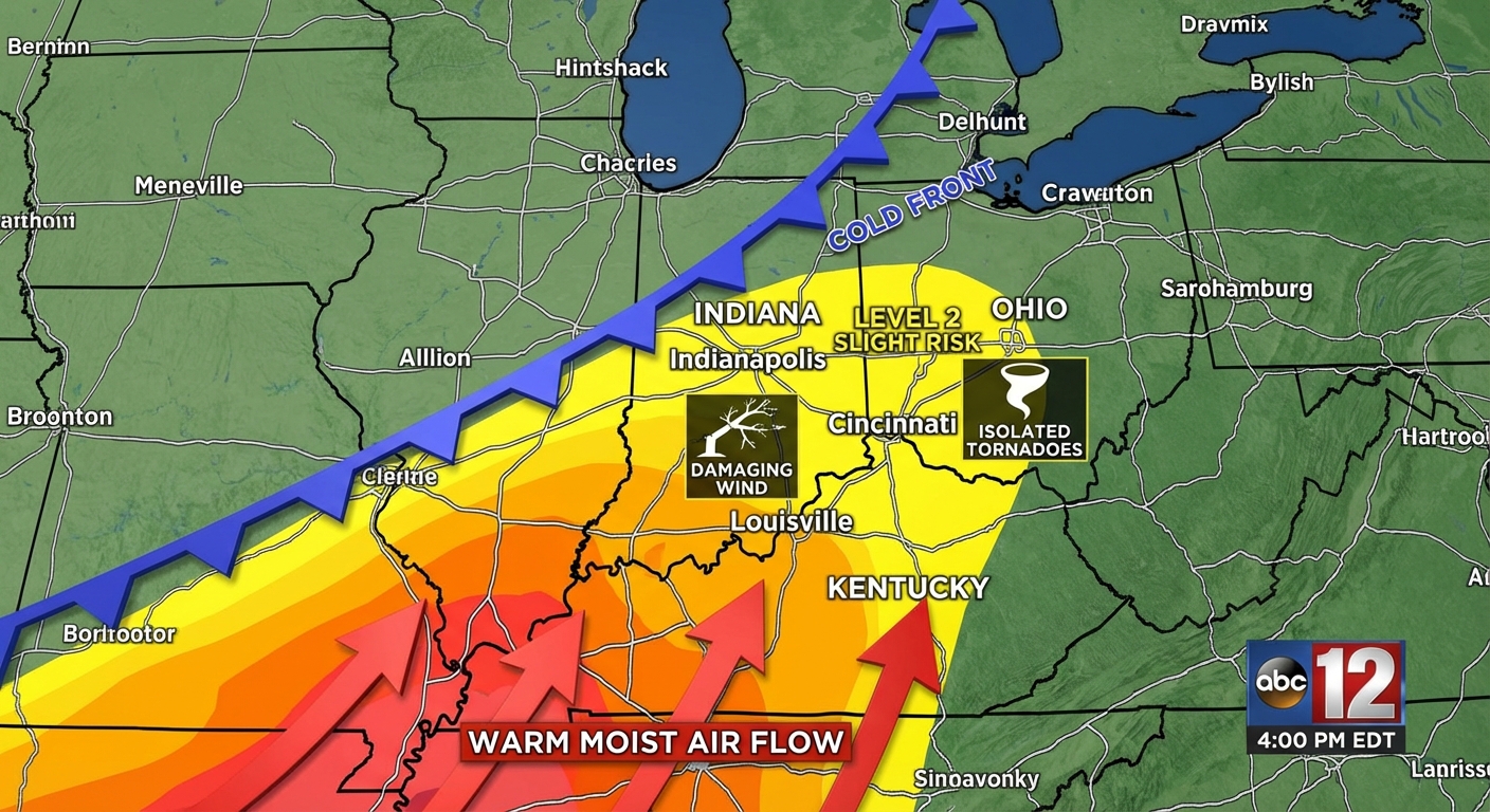
Here is the deal. We have unseasonably warm air with dewpoints creeping into the 60s. That is basically rocket fuel for thunderstorms. As a cold front plows into that warm air this afternoon and evening, we are looking at the potential for:
- Damaging Wind Gusts: This is the main threat. Winds could gust over 60 mph.
- Large Hail: Especially in the stronger storms early on.
- Tornadoes: The risk isn't zero. There is a 5% chance of a tornado within 25 miles of a point in that risk area. That sounds low, but it is significant enough that you need to have your phone charged and a way to get warnings.
If you are heading to the Whiskey Festival in Royal Oak, MI or have plans in Chicago, you are on the northern fringe of this. You will see rain and maybe some rumbles, but the severe stuff is likely staying just to your south.
Fire & Ice: A Tale of Two Regions
While the Ohio Valley is dodging storms, the Southern Plains are dealing with a different kind of disaster. The Ranger Road Fire in Oklahoma and Kansas has exploded to over 283,000 acres. The air behind this storm system is bone dry and windy. We have Critical Fire Weather conditions continuing today for parts of Oklahoma, Texas, and Missouri. If you are in these areas, please do not do anything that could spark a flame. The ground is dry and the wind is not your friend right now.
Meanwhile, for my snow lovers in the Northeast who felt left out by the viral maps—your time is coming. As this low pressure system moves east tonight into Friday, it is going to drag down just enough cold air to flip rain over to snow for Upstate New York, the Adirondacks, and Northern New England. We aren't talking about a blockbuster for NYC or Boston, but ski resorts in Vermont and New Hampshire are about to get a nice refresh.
The Weekend Outlook: Spring Training & Festivals
Looking ahead to the weekend, things are cooling down. That Arctic air is finally going to push the "False Spring" out to sea.
- Spring Training: If you are lucky enough to be in Arizona for the Royals/Rangers or D-Backs/Rockies games tomorrow, bring a jacket. It is going to be crisp. Florida games will be warmer, but watch out for that humidity.
- Travel: If you are driving I-90 or I-80 through the Great Lakes tonight, watch for that transition from rain to ice to snow. It can get slippery fast.
Bottom Line
This is a classic transition season event. Here is what you need to do:
- Ohio Valley (IN, OH, KY): Have your weather alerts on loud for this afternoon and evening. Respect the wind.
- Southern Plains: No burning. Period. The fire danger is extreme.
- Northeast: If you are traveling north tonight, be ready for winter driving conditions to return rapidly.
Stay safe out there, y'all!