Blog Article
Fire Risks & Midwest Storms: Feb 17 Weather Outlook
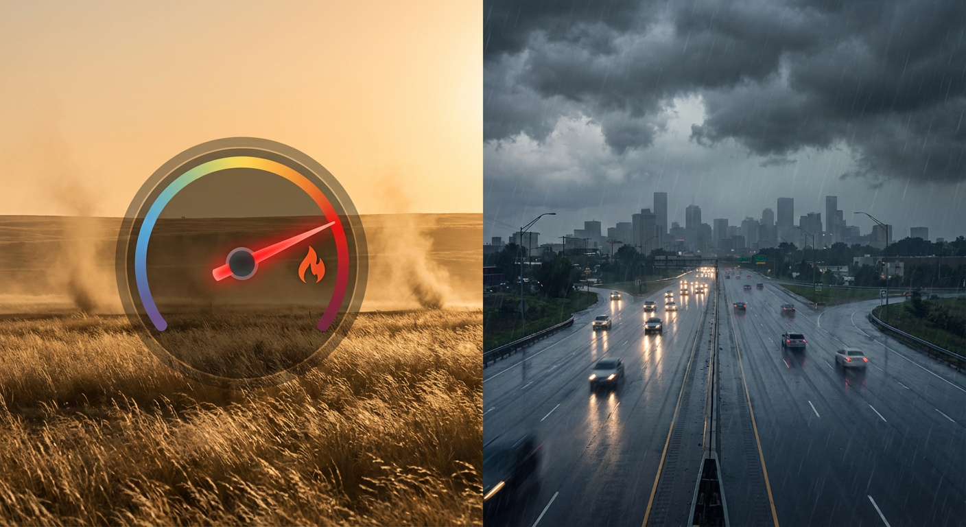
Extremely Critical fire weather hits the Plains while a new storm system brings snow to MN and severe storm risks to the Ohio Valley on Thursday.
Fire, Ice & A Midwest Slicer: The Storm System That Won't Quit
Alright folks, let's talk about it. Yesterday we were glued to the radar watching California get absolutely soaked. We saw flash flooding in LA and wind gusts causing havoc in the Central Valley. But here is the thing. That energy didn't just disappear. It is hopping the Rockies right now and it is changing its personality completely.
We are trading the floodwaters for fire warnings and winter coats. This is a classic example of how one system can cause three different types of headaches depending on where you live. Let's break down what is happening today and what is coming for the Midwest tomorrow.
The High Plains: A Dangerous Fire Setup
I need everyone in the High Plains to listen up close. The Storm Prediction Center has issued an Extremely Critical fire weather area for today. That is the highest level they have. We are looking at parts of Northeastern Colorado, Southwestern Nebraska, and Northwestern Kansas.
Here is what is happening. That storm system is pulling dry air down the slopes of the Rockies. We are talking humidity dropping to 10-15 percent paired with winds gusting 40 to 60 mph. If a fire starts in these conditions, it is going to move faster than you can run.
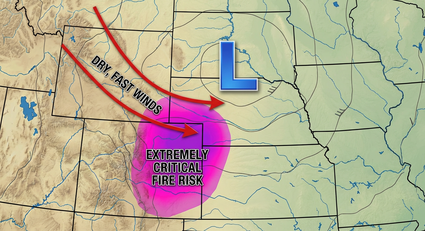
If you are in these areas, do not burn anything today. Be careful with farm equipment chains sparking on the road. This is serious stuff.
The Midwest Slicer: Snow, Ice, and... Thunder?
As this system moves east over the next 48 hours, it is going to drag a cold front through the heart of the country. By Thursday, we are looking at a messy setup for the Ohio Valley and the Great Lakes.
For the North:
Winter isn't done with you yet. We are tracking a heavy band of snow setting up for the Minnesota Arrowhead—we could see 12 to 24 inches up there. But the trickier part is going to be Northern Wisconsin and the Michigan "Mitten." The data is showing a signal for freezing rain and significant icing. If you have travel plans along the northern tier, you need to check your tires and your wipers.
For the South:
Down in the warm sector, it feels like spring. But that warmth is fuel. The SPC has highlighted a Slight Risk for severe weather on Thursday for folks in Indianapolis, Cincinnati, and Louisville. We aren't looking at a massive outbreak, but damaging winds and a few tornadoes are definitely on the table as that cold front slices through.
Baseball and Blue Skies Out West
Now for some better news. If you have been watching the Spring Training schedule, you know the Royals are playing the Rangers and the White Sox are playing the Cubs in Arizona later this week. The good news is that the heavy precip has moved out of the Southwest. It might be a bit breezy for those fly balls in Surprise and Mesa, but the soaking rains are done.
However, California is still dealing with the leftovers. There is a Marginal Risk for some excessive rain lingering in SoCal today, but the worst of the "atmospheric river" phase is behind us. Now it is cleanup time.
The Bottom Line
Here is what you need to do:
- High Plains (CO, NE, KS): absolute fire ban today. Keep your phone on for evacuation alerts just in case.
- Midwest (IL, IN, OH, KY): Thursday is your day to watch. Have a way to get warnings if storms fire up in the afternoon.
- Upper Midwest (MN, WI, MI): brace for a thump of winter precip. That ice potential in Wisconsin is sneaky dangerous.
Stay safe out there, y'all.
https://ryanhallyall.com/blog/fire-ice-a-midwest-slicer-the-storm-system-that-wont-quit