Blog Article
Fire, Snow, and Tornadoes: Tonight's Multi-Hazard Weather Breakdown
A breakdown of tonight's chaotic weather map: Ohio Valley tornado risks, the Ranger Road fire expansion, and why social media is seeing fire and ice at once.
Fire, Ice, & The Night Shift: Why Your Feed Is Having a Weather Identity Crisis
Alright folks, good evening. If you have been scrolling through TikTok or X (formerly Twitter) tonight, you might be feeling a little bit of meteorological whiplash. Here is the thing. You are not crazy.
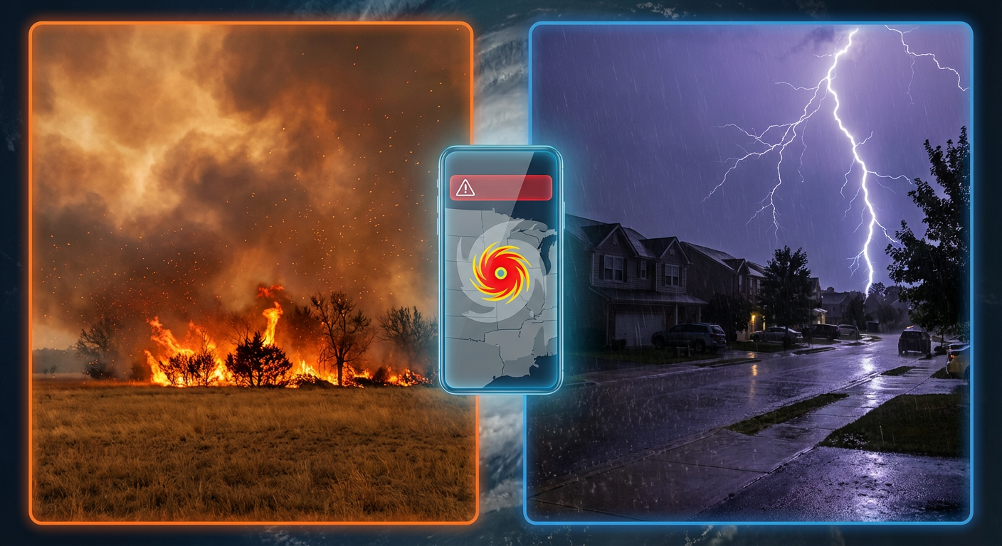
Depending on who you follow, your feed is either showing apocalyptic wildfires in Oklahoma, a literal blizzard in Minnesota, or severe tornado warnings in the Ohio Valley. It is a split-screen reality right now. We are watching one massive atmospheric system play four different roles at the exact same time. And while the viral videos are wild to look at, there is a serious situation unfolding tonight that we need to talk about.
The "Now" Problem: Ohio Valley Tornado Threat
First things first. We have to address the immediate danger happening right now. While a lot of national news is focused on the snow or the fires from earlier, the atmosphere is cranking up a nighttime severe weather event in the Ohio Valley.
Get this. We have an Enhanced Risk (that is a level 3 out of 5) for severe storms centered on Southern Illinois and Southern Indiana tonight. We are talking about places like Bloomington, Terre Haute, and stretching down toward Louisville. The concern here isn't just that storms are popping up. It is that they are happening after dark in February.
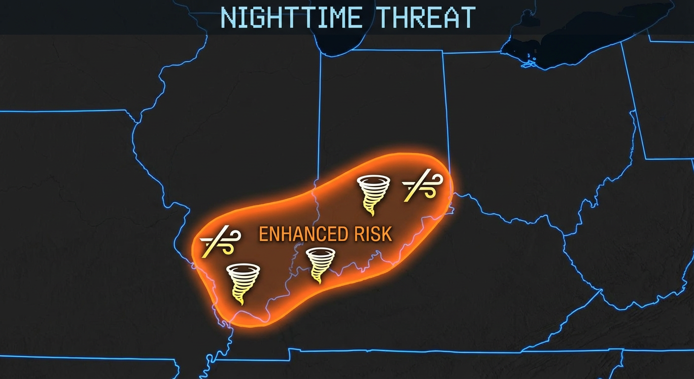
If you are in this zone, do not go to bed without a way to wake up. These storms have plenty of shear to work with. That means rotation is possible. If you know someone in Indianapolis, Cincinnati, or Louisville, shoot them a text. Make sure their weather radio is on.
The Viral Contrast: Why the Plains are Burning while the North Freezes
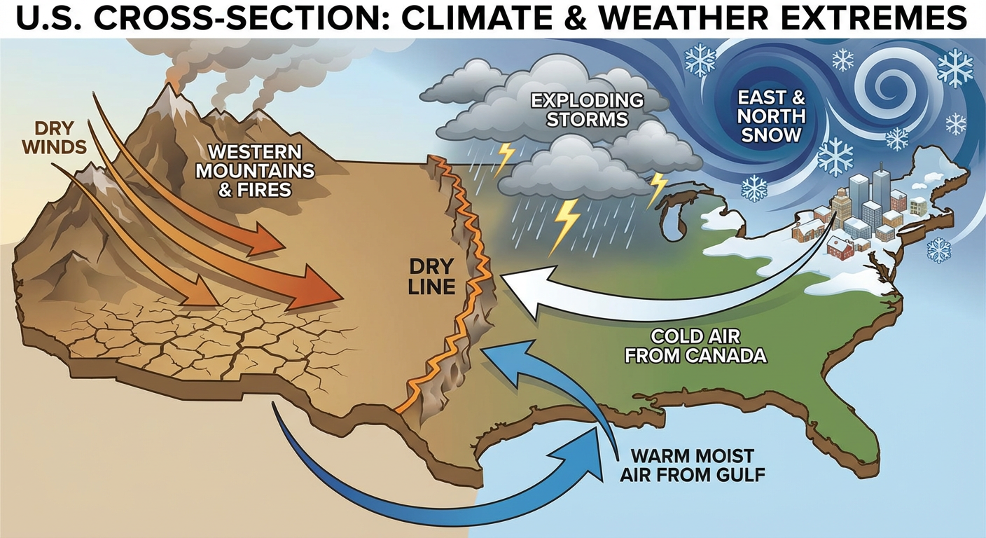
You have probably seen the footage of the Ranger Road Fire. It has exploded to over 283,000 acres on the Kansas/Oklahoma border. At the same time, Hovland, Minnesota just measured 34 inches of snow. How does that even happen in the same country, let alone the same day?
It comes down to the energy in this system. We are tracking a Departure of Seasonal Energy (DOS) sitting at about 109%. That is scientific talk for "this storm has way more juice than it should for mid-February."
This system is dragging dry, savage winds off the Rockies (creating the fire danger) while simultaneously pulling deep moisture up into the cold air (dumping the snow). It is a classic battle of air masses, but on steroids.
The California Hangover
I also want to touch on the West Coast because I'm seeing a lot of folks asking if it's over yet. The heavy rain in California is finally subsiding tonight as this energy moves east. But the ground is saturated. We have seen tragic news out of San Bernardino County with floodwaters, and that danger doesn't vanish the second the rain stops. The rivers and runoff are still reacting to what happened yesterday.
What This Means For Your Friday
Here is the bottom line. This weather pattern is what we call "high amplitude." That means everything is amplified. The cold is colder. The winds are faster. The storms are stronger.
If you are in the Ohio Valley, keep your head on a swivel tonight. If you are in the Plains, please respect those burn bans because the wind is not playing games. And for everyone else, just be patient. This active pattern is going to keep things interesting (and messy) as we head toward the weekend.
Stay safe out there, y'all.