Blog Article
Flash Flood Risk Kansas to Ohio, Mid-Atlantic Storms Return
WPC posts a Moderate flash flood risk from Kansas to Oklahoma with a Slight Risk into Ohio, while the Mid-Atlantic faces round two of severe storms today.
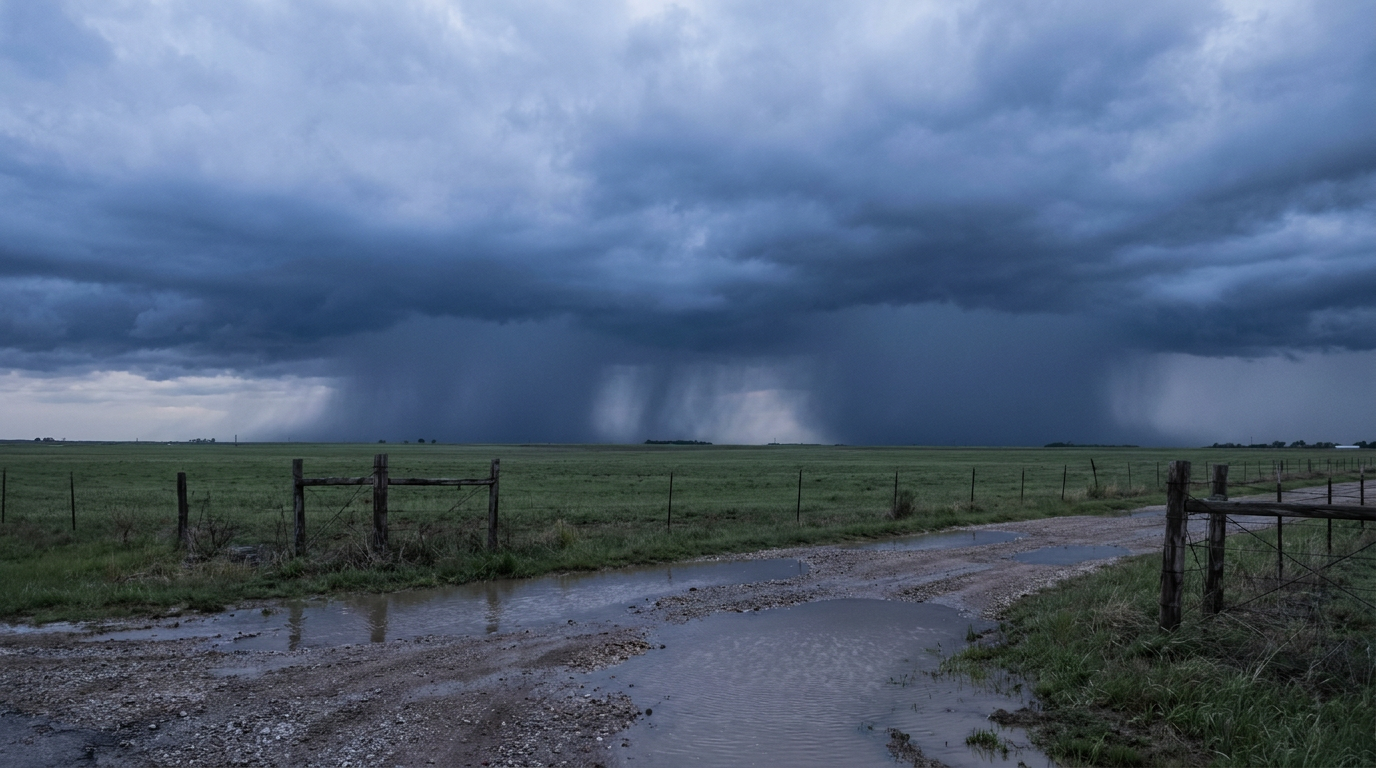
Flash Flood Threat Sets Up From Kansas to Ohio While the Mid-Atlantic Storms Again
Alright y'all, the rain is the story today. Not the flashy severe stuff, though we've got some of that too. The headline is water.
The Weather Prediction Center has a Moderate Risk for excessive rainfall posted this morning. That's a level 3 out of 4 on their flash flood scale, and it sits over southeast Kansas into Oklahoma. Around it, a Slight Risk reaches all the way into Indiana and Ohio. When WPC goes to Moderate, they're telling you the ground is primed and the rain rates are gonna be efficient. That's a serious flag, and it deserves the top spot today.
What's driving the rain
Here's the setup. A mesoscale convective vortex, or MCV, is riding east across the region. Think of it as the leftover spin from an overnight cluster of storms. That old complex dies down, but the atmosphere keeps a little swirl going, and that swirl becomes a focus for new storms to fire on the next day. WPC expects this MCV to track into and across Ohio, keeping the flash flood threat alive along its path.
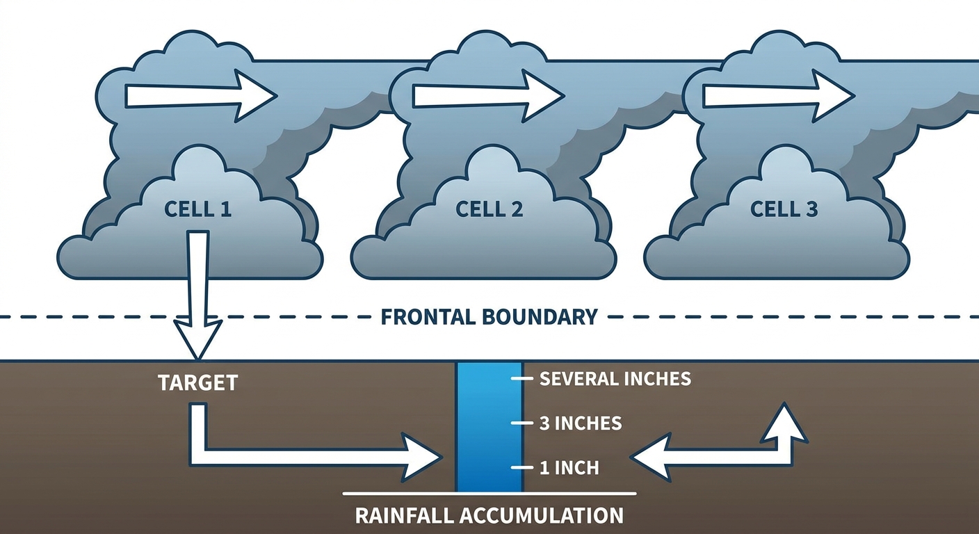
Downstream, there's a wavy, east-west frontal boundary draped across the region. Storms love to train along a boundary like that. Training means one storm after another rolling over the same ground, like train cars on a track. Same spot, again and again. That's how you rack up three, four, five inches in a hurry.
And this isn't happening on dry ground. We've been talking about the Upper Midwest flooding all week. Central Iowa took an absolute soaking on the Fourth, with Polk City measuring 13.5 inches in 24 hours. Water rescues in Des Moines and Ames. That soil is saturated, and the whole region has been running wet for days. When the ground can't take any more, even a normal summer downpour turns into runoff and rising creeks.
The Mid-Atlantic gets round two
If you were with us yesterday, you saw the Mid-Atlantic light up. Trees down all over Bucks County, Lancaster, the DC suburbs, Delmarva. An 87 mph gust measured on the Potomac that flipped boats. A tree fell on a car in Wyckoff, New Jersey and hurt somebody. That was a real evening.
Today, SPC has a Slight Risk posted again for the Mid-Atlantic. That covers Philadelphia, Washington, Baltimore, Wilmington, and Harrisburg. The main threat is damaging wind, with SPC carrying a 30% wind probability in the heart of it. That's their Level 3 wind area. If storms fire this afternoon, 60-plus mph gusts are on the table.
For context, Philadelphia's normal July high is 87 and DC sits at 89. We're in that muggy, loaded-atmosphere stretch that fuels these afternoon storms. Warm, humid air near the ground, storms build through the heat of the day, and they collapse with downburst winds by evening. Same script as yesterday.
There's also a separate severe area up in North Dakota, where SPC is watching for large to very large hail. A hatched area there means hen-egg-size hail, two inches or bigger, is possible if storms get going. That's a Fargo and Grand Forks concern.
Baseball and the ballpark angle
A lot of games sit right in the crosshairs today. The Pirates are at Washington and the Orioles are up the road in Cincinnati, both inside that Slight Risk for excessive rainfall and storms. The Cardinals and Cubs play in Chicago, where flooding has already been trending in the news after storms knocked out power and canceled Fourth of July fireworks. If you've got tickets to any of those, keep the radar handy and expect the chance of a delay.
The Twins-Yankees game in the Bronx is on the northern edge of the Mid-Atlantic storm threat too. Afternoon start, so an early storm could get in the way.
What I'm watching
- The MCV track across Ohio. Where that spin goes, the heaviest rain follows. Ohio Valley folks should watch for flash flood warnings this afternoon and evening.
- Rain rates over saturated ground in southeast Kansas and Oklahoma. The Moderate Risk is there for a reason. It doesn't take much on soaked soil.
- Afternoon storm timing in the Mid-Atlantic. Damaging wind is the play, same as yesterday. Peak heating into evening is the window.
- The North Dakota hail threat. Isolated, but the stones could get big.
Bottom line
If you're in southeast Kansas, Oklahoma, or the Ohio Valley today, the flash flood risk is the thing to respect. Never drive through water on a road. You can't tell how deep it is or whether the road under it is even still there. Turn around.
If you're in the Philly-to-DC corridor, plan around the afternoon and evening storms. Damaging wind gusts can knock trees onto power lines fast, just like they did yesterday. Have a way to get warnings, charge your phone, and if you're headed to a ballgame, build in some patience for a delay.
Rest of the country east of the Rockies stays in that summer pattern: hot, humid, pop-up storms. Out West, the Intermountain ridge keeps things dry and pleasant, with the Pacific Northwest and Northern California running some genuinely nice days.