Blog Article
Flood Risk Shifts North & East, Plains Watch Severe Storms
WPC flags flood risk from NJ to Maine and the Carolina coast while SPC watches severe storms in the northern Plains. Plus aurora chances tonight.
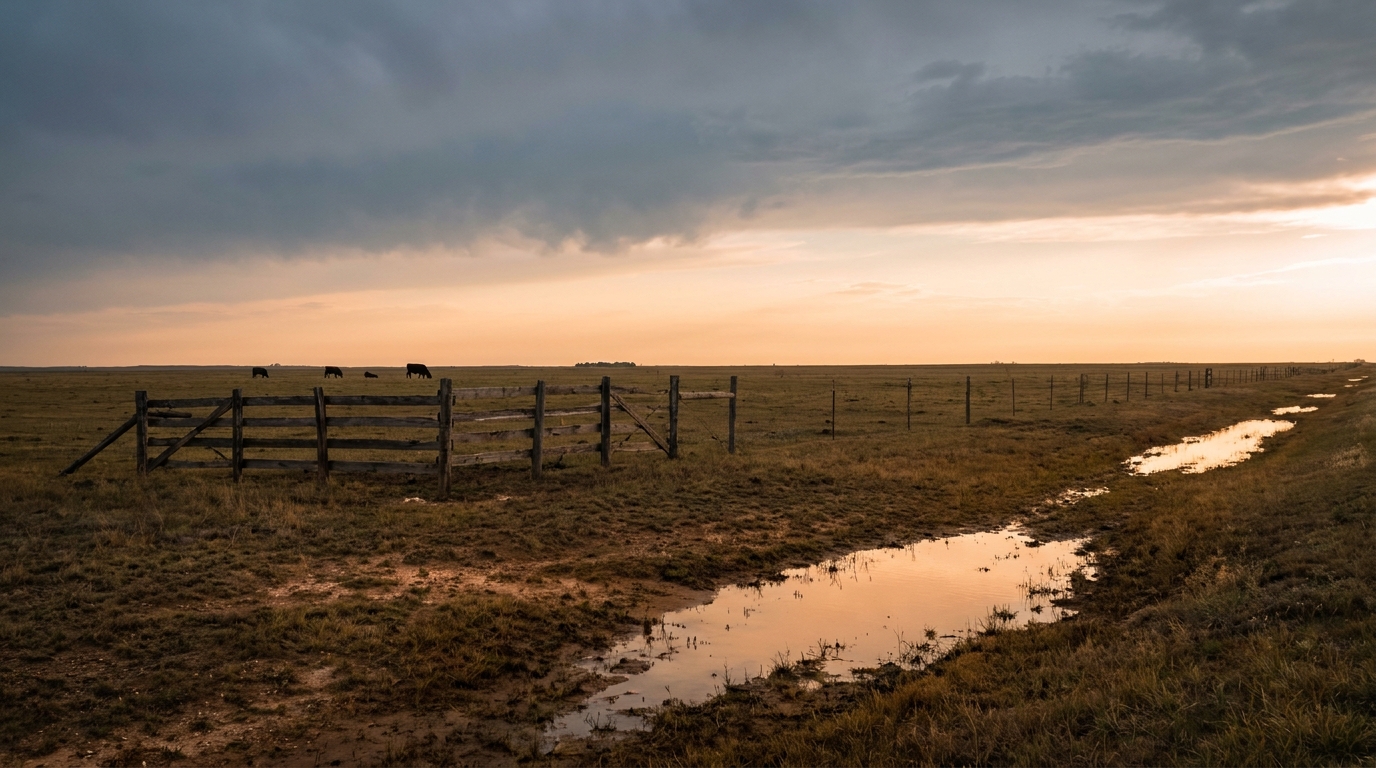
Flooding Fatigue Continues Up the Coast While the Northern Plains Watches for Hail and Wind
Alright y'all, let's talk about where the water's headed next. If you were anywhere near Surry County, North Carolina yesterday, you already know what this pattern can do. A Flash Flood Emergency, water rescues in Mt. Airy, a washed-out bridge on Norman Road, 4.39 inches of rain measured near Mount Airy. That system dragged north and east overnight, and it dumped serious rain on Pennsylvania and New York too, with a rescue in New Albany, PA and flooded streets in Lockport and Buffalo.
Here's the thing about these setups. They don't just pack up and leave once the sun comes up. Today WPC has a Slight Risk of excessive rainfall posted for a several separate zones: New Jersey up through Massachusetts, the coastal Carolinas, Florida's Big Bend, and far southern Arizona. That's four different flavors of flood risk on one map, and they're not connected, so let's take 'em one at a time.
The Northeast Gets Its Turn
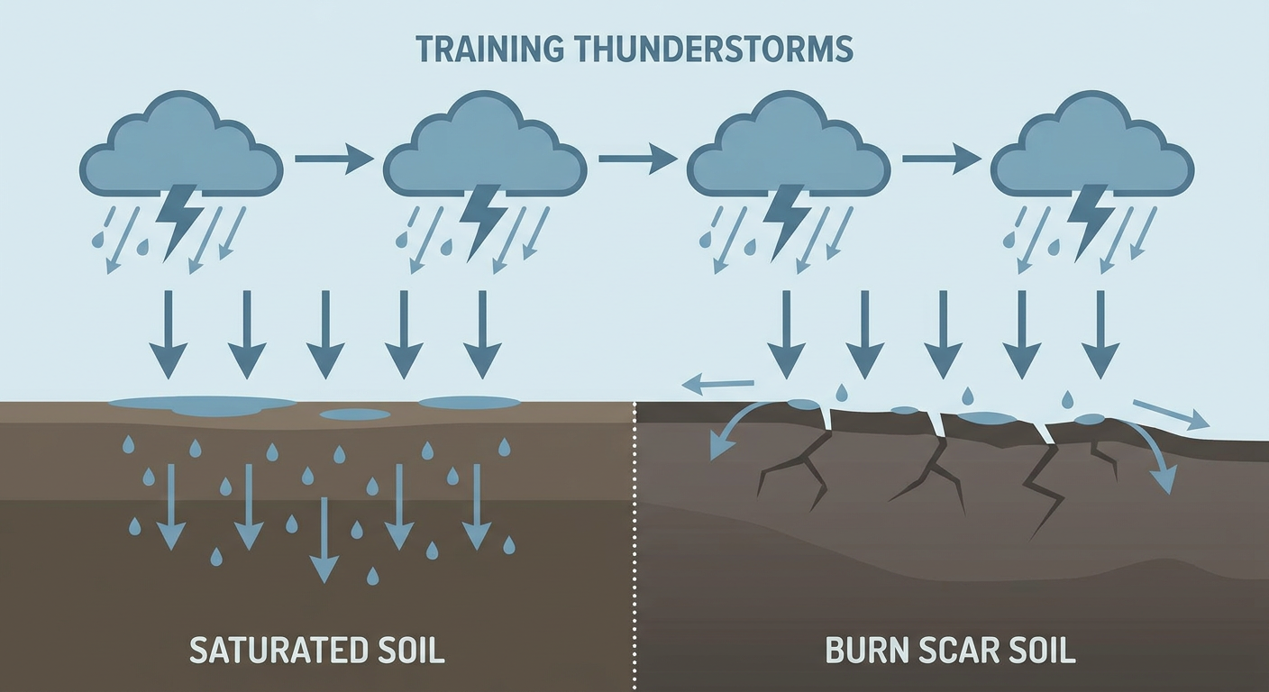
A shortwave trough is rotating through and helping close off a mid-level low over northern Georgia. That's setting up subtle lift and a jet streak pivoting into the Northeast, which means training thunderstorms are possible from New Jersey into southern New England. If you're headed to a Nationals-Phillies game in Philly this evening, or you've got plans near Bangor, Maine where the State Fair is going on right now, keep half an eye on the radar. Soils up there are still saturated from the mess earlier this week, so it won't take much rain to cause problems again.
Coastal Carolinas and Florida's Big Bend
The coastal Carolinas picked up a lot of wind damage yesterday from Georgia into South Carolina, mostly downed trees and power lines from thunderstorm gusts. Today's excessive rainfall risk there is separate from that wind threat, but it's the same general moisture-rich air mass. Down in the Big Bend, backbuilding thunderstorms off Gulf moisture can produce rain rates of 2 to 3 inches an hour on ground that's already soft. That's classic flash flood setup territory for the clay hills around Tallahassee.
Southern Arizona's Monsoon Keeps Rolling
Far southern Arizona is dealing with something completely different: monsoon thunderstorms with precipitable water values running more than one and a half standard deviations above normal and MUCAPE up near 2000 J/kg. Translation: the atmosphere down there is loaded and ready to produce heavy rain fast. Burn scars near Tucson are the main worry, since scorched ground sheds water instead of soaking it up.
Severe Storms Up North
Meanwhile, SPC has a Slight Risk of severe thunderstorms posted for late this afternoon and evening across northern Minnesota into the eastern Dakotas, catching Fargo, Bemidji, Detroit Lakes, and Fergus Falls. A compact system is digging in up there, and the main threats are damaging wind gusts up to 60 mph and hail over an inch in diameter, with a 15% probability for both. There's also a small 2% chance of an isolated tornado if storms can organize.
A broader Marginal Risk stretches across the northern Mid-Atlantic and New York, and separately down toward Tucson, so nobody east or west is completely off the hook today, even if the ceiling on that risk is lower than what the northern Plains is dealing with.
Space Weather: Aurora Chances Tonight
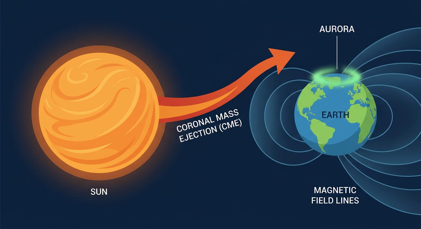
Here's a fun one. NOAA's Space Weather Prediction Center says G1 Minor geomagnetic storming is expected today, with a chance of bumping up to G2 Moderate early on, thanks to lingering effects from a coronal mass ejection. If you're far enough north, tonight could bring some aurora visibility on the horizon, especially if skies stay clear. Worth a look if you're up in the northern tier after dark.
Elsewhere: Fire Weather and Building Heat
Out west, the Spokane wildfire situation that's been trending in the news is tied to the same critical fire weather pattern we've been tracking since last week. Red Flag conditions remain elevated across the Great Basin and northern High Plains today, with low relative humidity in the 5 to 15% range and gusty winds mixing down from a mid-level jet. That's the same broad trough responsible for today's northern Plains severe risk.
Further out, the extended outlook from Days 4 through 7 shows a ridge building over the central US that pushes heat deeper into the Plains, Midwest, and Southeast. Cities like Oklahoma City, Tulsa, and Kansas City, all normally sitting near 88 to 93 degrees this time of year, could be looking at a stretch running noticeably hotter than that August normal by the weekend. We'll have firmer numbers as we get closer.
What We're Watching
- Training thunderstorms from New Jersey to Massachusetts tonight, a flash flood risk for saturated ground
- Burn scar flash flooding potential near Tucson as monsoon moisture stays locked in
- Northern Minnesota and eastern Dakotas severe storms this evening, 60+ mph gusts and quarter-size hail possible
- Continued critical fire weather across the Great Basin and northern Rockies
- G1 to possible G2 geomagnetic storming tonight, aurora chances for the northern tier
- A building heat pattern for the Plains, Midwest, and Southeast later this week
Bottom Line
If you're anywhere from New Jersey up through Massachusetts, or along the Carolina coast, or near Tucson, keep a rain-aware plan tonight. None of these are extreme risks on paper, they're all Slight Risk designations, but that's exactly the kind of setup that produced last night's flooded roads in Pennsylvania and New York. Up in northern Minnesota and the eastern Dakotas, know your severe weather plan for this evening's storms. Everybody else, it's a fairly ordinary early August day, just keep watching because this pattern has been throwing a lot at us all week.