Blog Article
Florida Flood Risk & Central Plains Severe Weather Outlook
A stalled front brings heavy rain and flood risks to Florida's Atlantic coast. Plus, tracking a severe weather and large hail setup for the Central Plains.
Florida's Stalled Front Brings Flood Risks While the Plains Prep for Hail
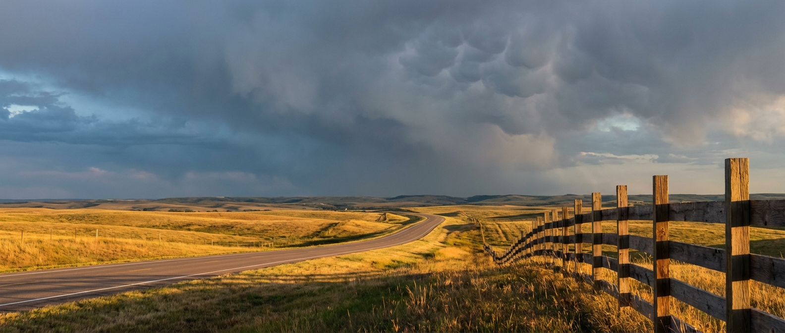
We talked yesterday about that stalled cold front draped across the Florida peninsula. It is still there, and it is still causing problems. The atmosphere is holding onto a ton of moisture, and that means outdoor plans across the state are going to take a hit today.
If you are heading to the Tampa Bay Wine and Food Festival, you need to pack an umbrella. Tampa normally sees a high around 82 degrees this time of year with plenty of sunshine. Today is going to look a lot different.
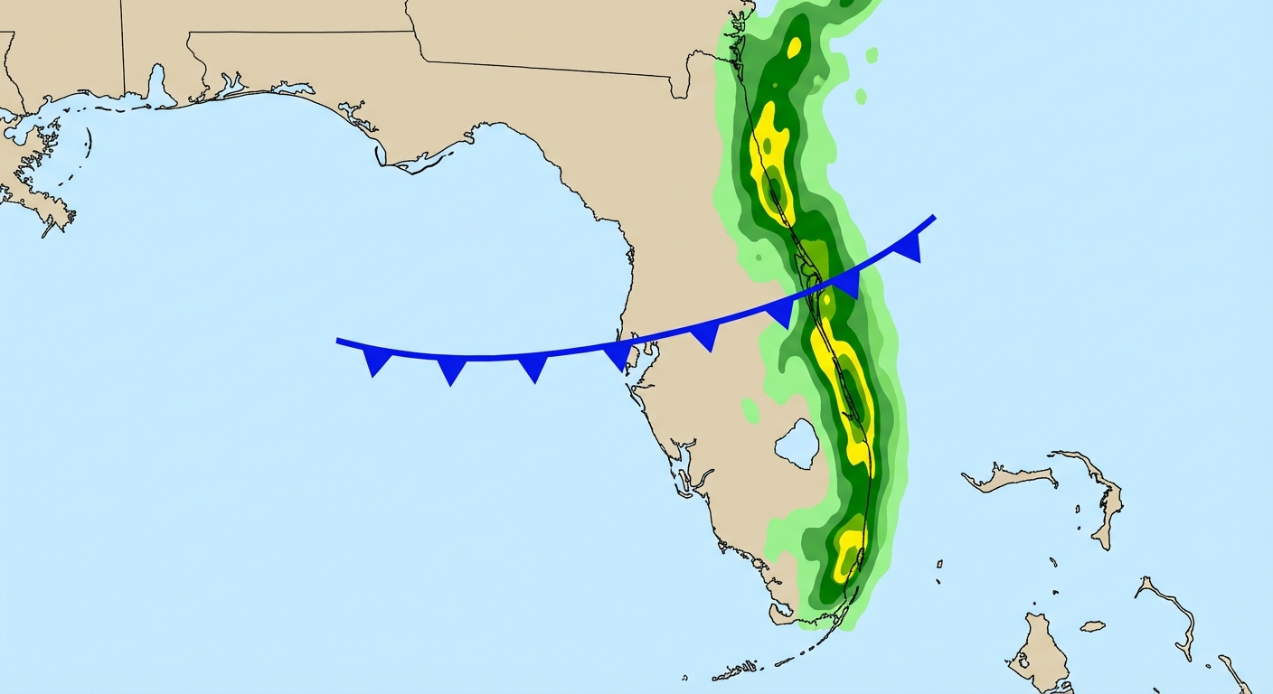
Florida's Waterlogged Coast
The Weather Prediction Center has outlined a Slight Risk for excessive rainfall today, specifically focused on the Atlantic side of the Florida peninsula.
Here is the thing. We already saw some intense rainfall yesterday. A mesonet station down in Brevard County recorded over 5.5 inches of rain in just a two-hour window. The soils are primed. They cannot take much more water. As this slow-moving front triggers new showers and thunderstorms today, that water has nowhere to go. Urban flash flooding is a real concern for folks living along the eastern coastline.
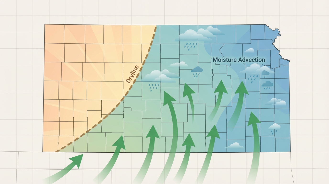
The Plains Wake Up
While Florida deals with the rain, we are watching a new system dig into the central United States. An upper-level trough is moving across the northern tier, and it is going to pull a cold front southeastward across the Central Plains by Wednesday.
The Storm Prediction Center has a Marginal Risk for severe thunderstorms in place for Wednesday across western and central Kansas. Cities like Salina and Dodge City are in the crosshairs. The main threat tomorrow is going to be isolated large hail. Forecast soundings show about 750 J/kg of MUCAPE, which is enough instability to get some robust updrafts going by late afternoon.
This is just the appetizer. As we head into the weekend, the pattern gets much more active. The SPC already has a 15% risk area highlighted for Days 5 through 7. That covers a massive chunk of real estate from Dallas up through Oklahoma City and Tulsa. Dallas normally tops out around 77 degrees in early April, but we are going to see a warm, moist airmass flood into the Southern Plains ahead of a strong trough. That is a classic spring severe weather setup.
Georgia Fire Danger
We also need to talk about the Southeast. A sprawling surface high pressure system over the Great Lakes is driving dry, northeasterly winds down into Georgia.
The SPC has issued a Critical Fire Weather area for south-central Georgia today. Folks in Thomasville and Tifton need to be extremely careful. We are looking at relative humidity values dropping into the 20 to 30 percent range, combined with sustained winds of 10 to 20 mph. The drought conditions down there mean the fuels are bone dry. Any spark will spread rapidly.
The Good Stuff
It is not all bad news today. That same high pressure system keeping Georgia dry is delivering absolutely beautiful weather to the Ohio Valley and parts of the Southeast.
If you are attending the Move As One Festival in Columbus today, you have spectacular weather on tap. We are talking zero percent precipitation chances, abundant sunshine, and a dry continental air mass.
Key Factors We Are Watching
- Rainfall rates in Florida: We are looking for localized downpours along the Atlantic coast that could quickly overwhelm drainage systems.
- Kansas moisture return: We need to see how far north the quality moisture gets on Wednesday ahead of that front to gauge the true hail threat.
- Georgia wind gusts: Afternoon mixing could bring stronger wind gusts to the surface in the critical fire weather area.
Bottom Line
Florida residents on the Atlantic coast need to have a way to receive flash flood warnings today and avoid driving through standing water. Folks in western and central Kansas should park the cars in the garage Wednesday evening to avoid hail damage. Down in south-central Georgia, hold off on any outdoor burning until the winds die down and the humidity recovers.