Blog Article
Friday the 13th Storm: Severe Weather Threats on Uri Anniversary
Five years after the Texas freeze, a new storm brings severe weather and flood risks to the South. Plus, heavy snow targets the West Coast.
Friday the 13th Deja Vu? 5 Years After Uri, The South Faces a Different Beast
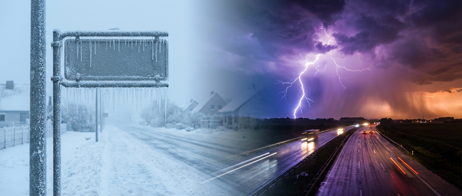
Alright folks, look at the calendar. It’s Friday the 13th. And if you’ve lived in the South—especially Texas—for any amount of time, this specific date might give you the shivers, and not just because of the superstition.
Get this: It is the exact five-year anniversary of the start of Winter Storm Uri. Y'all remember that one? The grid failure, the pipes bursting, the absolute deep freeze that paralyzed the state back in 2021. I'm seeing "On This Day" posts popping up all over social media, and I know a lot of you are looking at the sky wondering if history is about to repeat itself.
Here is the thing: We are tracking a major storm system for this weekend, but it is the Anti-Uri. Instead of a polar plunge, we have a surge of warm, unstable Gulf air that's going to fuel a messy mix of severe weather and heavy rain. Let's break down why you need to keep your phone loud tomorrow night.
The "Anti-Uri": Fire vs. Ice
Five years ago, we were tracking a nose-dive in temperatures. Tonight, we are tracking a setup that's all about energy. The Gulf of Mexico is wide open for business, pumping moisture into Texas and the Lower Mississippi Valley.
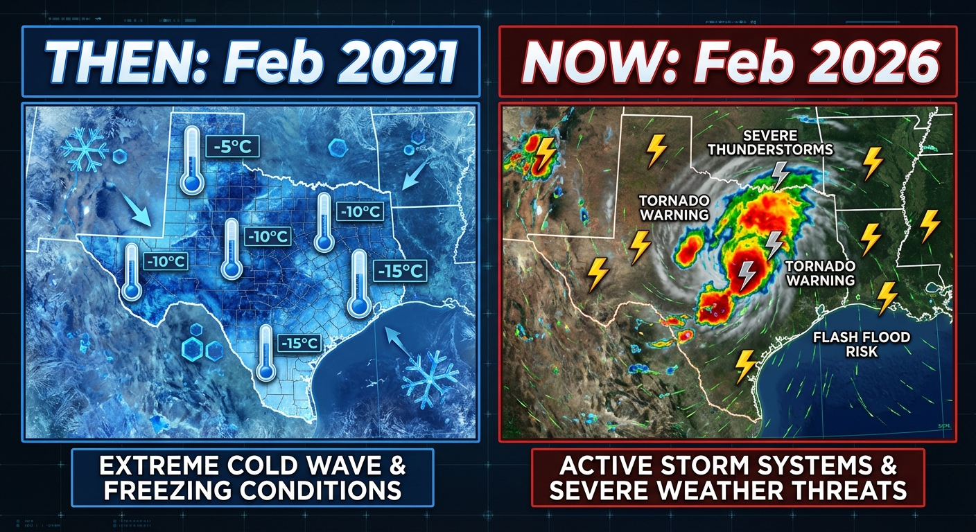
While we aren't worried about the power grid failing from cold, we do have a Slight Risk (Level 2/5) for severe weather kicking off Saturday. The Storm Prediction Center has highlighted East Texas, Louisiana, and Southwest Mississippi for tomorrow.
Here is the concern: This looks like it's going to evolve into a nocturnal event. We're talking about a squall line (meteorologists call it a QLCS) moving through Saturday night into Sunday morning. These lines can pack damaging winds and spin up quick tornadoes wrapped in rain. Since it'll be dark, you can't rely on looking out the window. You need a way to get warnings while you sleep.
The Valentine's Washout
If you have romantic dinner plans in the ArkLaTex or the Mid-South for Valentine's Day tomorrow, you might want to bring an umbrella—or a kayak.
We have a threatening setup for flash flooding. The atmosphere is squeezing out moisture like a wet sponge, and parts of Arkansas, Louisiana, and Mississippi could see rainfall rates that storm drains just can't handle. The Weather Prediction Center has slapped a Slight Risk of excessive rainfall over the area. If you're driving to a reservation, remember: turn around, don't drown. Nothing is romantic about stalling your sedan in high water.
meanwhile, Out West...
While the South is dealing with storms, the West Coast is about to get hammered in the best way possible for skiers (and the worst way possible for travelers).
People on TikTok are already buzzing about the "insane" snow maps for the Sierra Nevada, and for once, it's not just hype. A massive atmospheric river is crashing into California. We are talking about snowfall measured in feet, not inches, for the high elevations. If you're planning a ski trip to Tahoe, you might get stuck there.
The Bottom Line
This isn't 2021. We aren't freezing. But that doesn't mean you can let your guard down.
- Texas/Louisiana/Mississippi: Have a way to get warnings Saturday night. The wind and tornado threat is real.
- Travelers: Watch out for flash flooding on the roads tomorrow.
- West Coast: Prepare for heavy mountain snow and travel closures.
Stay safe, stay weather aware, and happy Valentine's weekend, y'all!